TopoQuest Logo
Do you find TopoQuest useful?
Help keep TopoQuest running and adding new maps/features by donating!
Bitcoin:  19c7KJd3qBynnjoSw5npx9KScwjBe4ifkT
Litecoin:  LXs6TkuXGGXo1vDsWCkWVdjQX94eUKd6ui
Home View Maps Find Maps Find Places Resources & Links


Tionesta, Pennsylvania Topographic Map

USGS Map Title: Tionesta, PA
USGS Map MRC: 41079D4
DRG (GeoTIFF) Download: o41079d4.tif


Neighboring USGS Topographic Map Quads:


  Pleasantville, PA  
41079E5
 

  West Hickory, PA  
41079E4
 

  Kellettville, PA  
41079E3
 

  President, PA  
41079D5
 

  Tionesta, PA  
41079D4
 

  Tylersburg, PA  
41079D3
 

  Kossuth, PA  
41079C5
 

  Fryburg, PA  
41079C4
 

  Lucinda, PA  
41079C3


Map MRC Location:

N42°
W80°
N42°
W79°
H8 H7 H6 H5 H4 H3 H2 H1
G8 G7 G6 G5 G4 G3 G2 G1
F8 F7 F6 F5 F4 F3 F2 F1
E8 E7 E6 E5 E4 E3 E2 E1
D8 D7 D6 D5 D4 D3 D2 D1
C8 C7 C6 C5 C4 C3 C2 C1
B8 B7 B6 B5 B4 B3 B2 B1
A8 A7 A6 A5 A4 A3 A2 A1
N41°
W80°
N41°
W79°

Tionesta, PA USGS 1:24K Topographic Map Preview:
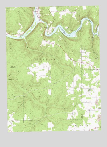
Tionesta, PA USGS Topographic Map
Click on map above to begin viewing in our Map Viewer.

This topographic map contains these locations and features:
Feature Name Type Latitude Longitude GNIS ID View Map
Auge RunStreamN41.3826°W79.4628°1198341View Map
Auges CornersLocaleN41.3862°W79.4937°1198342View Map
Bates RunStreamN41.4709°W79.4906°1209398View Map
Blocher School (historical)SchoolN41.4448°W79.4100°1200619View Map
Borough of TionestaCivilN41.4937°W79.4480°1215242View Map
Camp TionestaLocaleN41.4753°W79.4137°1198529View Map
Chauncey RunStreamN41.4176°W79.4764°1198560View Map
Coon CreekStreamN41.4715°W79.3784°1209525View Map
East Branch Hemlock CreekStreamN41.3992°W79.4467°1198688View Map
Forest Area SchoolSchoolN41.4928°W79.4539°1198749View Map
Forest County CourthouseBuildingN41.4965°W79.4556°2044427View Map
Forest County JailBuildingN41.4965°W79.4553°2044428View Map
Forest County Sheriff's OfficeBuildingN41.4964°W79.4558°2780472View Map
Forest County War MemorialLocaleN41.4953°W79.4562°2044429View Map
Glasner RunStreamN41.4767°W79.4200°1198805View Map
Hinder SchoolSchoolN41.4412°W79.3878°1200618View Map
Huddleson SchoolSchoolN41.4306°W79.4473°1200632View Map
HunterPopulated PlaceN41.4742°W79.4975°1203860View Map
Hunter RunStreamN41.4953°W79.4609°1209685View Map
Indian Camp RunStreamN41.4706°W79.4970°1198924View Map
Johns RunStreamN41.4728°W79.4312°1198950View Map
Korb RunStreamN41.4267°W79.4981°1213701View Map
Lake LucyLakeN41.3960°W79.3888°1199096View Map
Little Piney RunStreamN41.4853°W79.3989°1199057View Map
Little Tionesta CreekStreamN41.4695°W79.4742°1199067View Map
Mc Cauley's AirportAirportN41.3849°W79.4988°2442901View Map
McCauley RunStreamN41.3917°W79.4495°1199126View Map
Mount Collins CemeteryCemeteryN41.4902°W79.4628°1199197View Map
Mount Zion ChurchChurchN41.4201°W79.4200°1199203View Map
NebraskaPopulated PlaceN41.4692°W79.3834°1204264View Map
North Branch Hemlock CreekStreamN41.3992°W79.4470°1199230View Map
Number 10 SchoolSchoolN41.4953°W79.4273°1200616View Map
Oldtown School (historical)SchoolN41.4834°W79.4264°1200617View Map
Peters RunStreamN41.4795°W79.4423°1199296View Map
Piney RunStreamN41.4712°W79.3820°1199314View Map
Red SpringSpringN41.4398°W79.4245°1199365View Map
Saint Anthony Catholic ChurchChurchN41.4934°W79.4573°2054795View Map
Sandrock RunStreamN41.4123°W79.4700°1199482View Map
Schriver SchoolSchoolN41.4101°W79.4081°1200620View Map
Smoky Hill SchoolSchoolN41.4667°W79.4509°1200615View Map
Sugar RunStreamN41.4884°W79.3903°1199639View Map
TaylorLocaleN41.4715°W79.4506°1200621View Map
TionestaPopulated PlaceN41.4953°W79.4559°1210045View Map
Tionesta Borough Volunteer Fire DepartmentBuildingN41.4941°W79.4580°2054796View Map
Tionesta CreekStreamN41.4876°W79.4567°1210221View Map
Tionesta DamDamN41.4756°W79.4448°1199684View Map
Tionesta LakeReservoirN41.4751°W79.4456°1210222View Map
Tionesta LakeLakeN41.4740°W79.4076°1210046View Map
Tionesta Post OfficePost OfficeN41.4950°W79.4587°2779876View Map
Tionesta Presbyterian ChurchChurchN41.4917°W79.4564°2054797View Map
Tionesta StationLocaleN41.4951°W79.4634°1212060View Map
Township of TionestaCivilN41.4590°W79.4527°1216458View Map
United Methodist ChurchChurchN41.4912°W79.4556°2054798View Map
Washington ChurchChurchN41.3956°W79.3770°1199751View Map
Wolfs CornersPopulated PlaceN41.4159°W79.3873°1199810View Map

Note: Coordinates in the location and feature list above are referenced to NAD83 datum.


Copyright (C) 2008-2025 Ryan Niemi / Sunset Dynamics ... All Rights Reserved