TopoQuest Logo
Do you find TopoQuest useful?
Help keep TopoQuest running and adding new maps/features by donating!
Bitcoin:  19c7KJd3qBynnjoSw5npx9KScwjBe4ifkT
Litecoin:  LXs6TkuXGGXo1vDsWCkWVdjQX94eUKd6ui
Home View Maps Find Maps Find Places Resources & Links


Le Raysville, Pennsylvania Topographic Map

USGS Map Title: Le Raysville, PA
USGS Map MRC: 41076G2
DRG (GeoTIFF) Download: o41076g2.tif


Neighboring USGS Topographic Map Quads:


  Windham, PA  
41076H3
 

  Little Meadows, PA  
41076H2
 

  Friendsville, PA  
41076H1
 

  Rome, PA  
41076G3
 

  Le Raysville, PA  
41076G2
 

  Lawton, PA  
41076G1
 

  Wyalusing, PA  
41076F3
 

  Laceyville, PA  
41076F2
 

  Auburn Center, PA  
41076F1


Map MRC Location:

N42°
W77°
N42°
W76°
H8 H7 H6 H5 H4 H3 H2 H1
G8 G7 G6 G5 G4 G3 G2 G1
F8 F7 F6 F5 F4 F3 F2 F1
E8 E7 E6 E5 E4 E3 E2 E1
D8 D7 D6 D5 D4 D3 D2 D1
C8 C7 C6 C5 C4 C3 C2 C1
B8 B7 B6 B5 B4 B3 B2 B1
A8 A7 A6 A5 A4 A3 A2 A1
N41°
W77°
N41°
W76°

Le Raysville, PA USGS 1:24K Topographic Map Preview:
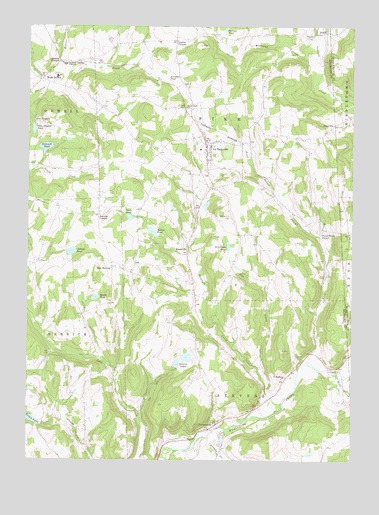
Le Raysville, PA USGS Topographic Map
Click on map above to begin viewing in our Map Viewer.

This topographic map contains these locations and features:
Feature Name Type Latitude Longitude GNIS ID View Map
Agnew PondLakeN41.8158°W76.2016°1168089View Map
Atwoods PondLakeN41.8594°W76.1952°1168496View Map
Beaver CreekStreamN41.8631°W76.2394°1169007View Map
Bert Jayne PondLakeN41.8117°W76.1724°1169318View Map
Borough of Le RaysvilleCivilN41.8381°W76.1776°1214952View Map
Bosworth CemeteryCemeteryN41.8125°W76.1612°2776408View Map
BrushvillePopulated PlaceN41.8101°W76.1877°1203177View Map
Centerville / Stevens CemeteryCemeteryN41.8200°W76.1715°1171473View Map
Chaffee CornersLocaleN41.8712°W76.1922°1171525View Map
Chillson PondLakeN41.8100°W76.2329°1192260View Map
Concklin CornersLocaleN41.8651°W76.2377°1172279View Map
East HerrickPopulated PlaceN41.8056°W76.2169°1203474View Map
East Herrick CemeteryCemeteryN41.8057°W76.2135°2776421View Map
Ford Family CemeteryCemeteryN41.8180°W76.1421°2776428View Map
Ford Street CreekStreamN41.8140°W76.1366°1174957View Map
Giffin AirportAirportN41.7781°W76.1373°1194284View Map
Le RaysvillePopulated PlaceN41.8387°W76.1802°1179076View Map
Le Raysville CemeteryCemeteryN41.8446°W76.1821°2776453View Map
Le Raysville Post OfficePost OfficeN41.8425°W76.1819°2773179View Map
Leisure LakesReservoirN41.7797°W76.1882°1179180View Map
Leraysville - Pike Volunteer Fire Department - Station 6BuildingN41.8393°W76.1834°2653295View Map
Maple Grove SchoolSchoolN41.8517°W76.1883°1180342View Map
Mill CreekStreamN41.7751°W76.1580°1181135View Map
NeathPopulated PlaceN41.8734°W76.1352°1204262View Map
Neath CemeteryCemeteryN41.8725°W76.1418°2776469View Map
Northeast Bradford High SchoolSchoolN41.8642°W76.2358°1182660View Map
Overpeck CemeteryCemeteryN41.7654°W76.2490°2776476View Map
Phillips PondReservoirN41.8742°W76.1738°1183677View Map
Pike Post Office (historical)Post OfficeN41.7765°W76.1585°1214383View Map
PrattvillePopulated PlaceN41.8467°W76.1316°1204444View Map
Reeves PondLakeN41.7969°W76.2234°1184852View Map
Rockwell CreekStreamN41.7640°W76.1538°1185338View Map
Rockwell PondLakeN41.8401°W76.2430°1185339View Map
Ross CreekStreamN41.7787°W76.1413°1185488View Map
Saint Matthews ChurchChurchN41.7740°W76.1497°1186459View Map
Smith PondLakeN41.8200°W76.2101°1187882View Map
Stevens CornersLocaleN41.8206°W76.2222°1188624View Map
StevensvillePopulated PlaceN41.7606°W76.1763°1188642View Map
Stevensville CemeteryCemeteryN41.7610°W76.1744°2776503View Map
Stevensville Post OfficePost OfficeN41.7603°W76.1770°2773264View Map
Stone House CornerPopulated PlaceN41.8148°W76.1369°1204743View Map
Totem LakeReservoirN41.7620°W76.2494°1189670View Map
Totem Lake DamDamN41.7601°W76.2430°1195785View Map
Township of PikeCivilN41.8449°W76.1754°1215988View Map
Township of StevensCivilN41.7733°W76.1690°1215996View Map
Valley View CemeteryCemeteryN41.8647°W76.2073°2776516View Map
Wells HollowPopulated PlaceN41.8598°W76.2449°1204917View Map
Williams CreekStreamN41.8665°W76.1380°1191459View Map
Wolf CreekStreamN41.7734°W76.1285°1191654View Map
Zion HeightsPopulated PlaceN41.8465°W76.2480°1205017View Map
Zion Heights PondLakeN41.8451°W76.2475°1192015View Map

Note: Coordinates in the location and feature list above are referenced to NAD83 datum.


Copyright (C) 2008-2025 Ryan Niemi / Sunset Dynamics ... All Rights Reserved