TopoQuest Logo
Do you find TopoQuest useful?
Help keep TopoQuest running and adding new maps/features by donating!
Bitcoin:  19c7KJd3qBynnjoSw5npx9KScwjBe4ifkT
Litecoin:  LXs6TkuXGGXo1vDsWCkWVdjQX94eUKd6ui
Home View Maps Find Maps Find Places Resources & Links


Rome, Pennsylvania Topographic Map

USGS Map Title: Rome, PA
USGS Map MRC: 41076G3
DRG (GeoTIFF) Download: o41076g3.tif


Neighboring USGS Topographic Map Quads:


  Litchfield, PA  
41076H4
 

  Windham, PA  
41076H3
 

  Little Meadows, PA  
41076H2
 

  Towanda, PA  
41076G4
 

  Rome, PA  
41076G3
 

  Le Raysville, PA  
41076G2
 

  Monroeton, PA  
41076F4
 

  Wyalusing, PA  
41076F3
 

  Laceyville, PA  
41076F2


Map MRC Location:

N42°
W77°
N42°
W76°
H8 H7 H6 H5 H4 H3 H2 H1
G8 G7 G6 G5 G4 G3 G2 G1
F8 F7 F6 F5 F4 F3 F2 F1
E8 E7 E6 E5 E4 E3 E2 E1
D8 D7 D6 D5 D4 D3 D2 D1
C8 C7 C6 C5 C4 C3 C2 C1
B8 B7 B6 B5 B4 B3 B2 B1
A8 A7 A6 A5 A4 A3 A2 A1
N41°
W77°
N41°
W76°

Rome, PA USGS 1:24K Topographic Map Preview:
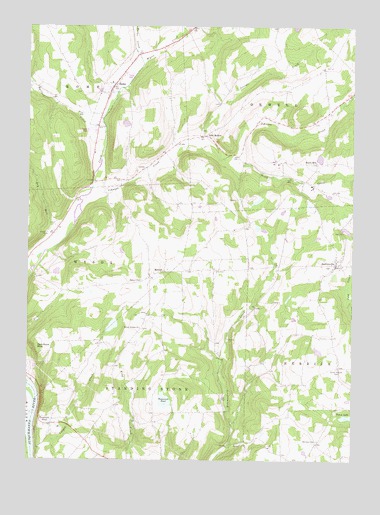
Rome, PA USGS Topographic Map
Click on map above to begin viewing in our Map Viewer.

This topographic map contains these locations and features:
Feature Name Type Latitude Longitude GNIS ID View Map
Allis HollowPopulated PlaceN41.8434°W76.3058°1202968View Map
Allis Hollow CemeteryCemeteryN41.8455°W76.3080°2776400View Map
Ballibay CemeteryCemeteryN41.7555°W76.2630°1168668View Map
Ballibay School (historical)SchoolN41.7554°W76.2630°1197346View Map
Bear CreekStreamN41.8567°W76.3397°1988111View Map
Borough of RomeCivilN41.8575°W76.3414°1214955View Map
Bullard CreekStreamN41.8459°W76.3455°1170655View Map
Cebu School (historical)SchoolN41.8167°W76.2924°1197341View Map
Center SchoolSchoolN41.7659°W76.3330°1197344View Map
Chestnut SchoolSchoolN41.7912°W76.3227°1197343View Map
Claverack PondReservoirN41.7610°W76.3658°1171939View Map
Dry RunStreamN41.8131°W76.3619°1173551View Map
Fall RunStreamN41.8106°W76.3666°1212957View Map
Herrick Post Office (historical)Post OfficeN41.7770°W76.2547°1214384View Map
HerrickvillePopulated PlaceN41.8065°W76.2563°1176884View Map
Herrickville CemeteryCemeteryN41.8064°W76.2592°2776439View Map
Herrickville Volunteer Fire Department 4BuildingN41.8082°W76.2556°2653231View Map
Ireland Catholic CemeteryCemeteryN41.8047°W76.3027°2776445View Map
Jannone-Ballibay Airport (historical)AirportN41.7520°W76.2844°1194280View Map
Jerome CreekStreamN41.8412°W76.3080°1178052View Map
Johnson CreekStreamN41.8251°W76.3533°1178114View Map
Keene Summit CemeteryCemeteryN41.7880°W76.3308°2776447View Map
Keene Summit ChurchChurchN41.7879°W76.3313°1178289View Map
London School (historical)SchoolN41.7859°W76.2658°1197345View Map
MercurPopulated PlaceN41.8026°W76.3277°1204154View Map
Mercur CemeteryCemeteryN41.8019°W76.3310°1180939View Map
Parks CreekStreamN41.8648°W76.3305°1183331View Map
Red Rock MountainSummitN41.7826°W76.3710°1184779View Map
RomePopulated PlaceN41.8584°W76.3408°1185413View Map
Rome CemeteryCemeteryN41.8641°W76.3348°2776485View Map
Rome Post OfficePost OfficeN41.8561°W76.3435°2777450View Map
Sierra Ridge Airport (historical)AirportN41.8056°W76.2613°1194291View Map
South CreekStreamN41.8373°W76.2944°1188054View Map
South Herrick CemeteryCemeteryN41.7766°W76.2555°1188077View Map
South HillPopulated PlaceN41.8359°W76.2635°1204689View Map
South Hill CemeteryCemeteryN41.8354°W76.2635°2776498View Map
Tamarack PondLakeN41.7672°W76.3218°1189247View Map
Taylers CreekStreamN41.8404°W76.3172°1212956View Map
Township of HerrickCivilN41.7866°W76.2536°1215981View Map
Township of OrwellCivilN41.8734°W76.2707°1215986View Map
Township of RomeCivilN41.8740°W76.3637°1215990View Map
Township of Standing StoneCivilN41.7673°W76.3263°1215995View Map
Vigilante Engine Company 1BuildingN41.8577°W76.3415°2653600View Map
West Valley School (historical)SchoolN41.7698°W76.3552°1197342View Map
Woodburn CemeteryCemeteryN41.8213°W76.3583°2776526View Map

Note: Coordinates in the location and feature list above are referenced to NAD83 datum.


Copyright (C) 2008-2025 Ryan Niemi / Sunset Dynamics ... All Rights Reserved