TopoQuest Logo
Do you find TopoQuest useful?
Help keep TopoQuest running and adding new maps/features by donating!
Bitcoin:  19c7KJd3qBynnjoSw5npx9KScwjBe4ifkT
Litecoin:  LXs6TkuXGGXo1vDsWCkWVdjQX94eUKd6ui
Home View Maps Find Maps Find Places Resources & Links


Sandgap, Kentucky Topographic Map

USGS Map Title: Sandgap, KY
USGS Map MRC: 37084D1
DRG (GeoTIFF) Download: o37084d1.tif


Neighboring USGS Topographic Map Quads:


  Bighill, KY  
37084E2
 

  Alcorn, KY  
37084E1
 

  Leighton, KY  
37083E8
 

  Johnetta, KY  
37084D2
 

  Sandgap, KY  
37084D1
 

  McKee, KY  
37083D8
 

  Livingston, KY  
37084C2
 

  Parrot, KY  
37084C1
 

  Tyner, KY  
37083C8


Map MRC Location:

N38°
W85°
N38°
W84°
H8 H7 H6 H5 H4 H3 H2 H1
G8 G7 G6 G5 G4 G3 G2 G1
F8 F7 F6 F5 F4 F3 F2 F1
E8 E7 E6 E5 E4 E3 E2 E1
D8 D7 D6 D5 D4 D3 D2 D1
C8 C7 C6 C5 C4 C3 C2 C1
B8 B7 B6 B5 B4 B3 B2 B1
A8 A7 A6 A5 A4 A3 A2 A1
N37°
W85°
N37°
W84°

Sandgap, KY USGS 1:24K Topographic Map Preview:
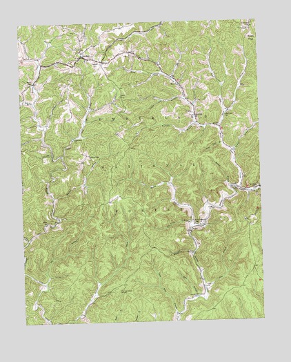
Sandgap, KY USGS Topographic Map
Click on map above to begin viewing in our Map Viewer.

This topographic map contains these locations and features:
Feature Name Type Latitude Longitude GNIS ID View Map
Becket BranchStreamN37.4306°W84.0155°510491View Map
Bethel (historical)Populated PlaceN37.4165°W84.1126°2505085View Map
Bethel Baptist ChurchChurchN37.4161°W84.1127°2505035View Map
Bethel SchoolSchoolN37.4165°W84.1119°510572View Map
Birch Lick ChurchChurchN37.4618°W84.0330°510736View Map
Birch Lick CreekStreamN37.4306°W84.0105°510737View Map
Birch Lick School (historical)SchoolN37.4603°W84.0333°2505038View Map
Carpenter RidgeRidgeN37.4078°W84.0887°2505047View Map
Cavanaugh SchoolSchoolN37.4979°W84.0035°511257View Map
Clover Bottom CreekStreamN37.4087°W84.1219°511420View Map
Collier Post Office (historical)Post OfficeN37.4478°W84.1026°2505057View Map
Collingsworth Post Office (historical)Post OfficeN37.4858°W84.1155°2505058View Map
Congleton HollowValleyN37.4768°W84.0450°2505059View Map
Deer Stable Baptist ChurchChurchN37.4878°W84.0692°2505068View Map
Dry BranchStreamN37.3909°W84.1138°511909View Map
Elisha BranchStreamN37.4462°W84.0144°512027View Map
Garden HollowValleyN37.4572°W84.1116°2505083View Map
Gravel LickLocaleN37.4523°W84.0982°2505084View Map
Gravel Lick BranchStreamN37.4445°W84.1035°512398View Map
Gravel Lick SchoolSchoolN37.4520°W84.0969°512400View Map
Hooten BranchStreamN37.4151°W84.0347°512775View Map
HurleyPopulated PlaceN37.4126°W84.0372°512855View Map
Hurley Post Office (historical)Post OfficeN37.4142°W84.0363°2504904View Map
Hurst SchoolSchoolN37.4754°W84.1191°512876View Map
Jackson CountyCivilN37.4198°W84.0058°516901View Map
Joes BranchStreamN37.3913°W84.0853°2504908View Map
Lettered Rock ChurchChurchN37.4448°W84.0888°513346View Map
Lower Bills BranchStreamN37.3776°W84.0441°513672View Map
Mayapple BranchStreamN37.4581°W84.0319°513835View Map
Mill Creek Wildlife Management AreaParkN37.3998°W84.0210°516776View Map
Old Field BranchStreamN37.4140°W84.0380°516619View Map
Pigeon Roost CreekStreamN37.4309°W84.0108°514549View Map
Poplar Lick BranchStreamN37.4684°W84.0374°514717View Map
Rock Lick BranchStreamN37.4668°W84.1180°515032View Map
Roses ForkStreamN37.4623°W84.0172°515112View Map
S Tree CampgroundLocaleN37.3862°W84.0733°516620View Map
S Tree Lookout TowerTowerN37.3876°W84.0735°517274View Map
Sand Gap Fire DepartmentBuildingN37.4840°W84.0837°2636562View Map
Sand LickFlatN37.4617°W84.0171°2504993View Map
Sand Lick CreekStreamN37.4565°W84.0205°515223View Map
Sand Lick SchoolSchoolN37.4612°W84.0172°515226View Map
SandgapPopulated PlaceN37.4862°W84.0905°515235View Map
Sandgap DivisionCivilN37.4793°W84.1145°1937241View Map
School Number 1SchoolN37.4834°W84.0835°517277View Map
School Number 2SchoolN37.4693°W84.0722°517279View Map
Shop BranchStreamN37.3851°W84.0335°515367View Map
Shop Branch Post Office (historical)Post OfficeN37.3856°W84.0355°2504962View Map
Stone Coal BranchStreamN37.4495°W84.0188°515721View Map
Stone Coal LickFlatN37.3760°W84.1126°2504994View Map
Toms BranchStreamN37.3893°W84.0302°515975View Map
Upper Indian Creek (historical)Populated PlaceN37.4146°W84.0347°2504981View Map
Upper Indian Creek SchoolSchoolN37.4156°W84.0330°516131View Map
Walkers BranchStreamN37.4279°W84.1083°516210View Map
WanetaPopulated PlaceN37.4745°W84.0410°516222View Map
Waneta Post OfficePost OfficeN37.4681°W84.0377°2504983View Map
Whetstone BranchStreamN37.4034°W84.0355°516287View Map

Note: Coordinates in the location and feature list above are referenced to NAD83 datum.


Copyright (C) 2008-2024 Ryan Niemi / Sunset Dynamics ... All Rights Reserved