TopoQuest Logo
Do you find TopoQuest useful?
Help keep TopoQuest running and adding new maps/features by donating!
Bitcoin:  19c7KJd3qBynnjoSw5npx9KScwjBe4ifkT
Litecoin:  LXs6TkuXGGXo1vDsWCkWVdjQX94eUKd6ui
Home View Maps Find Maps Find Places Resources & Links


Liddieville, Louisiana Topographic Map

USGS Map Title: Liddieville, LA
USGS Map MRC: 32091B7
DRG (GeoTIFF) Download: o32091b7.tif


Neighboring USGS Topographic Map Quads:


  Gilleyville, LA  
32091C8
 

  Mangham, LA  
32091C7
 

  Baskinton, LA  
32091C6
 

  Hebert, LA  
32091B8
 

  Liddieville, LA  
32091B7
 

  Winnsboro, LA  
32091B6
 

  Mason, LA  
32091A8
 

  Fort Necessity, LA  
32091A7
 

  Gilbert, LA  
32091A6


Map MRC Location:

N33°
W92°
N33°
W91°
H8 H7 H6 H5 H4 H3 H2 H1
G8 G7 G6 G5 G4 G3 G2 G1
F8 F7 F6 F5 F4 F3 F2 F1
E8 E7 E6 E5 E4 E3 E2 E1
D8 D7 D6 D5 D4 D3 D2 D1
C8 C7 C6 C5 C4 C3 C2 C1
B8 B7 B6 B5 B4 B3 B2 B1
A8 A7 A6 A5 A4 A3 A2 A1
N32°
W92°
N32°
W91°

Liddieville, LA USGS 1:24K Topographic Map Preview:
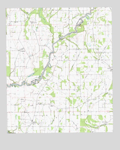
Liddieville, LA USGS Topographic Map
Click on map above to begin viewing in our Map Viewer.

This topographic map contains these locations and features:
Feature Name Type Latitude Longitude GNIS ID View Map
Apostolic Church of Jesus ChristChurchN32.1888°W91.7518°556305View Map
Apostolic TabernacleChurchN32.1529°W91.8229°541346View Map
Austin CemeteryCemeteryN32.2310°W91.8376°541365View Map
Boeuf River Baptist ChurchChurchN32.1349°W91.8449°556620View Map
Duncan CemeteryCemeteryN32.2429°W91.8726°534653View Map
Egypt SchoolSchoolN32.2371°W91.8454°534781View Map
Goldmine Plantation Landing StripAirportN32.2057°W91.8515°548680View Map
Greater Pilgrim Rest ChurchChurchN32.2360°W91.8449°541364View Map
Henry CemeteryCemeteryN32.1290°W91.7665°547459View Map
Hewitt LakeLakeN32.1831°W91.8466°554702View Map
KMAR-AM (Winnsboro)TowerN32.1946°W91.7585°1633250View Map
KMAR-FM (Winnsboro)TowerN32.1946°W91.7585°1633120View Map
LiddievillePopulated PlaceN32.1357°W91.8457°543398View Map
Liddieville AirportAirportN32.1570°W91.8443°544111View Map
Liddieville Free Methodist ChurchChurchN32.1382°W91.8451°544583View Map
Little BrakeStreamN32.1354°W91.7835°553751View Map
Little CreekStreamN32.2146°W91.8196°536532View Map
Lone Cedar Baptist ChurchChurchN32.2052°W91.7662°555129View Map
Lone Cedar CemeteryCemeteryN32.2043°W91.7643°544093View Map
Mound BayouGutN32.1943°W91.7951°537274View Map
Mount Zion ChurchChurchN32.1540°W91.8362°537443View Map
New Hope ChurchChurchN32.1774°W91.8265°541347View Map
New Zion Baptist ChurchChurchN32.1252°W91.7760°555490View Map
New Zion CemeteryCemeteryN32.1254°W91.7757°541348View Map
Nickols CemeteryCemeteryN32.2457°W91.8471°537677View Map
Ogden CemeteriesCemeteryN32.1463°W91.8526°537817View Map
Ogden High SchoolSchoolN32.1371°W91.8457°544097View Map
Pardue SchoolSchoolN32.1932°W91.8162°537965View Map
Parish Governing Authority District 2CivilN32.1446°W91.8176°1929893View Map
Pine BayouStreamN32.2488°W91.7704°538157View Map
Pine BayouStreamN32.2252°W91.7918°555650View Map
Russell Airport (historical)AirportN32.1571°W91.8607°1633013View Map
Sardis ChurchChurchN32.1571°W91.7793°539180View Map
Simms Chapel CemeteryCemeteryN32.2363°W91.8651°541363View Map
Sims CemeteryCemeteryN32.2271°W91.8673°539392View Map
Sims ChurchChurchN32.2374°W91.8571°539393View Map
Smith CemeteryCemeteryN32.1982°W91.8190°539439View Map
Ward EightCivilN32.1346°W91.8435°545033View Map
Williams Flying ServiceAirportN32.2290°W91.8552°2676773View Map
Zion Travelers ChurchChurchN32.2035°W91.8412°540609View Map

Note: Coordinates in the location and feature list above are referenced to NAD83 datum.


Copyright (C) 2008-2024 Ryan Niemi / Sunset Dynamics ... All Rights Reserved