TopoQuest Logo
Do you find TopoQuest useful?
Help keep TopoQuest running and adding new maps/features by donating!
Bitcoin:  19c7KJd3qBynnjoSw5npx9KScwjBe4ifkT
Litecoin:  LXs6TkuXGGXo1vDsWCkWVdjQX94eUKd6ui
Home View Maps Find Maps Find Places Resources & Links


Uniondale, Indiana Topographic Map

USGS Map Title: Uniondale, IN
USGS Map MRC: 40085G2
DRG (GeoTIFF) Download: o40085g2.tif


Neighboring USGS Topographic Map Quads:


  Zanesville, IN  
40085H3
 

  Ossian, IN  
40085H2
 

  Poe, IN  
40085H1
 

  Markle, IN  
40085G3
 

  Uniondale, IN  
40085G2
 

  Preble, IN  
40085G1
 

  Liberty Center, IN  
40085F3
 

  Bluffton, IN  
40085F2
 

  Linn Grove, IN  
40085F1


Map MRC Location:

N41°
W86°
N41°
W85°
H8 H7 H6 H5 H4 H3 H2 H1
G8 G7 G6 G5 G4 G3 G2 G1
F8 F7 F6 F5 F4 F3 F2 F1
E8 E7 E6 E5 E4 E3 E2 E1
D8 D7 D6 D5 D4 D3 D2 D1
C8 C7 C6 C5 C4 C3 C2 C1
B8 B7 B6 B5 B4 B3 B2 B1
A8 A7 A6 A5 A4 A3 A2 A1
N40°
W86°
N40°
W85°

Uniondale, IN USGS 1:24K Topographic Map Preview:
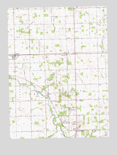
Uniondale, IN USGS Topographic Map
Click on map above to begin viewing in our Map Viewer.

This topographic map contains these locations and features:
Feature Name Type Latitude Longitude GNIS ID View Map
Bender DitchCanalN40.7892°W85.2480°430799View Map
Calvary ChurchChurchN40.7648°W85.1664°431986View Map
Dowty DitchCanalN40.8084°W85.1939°433677View Map
Flemming DitchCanalN40.8175°W85.2266°434587View Map
Grandlienard-Hogg AirportAirportN40.7564°W85.2469°2677023View Map
GreenwoodPopulated PlaceN40.8445°W85.1769°435462View Map
Halls CreekStreamN40.7625°W85.1919°435623View Map
Johns CreekStreamN40.7609°W85.1397°437024View Map
KingslandPopulated PlaceN40.8300°W85.1772°437335View Map
Lancaster Central SchoolSchoolN40.7856°W85.1619°437592View Map
Lancaster ChapelChurchN40.8009°W85.1372°437593View Map
Lusk DitchCanalN40.7575°W85.2122°438412View Map
Mayer AirportAirportN40.7884°W85.2436°2677107View Map
McCullough DitchCanalN40.7798°W85.2139°438843View Map
MurrayPopulated PlaceN40.7920°W85.2008°439894View Map
Murray CemeteryCemeteryN40.8003°W85.1955°439896View Map
Murray Conservation ClubLocaleN40.7925°W85.2139°452367View Map
North OaksPopulated PlaceN40.7767°W85.1739°440281View Map
Oak Lawn CemeteryCemeteryN40.8746°W85.1653°440443View Map
Prospect ChurchChurchN40.8742°W85.2364°441611View Map
Skip's Place AirportAirportN40.8365°W85.1673°2676903View Map
Stewart DitchCanalN40.7762°W85.1319°444153View Map
Toll Gate HeightsPopulated PlaceN40.7573°W85.1658°444801View Map
Toll Gate Rest ParkParkN40.7917°W85.1655°444802View Map
Town of UniondaleCivilN40.8300°W85.2408°2397705View Map
Township of JeffersonCivilN40.8736°W85.1480°453503View Map
Township of LancasterCivilN40.7863°W85.1471°453540View Map
UniondalePopulated PlaceN40.8306°W85.2416°445136View Map
Uniondale Volunteer Fire DepartmentBuildingN40.8307°W85.2368°2626461View Map

Note: Coordinates in the location and feature list above are referenced to NAD83 datum.


Copyright (C) 2008-2025 Ryan Niemi / Sunset Dynamics ... All Rights Reserved