TopoQuest Logo
Do you find TopoQuest useful?
Help keep TopoQuest running and adding new maps/features by donating!
Bitcoin:  19c7KJd3qBynnjoSw5npx9KScwjBe4ifkT
Litecoin:  LXs6TkuXGGXo1vDsWCkWVdjQX94eUKd6ui
Home View Maps Find Maps Find Places Resources & Links


Logtown, Mississippi Topographic Map

USGS Map Title: Logtown, MS
USGS Map MRC: 30089C5
DRG (GeoTIFF) Download: o30089c5.tif


Neighboring USGS Topographic Map Quads:


  Nicholson, MS  
30089D6
 

  Dead Tiger Creek, MS  
30089D5
 

  Kiln, MS  
30089D4
 

  Haaswood, LA  
30089C6
 

  Logtown, MS  
30089C5
 

  Waveland, MS  
30089C4
 

  Rigolets, LA  
30089B6
 

  English Lookout, LA  
30089B5
 

  Saint Joe Pass, MS  
30089B4


Map MRC Location:

N31°
W90°
N31°
W89°
H8 H7 H6 H5 H4 H3 H2 H1
G8 G7 G6 G5 G4 G3 G2 G1
F8 F7 F6 F5 F4 F3 F2 F1
E8 E7 E6 E5 E4 E3 E2 E1
D8 D7 D6 D5 D4 D3 D2 D1
C8 C7 C6 C5 C4 C3 C2 C1
B8 B7 B6 B5 B4 B3 B2 B1
A8 A7 A6 A5 A4 A3 A2 A1
N30°
W90°
N30°
W89°

Logtown, MS USGS 1:24K Topographic Map Preview:
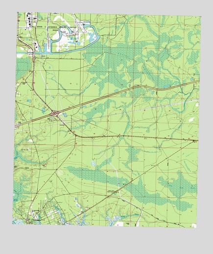
Logtown, MS USGS Topographic Map
Click on map above to begin viewing in our Map Viewer.

This topographic map contains these locations and features:
Feature Name Type Latitude Longitude GNIS ID View Map
Devils SwampSwampN30.3485°W89.5448°669242View Map
First Southern Baptist ChurchChurchN30.2531°W89.6154°2597108View Map
Greater Mount Zion African Methodist Episcopal ChurchChurchN30.2590°W89.6022°2596325View Map
Holmes Chapel United Methodist ChurchChurchN30.2509°W89.6132°2596191View Map
Interchange 2CrossingN30.3158°W89.6020°691346View Map
Interstate 10 Mississippi Welcome CenterBuildingN30.3131°W89.5996°2596733View Map
LogtownPopulated PlaceN30.2830°W89.6212°672774View Map
Logtown CemeteryCemeteryN30.2827°W89.6242°672775View Map
Lower Devils SwampSwampN30.2745°W89.5112°672913View Map
Mount Zion ChurchChurchN30.2927°W89.6098°674326View Map
New Hope Baptist ChurchChurchN30.2630°W89.6021°2596326View Map
Spring Branch ChurchChurchN30.3124°W89.6181°678078View Map
Supervisor District 2CivilN30.3596°W89.6033°695805View Map
The Point CemeteryCemeteryN30.2941°W89.6151°678666View Map
Westonia (historical)Populated PlaceN30.3016°W89.5834°710454View Map
Westonia LookoutLocaleN30.3013°W89.5806°679542View Map

Note: Coordinates in the location and feature list above are referenced to NAD83 datum.


Copyright (C) 2008-2025 Ryan Niemi / Sunset Dynamics ... All Rights Reserved