TopoQuest Logo
Do you find TopoQuest useful?
Help keep TopoQuest running and adding new maps/features by donating!
Bitcoin:  19c7KJd3qBynnjoSw5npx9KScwjBe4ifkT
Litecoin:  LXs6TkuXGGXo1vDsWCkWVdjQX94eUKd6ui
Home View Maps Find Maps Find Places Resources & Links


Battle Ax, Oregon Topographic Map

USGS Map Title: Battle Ax, OR
USGS Map MRC: 44122G2
DRG (GeoTIFF) Download: o44122g2.tif


Neighboring USGS Topographic Map Quads:


  Rooster Rock, OR  
44122H3
 

  Bagby Hot Springs, OR  
44122H2
 

  Bull of the Woods, OR  
44122H1
 

  Elkhorn, OR  
44122G3
 

  Battle Ax, OR  
44122G2
 

  Mother Lode Mountain, OR  
44122G1
 

  Lawhead Creek, OR  
44122F3
 

  Detroit, OR  
44122F2
 

  Idanha, OR  
44122F1


Map MRC Location:

N45°
W123°
N45°
W122°
H8 H7 H6 H5 H4 H3 H2 H1
G8 G7 G6 G5 G4 G3 G2 G1
F8 F7 F6 F5 F4 F3 F2 F1
E8 E7 E6 E5 E4 E3 E2 E1
D8 D7 D6 D5 D4 D3 D2 D1
C8 C7 C6 C5 C4 C3 C2 C1
B8 B7 B6 B5 B4 B3 B2 B1
A8 A7 A6 A5 A4 A3 A2 A1
N44°
W123°
N44°
W122°

Battle Ax, OR USGS 1:24K Topographic Map Preview:
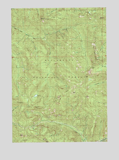
Battle Ax, OR USGS Topographic Map
Click on map above to begin viewing in our Map Viewer.

This topographic map contains these locations and features:
Feature Name Type Latitude Longitude GNIS ID View Map
Amalgamated MineMineN44.8426°W122.1995°1155876View Map
Battle AxSummitN44.8265°W122.1396°1137578View Map
Battle Ax CreekStreamN44.8457°W122.2081°1137579View Map
Beachie CreekStreamN44.8287°W122.2012°1155484View Map
Beachie SaddleGapN44.8185°W122.1451°1137613View Map
Beachie TrailTrailN44.8165°W122.1595°1137614View Map
Blue Jay CreekStreamN44.8554°W122.1790°1153811View Map
Blue Jay MineMineN44.8543°W122.1790°1138306View Map
Boulder PeakSummitN44.7957°W122.1713°1138486View Map
Byars PeakSummitN44.7919°W122.1529°1139088View Map
Cedar LakeLakeN44.7837°W122.2299°1139522View Map
Dog Tooth RockPillarN44.7830°W122.2202°1141148View Map
Dome RockSummitN44.7526°W122.2086°1141166View Map
East Marion DivisionCivilN44.7974°W122.1253°1938061View Map
Elk Lake Recreation SiteLocaleN44.8204°W122.1281°1155877View Map
French Creek RidgeRidgeN44.7929°W122.1834°1142463View Map
French Creek TrailTrailN44.7960°W122.1590°1142464View Map
Giebeler LakeLakeN44.8080°W122.1486°1155481View Map
Jawbone Flats (historical)Populated PlaceN44.8469°W122.2093°2084317View Map
Knutson SaddleGapN44.7518°W122.2373°1144696View Map
Marten ButtesSummitN44.7862°W122.1913°1163127View Map
Marten CreekStreamN44.7629°W122.1742°1163654View Map
Mount BeachieSummitN44.8099°W122.1543°1162832View Map
Needle RockPillarN44.7501°W122.2042°1146754View Map
Opal CreekStreamN44.8426°W122.2031°1147244View Map
Opal Creek TrailTrailN44.8395°W122.2008°2084211View Map
Opal LakeLakeN44.7932°W122.2198°1147248View Map
Opal PoolLakeN44.8441°W122.2063°2084207View Map
Phantom Natural BridgeArchN44.7871°W122.2442°1147628View Map
Rocky Top ShelterLocaleN44.7826°W122.2365°1148678View Map
Rocky Top TrailTrailN44.7810°W122.2390°1148679View Map
Sardine MountainSummitN44.7566°W122.2376°1163257View Map
Silver King LakeLakeN44.8703°W122.1481°1134687View Map
Silver King MountainSummitN44.8643°W122.1342°1149500View Map
Stony CreekStreamN44.8476°W122.2229°1150453View Map
United States Forest Service Elk Lake Campground Boat RampLocaleN44.8221°W122.1257°2699909View Map
Whetstone MountainSummitN44.8650°W122.2082°1152179View Map

Note: Coordinates in the location and feature list above are referenced to NAD83 datum.


Copyright (C) 2008-2024 Ryan Niemi / Sunset Dynamics ... All Rights Reserved