TopoQuest Logo
Do you find TopoQuest useful?
Help keep TopoQuest running and adding new maps/features by donating!
Bitcoin:  19c7KJd3qBynnjoSw5npx9KScwjBe4ifkT
Litecoin:  LXs6TkuXGGXo1vDsWCkWVdjQX94eUKd6ui
Home View Maps Find Maps Find Places Resources & Links


Brownstown, Illinois Topographic Map

USGS Map Title: Brownstown, IL
USGS Map MRC: 38088H8
DRG (GeoTIFF) Download: o38088h8.tif


Neighboring USGS Topographic Map Quads:


  Vera, IL  
39089A1
 

  Avena, IL  
39088A8
 

  Altamont West, IL  
39088A7
 

  Vandalia, IL  
38089H1
 

  Brownstown, IL  
38088H8
 

  Loogootee, IL  
38088H7
 

  Patoka, IL  
38089G1
 

  Saint Paul, IL  
38088G8
 

  Kinmundy, IL  
38088G7


Map MRC Location:

N39°
W89°
N39°
W88°
H8 H7 H6 H5 H4 H3 H2 H1
G8 G7 G6 G5 G4 G3 G2 G1
F8 F7 F6 F5 F4 F3 F2 F1
E8 E7 E6 E5 E4 E3 E2 E1
D8 D7 D6 D5 D4 D3 D2 D1
C8 C7 C6 C5 C4 C3 C2 C1
B8 B7 B6 B5 B4 B3 B2 B1
A8 A7 A6 A5 A4 A3 A2 A1
N38°
W89°
N38°
W88°

Brownstown, IL USGS 1:24K Topographic Map Preview:
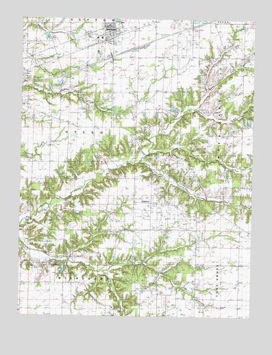
Brownstown, IL USGS Topographic Map
Click on map above to begin viewing in our Map Viewer.

This topographic map contains these locations and features:
Feature Name Type Latitude Longitude GNIS ID View Map
Arm Prairie CemeteryCemeteryN38.9128°W88.9437°1802256View Map
Arm Prairie ChurchChurchN38.9137°W88.9428°403615View Map
Berry Hill School (historical)SchoolN38.9559°W88.9006°404222View Map
BrownstownPopulated PlaceN38.9959°W88.9528°404988View Map
Brownstown Elementary SchoolSchoolN38.9920°W88.9598°1773054View Map
Brownstown High SchoolSchoolN38.9920°W88.9573°1773055View Map
Brownstown Post OfficePost OfficeN38.9963°W88.9543°1773056View Map
Brownstown United Methodist ChurchChurchN38.9945°W88.9531°2055235View Map
Brownstown Volunteer Fire DepartmentBuildingN38.9919°W88.9507°2640193View Map
Brush College School (historical)SchoolN38.9103°W88.9762°405014View Map
Center CemeteryCemeteryN38.8892°W88.9898°1802260View Map
Center Church (historical)ChurchN38.8881°W88.9898°405788View Map
Cheshier CemeteryCemeteryN38.8848°W88.9687°1965926View Map
ConfidencePopulated PlaceN38.9228°W88.9264°422574View Map
Cumberland School (historical)SchoolN38.9850°W88.9762°406886View Map
First Baptist Church of BrownstownChurchN38.9970°W88.9481°2055241View Map
First Christian ChurchChurchN38.9934°W88.9531°2055242View Map
Fourmile School (historical)SchoolN38.9567°W88.9751°408598View Map
Frogtown CemeteryCemeteryN38.8778°W88.9464°1966018View Map
Gatch LakeReservoirN38.8953°W88.9765°1691761View Map
German Reformed CemeteryCemeteryN38.9328°W88.9051°1802263View Map
German Reformed Church (historical)ChurchN38.9334°W88.9053°408969View Map
Griffith CemeteryCemeteryN38.9770°W88.9784°409502View Map
Little Hickory CreekStreamN38.9403°W88.9362°412353View Map
Mahon School (historical)SchoolN38.9664°W88.9370°412853View Map
Old Loogootee CemeteryCemeteryN38.9217°W88.8934°1802274View Map
Old Loogootee School (historical)SchoolN38.9214°W88.8953°415025View Map
Oliver Reece PondReservoirN38.9434°W88.9151°1691747View Map
Oliver Reece Pond DamDamN38.9434°W88.9151°1691746View Map
Pilcher CemeteryCemeteryN38.9661°W88.9681°415672View Map
Pleasant Grove School (historical)SchoolN38.8981°W88.9006°415798View Map
Saint Peter Sportsman DamDamN38.8967°W88.9767°1691760View Map
Sidener CemeteryCemeteryN38.9839°W88.8775°1965987View Map
Stone CreekStreamN38.9439°W88.9303°419163View Map
Township of OtegoCivilN38.9545°W88.9744°429512View Map
Village of BrownstownCivilN38.9943°W88.9553°2397473View Map
Walnut CreekStreamN38.9628°W88.9062°420443View Map
Walnut Grove School (historical)SchoolN38.9850°W88.8995°420462View Map
WilbertonPopulated PlaceN38.8795°W88.9514°1773125View Map
Wilberton School (historical)SchoolN38.8798°W88.9534°421136View Map
Winslow Pilcher CemeteryCemeteryN38.9620°W88.9673°1965935View Map

Note: Coordinates in the location and feature list above are referenced to NAD83 datum.


Copyright (C) 2008-2024 Ryan Niemi / Sunset Dynamics ... All Rights Reserved