TopoQuest Logo
Do you find TopoQuest useful?
Help keep TopoQuest running and adding new maps/features by donating!
Bitcoin:  19c7KJd3qBynnjoSw5npx9KScwjBe4ifkT
Litecoin:  LXs6TkuXGGXo1vDsWCkWVdjQX94eUKd6ui
Home View Maps Find Maps Find Places Resources & Links


Dushore, Pennsylvania Topographic Map

USGS Map Title: Dushore, PA
USGS Map MRC: 41076E4
DRG (GeoTIFF) Download: o41076e4.tif


Neighboring USGS Topographic Map Quads:


  Powell, PA  
41076F5
 

  Monroeton, PA  
41076F4
 

  Wyalusing, PA  
41076F3
 

  Overton, PA  
41076E5
 

  Dushore, PA  
41076E4
 

  Colley, PA  
41076E3
 

  Eagles Mere, PA  
41076D5
 

  Laporte, PA  
41076D4
 

  Lopez, PA  
41076D3


Map MRC Location:

N42°
W77°
N42°
W76°
H8 H7 H6 H5 H4 H3 H2 H1
G8 G7 G6 G5 G4 G3 G2 G1
F8 F7 F6 F5 F4 F3 F2 F1
E8 E7 E6 E5 E4 E3 E2 E1
D8 D7 D6 D5 D4 D3 D2 D1
C8 C7 C6 C5 C4 C3 C2 C1
B8 B7 B6 B5 B4 B3 B2 B1
A8 A7 A6 A5 A4 A3 A2 A1
N41°
W77°
N41°
W76°

Dushore, PA USGS 1:24K Topographic Map Preview:
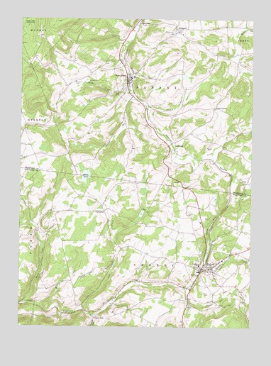
Dushore, PA USGS Topographic Map
Click on map above to begin viewing in our Map Viewer.

This topographic map contains these locations and features:
Feature Name Type Latitude Longitude GNIS ID View Map
Beaver PondLakeN41.5611°W76.4641°1169023View Map
Beaver RunStreamN41.5962°W76.4399°1169030View Map
Black CreekStreamN41.5101°W76.4969°1169697View Map
Bob Kosts PondReservoirN41.5309°W76.3981°1212582View Map
Borough of DushoreCivilN41.5250°W76.3987°1215603View Map
Borough of New AlbanyCivilN41.6002°W76.4446°1214954View Map
Bowman CreekStreamN41.5698°W76.3966°1170064View Map
Cherry MillsPopulated PlaceN41.5037°W76.4588°1203259View Map
CoveytownPopulated PlaceN41.5467°W76.4538°1203356View Map
Coyles CornersLocaleN41.5890°W76.3952°1172572View Map
DushorePopulated PlaceN41.5242°W76.4008°1173647View Map
Dushore Post OfficePost OfficeN41.5240°W76.4017°2773126View Map
Dushore Volunteer Fire Company Station 57BuildingN41.5237°W76.4026°2653486View Map
Dwight's Delight AirportAirportN41.5219°W76.4610°1194249View Map
EvergreenPopulated PlaceN41.6201°W76.4141°1174360View Map
Evergreen CemeteryCemeteryN41.6193°W76.4172°2776425View Map
Fairview CemeteryCemeteryN41.5137°W76.3955°1174503View Map
French CreekStreamN41.5890°W76.4316°1175220View Map
Heverly Family CemeteryCemeteryN41.5777°W76.4968°2776440View Map
Hillcrest CemeteryCemeteryN41.5959°W76.4425°2776427View Map
Ladds CreekStreamN41.5998°W76.4388°1178746View Map
LaddsburgPopulated PlaceN41.5748°W76.4172°1203971View Map
Laddsburg CemeteryCemeteryN41.5748°W76.4159°2776450View Map
Lick CreekStreamN41.5079°W76.4663°1179278View Map
Marsh RunStreamN41.5229°W76.4033°1180457View Map
Methodist CemeteryCemeteryN41.5688°W76.4985°2776441View Map
Mill CreekStreamN41.5087°W76.4880°1181132View Map
Mount Tabor CemeteryCemeteryN41.5992°W76.4702°1181855View Map
New AlbanyPopulated PlaceN41.6001°W76.4419°1182281View Map
New Albany Post OfficePost OfficeN41.5981°W76.4421°2773222View Map
New Albany Volunteer Fire Company Station 8BuildingN41.5989°W76.4416°2653194View Map
Payne RunStreamN41.5159°W76.4105°1183413View Map
Redeemer ChurchChurchN41.5212°W76.4030°1184805View Map
Saint Basils SchoolSchoolN41.5254°W76.4024°1185816View Map
Saint Pauls ChurchChurchN41.5251°W76.3963°1186630View Map
SatterfieldLocaleN41.5106°W76.4080°1212581View Map
StevensonPopulated PlaceN41.6231°W76.4347°1204734View Map
Township of AlbanyCivilN41.6008°W76.4244°1215971View Map
Township of CherryCivilN41.5060°W76.4067°1217067View Map
Wampole RunStreamN41.5045°W76.4586°1190572View Map
Wilcox Stevenson CemeteryCemeteryN41.6224°W76.4367°2776521View Map
Zadock P Corson CemeteryCemeteryN41.6168°W76.4228°2776529View Map

Note: Coordinates in the location and feature list above are referenced to NAD83 datum.


Copyright (C) 2008-2025 Ryan Niemi / Sunset Dynamics ... All Rights Reserved