TopoQuest Logo
Do you find TopoQuest useful?
Help keep TopoQuest running and adding new maps/features by donating!
Bitcoin:  19c7KJd3qBynnjoSw5npx9KScwjBe4ifkT
Litecoin:  LXs6TkuXGGXo1vDsWCkWVdjQX94eUKd6ui
Home View Maps Find Maps Find Places Resources & Links


Lowryville, Tennessee Topographic Map

USGS Map Title: Lowryville, TN
USGS Map MRC: 35088A1
DRG (GeoTIFF) Download: o35088a1.tif


Neighboring USGS Topographic Map Quads:


  Savannah, TN  
35088B2
 

  Wolf Pit Ridge, TN  
35088B1
 

  Martins Mills, TN  
35087B8
 

  Pickwick, TN  
35088A2
 

  Lowryville, TN  
35088A1
 

  Ransom Stand, TN  
35087A8
 

  Yellow Creek, MS  
34088H2
 

  Waterloo, AL  
34088H1
 

  Wright, AL  
34087H8


Map MRC Location:

N36°
W89°
N36°
W88°
H8 H7 H6 H5 H4 H3 H2 H1
G8 G7 G6 G5 G4 G3 G2 G1
F8 F7 F6 F5 F4 F3 F2 F1
E8 E7 E6 E5 E4 E3 E2 E1
D8 D7 D6 D5 D4 D3 D2 D1
C8 C7 C6 C5 C4 C3 C2 C1
B8 B7 B6 B5 B4 B3 B2 B1
A8 A7 A6 A5 A4 A3 A2 A1
N35°
W89°
N35°
W88°

Lowryville, TN USGS 1:24K Topographic Map Preview:
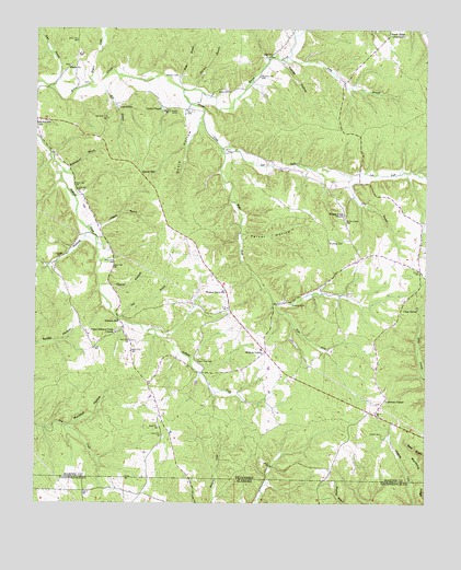
Lowryville, TN USGS Topographic Map
Click on map above to begin viewing in our Map Viewer.

This topographic map contains these locations and features:
Feature Name Type Latitude Longitude GNIS ID View Map
Barrier School (historical)SchoolN35.0387°W88.0861°1323724View Map
Big IvyPopulated PlaceN35.1176°W88.0506°1314678View Map
Big Ivy CemeteryCemeteryN35.1176°W88.0506°1323734View Map
Boltie HollowValleyN35.1100°W88.0532°1313241View Map
Brown CemeteryCemeteryN35.1087°W88.0639°1278520View Map
Cantrell-Johnson CemeteryCemeteryN35.1031°W88.1234°1652244View Map
Cave Hollow CemeteryCemeteryN35.1176°W88.0386°1323753View Map
Cherry CemeteryCemeteryN35.1081°W88.0911°1323756View Map
Cherry ChapelChurchN35.1037°W88.0848°1305876View Map
Cherry Chapel CemeteryCemeteryN35.1034°W88.0795°1646823View Map
Cherry School (historical)SchoolN35.1042°W88.0848°1323757View Map
Church CemeteryCemeteryN35.1059°W88.0578°1323761View Map
Clack SpringSpringN35.0515°W88.0023°1305935View Map
Clay BranchStreamN35.0862°W88.0245°1280624View Map
Clover HollowValleyN35.0575°W88.1007°1280777View Map
Commissioner District 7CivilN35.1075°W88.0903°2464614View Map
Cossey CemeteryCemeteryN35.0867°W88.0606°1323765View Map
Davis HollowValleyN35.1018°W88.0728°1282182View Map
Dean BranchStreamN35.1092°W88.1211°1282263View Map
District 7 (historical)CivilN35.0751°W88.0459°1310170View Map
Duke School (historical)SchoolN35.0034°W88.1089°141136View Map
Duncan ChapelChurchN35.0273°W88.0123°1283158View Map
Duncans Chapel School (historical)SchoolN35.0279°W88.0123°1323783View Map
Faint Hope CemeteryCemeteryN35.0379°W88.0731°1283967View Map
Fielder CemeteryCemeteryN35.0187°W88.0139°1284240View Map
Forest Ridge Union ChurchChurchN35.1234°W88.0123°1284606View Map
Fox HollowValleyN35.0698°W88.1096°1284783View Map
Franks Store CemeteryCemeteryN35.1073°W88.0975°1323795View Map
Frazier HollowValleyN35.1163°W88.0463°1284859View Map
Hardin County Fire Department / Emergency Management District 11 Station 1BuildingN35.0433°W88.0522°2653738View Map
Harrison BranchStreamN35.1090°W88.0742°1287003View Map
Holland Creek School (historical)SchoolN35.0595°W88.1011°1323825View Map
Hollands Creek CemeteryCemeteryN35.0454°W88.0989°1323826View Map
Holly BranchStreamN35.0337°W88.0000°1288097View Map
Johnson BranchStreamN35.0726°W88.1089°1289522View Map
Jones Store (historical)LocaleN35.1012°W88.1248°1323843View Map
Left Fork Whites CreekStreamN35.0931°W88.0650°1290993View Map
Lower Church (historical)ChurchN35.0595°W88.1020°1323856View Map
LowryvillePopulated PlaceN35.1042°W88.0989°1315444View Map
Marshall HollowValleyN35.0203°W88.1137°1292770View Map
Math BranchStreamN35.1098°W88.0795°1292917View Map
Meetinghouse BranchStreamN35.0876°W88.1167°1293542View Map
Mill BranchStreamN35.1109°W88.1045°1293790View Map
Parker HollowValleyN35.0708°W88.0590°1296829View Map
Petty BranchStreamN35.1176°W88.0436°1297267View Map
Petty Branch CemeteryCemeteryN35.1129°W88.0270°1323899View Map
Pollards MillPopulated PlaceN35.0479°W88.0978°1315751View Map
Porter CemeteryCemeteryN35.1106°W88.1084°1323912View Map
Prospect CemeteryCemeteryN35.0531°W88.0428°1298574View Map
Right Fork Whites CreekStreamN35.0931°W88.0650°1299437View Map
Rogers CreekStreamN35.1101°W88.1061°1300007View Map
Roundtop CemeteryCemeteryN35.0692°W88.0309°1300188View Map
Roundtop Church (historical)ChurchN35.0695°W88.0311°1323922View Map
Russell CemeteryCemeteryN35.1051°W88.0567°1323924View Map
Sand HillSummitN35.0870°W88.0914°1300664View Map
Still BranchStreamN35.0487°W88.0978°1271383View Map
Stricklin CemeteryCemeteryN35.1126°W88.0792°1271593View Map
Upper Holland Creek ChurchChurchN35.0451°W88.0992°1304279View Map
Walnut GrovePopulated PlaceN35.0401°W88.0511°1304349View Map
Walnut Grove CemeteryCemeteryN35.0559°W88.0653°1323974View Map
Walnut Grove Census Designated PlaceCensusN35.0479°W88.0641°2586085View Map
Walnut Grove ChurchChurchN35.0562°W88.0642°1304351View Map
Walnut Grove Elementary SchoolSchoolN35.0406°W88.0525°1323976View Map
Wards CemeteryCemeteryN35.1156°W88.1145°1323978View Map
Wards ChurchChurchN35.1151°W88.1136°1273804View Map
Wards School (historical)SchoolN35.1148°W88.1145°1323979View Map
Weatherford CemeteryCemeteryN35.0979°W88.0692°1323981View Map
Whites CreekStreamN35.1087°W88.0778°1274456View Map
Whites Creek CemeteryCemeteryN35.0751°W88.0259°1274460View Map
Whites Creek ChurchChurchN35.0762°W88.0261°1274461View Map
Whites Creek School (historical)SchoolN35.0770°W88.0270°1323991View Map

Note: Coordinates in the location and feature list above are referenced to NAD83 datum.


Copyright (C) 2008-2025 Ryan Niemi / Sunset Dynamics ... All Rights Reserved