TopoQuest Logo
Do you find TopoQuest useful?
Help keep TopoQuest running and adding new maps/features by donating!
Bitcoin:  19c7KJd3qBynnjoSw5npx9KScwjBe4ifkT
Litecoin:  LXs6TkuXGGXo1vDsWCkWVdjQX94eUKd6ui
Home View Maps Find Maps Find Places Resources & Links


Lynch, Pennsylvania Topographic Map

USGS Map Title: Lynch, PA
USGS Map MRC: 41079E1
DRG (GeoTIFF) Download: o41079e1.tif


Neighboring USGS Topographic Map Quads:


  Cherry Grove, PA  
41079F2
 

  Sheffield, PA  
41079F1
 

  Ludlow, PA  
41078F8
 

  Mayburg, PA  
41079E2
 

  Lynch, PA  
41079E1
 

  Russell City, PA  
41078E8
 

  Marienville West, PA  
41079D2
 

  Marienville East, PA  
41079D1
 

  Hallton, PA  
41078D8


Map MRC Location:

N42°
W80°
N42°
W79°
H8 H7 H6 H5 H4 H3 H2 H1
G8 G7 G6 G5 G4 G3 G2 G1
F8 F7 F6 F5 F4 F3 F2 F1
E8 E7 E6 E5 E4 E3 E2 E1
D8 D7 D6 D5 D4 D3 D2 D1
C8 C7 C6 C5 C4 C3 C2 C1
B8 B7 B6 B5 B4 B3 B2 B1
A8 A7 A6 A5 A4 A3 A2 A1
N41°
W80°
N41°
W79°

Lynch, PA USGS 1:24K Topographic Map Preview:
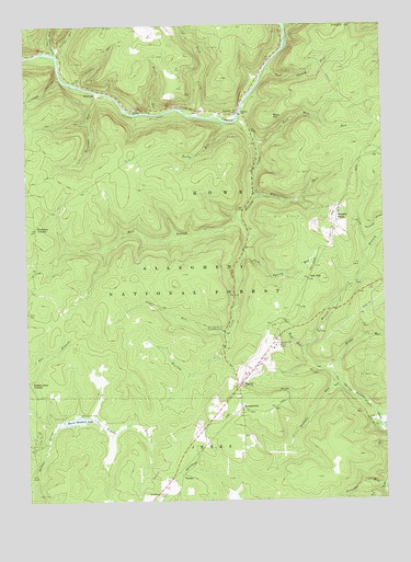
Lynch, PA USGS Topographic Map
Click on map above to begin viewing in our Map Viewer.

This topographic map contains these locations and features:
Feature Name Type Latitude Longitude GNIS ID View Map
Bald HillSummitN41.6006°W79.0384°1209392View Map
Bald Hill RunStreamN41.5934°W79.0434°1209393View Map
Beaver Meadows DamDamN41.5217°W79.1098°1210256View Map
Beaver Meadows LakeReservoirN41.5213°W79.1074°1209408View Map
Beaver Meadows Recreation SiteLocaleN41.5228°W79.1064°1210509View Map
Blue Jay Spring Recreation AreaLocaleN41.5453°W79.0562°1209433View Map
Bluejay CreekStreamN41.5998°W79.0498°1209437View Map
Bush CreekStreamN41.6012°W79.0625°1209463View Map
ByromtownPopulated PlaceN41.5242°W79.0503°1209467View Map
Deadman CornersLocaleN41.5720°W79.1214°1209552View Map
Gilfoyle RunStreamN41.5306°W79.0150°1209629View Map
HastingsPopulated PlaceN41.6070°W79.0998°1209660View Map
Hastings RunStreamN41.6078°W79.0998°1209661View Map
Iron CityPopulated PlaceN41.5581°W79.0264°1209692View Map
Lindsey HollowValleyN41.6117°W79.1127°1209760View Map
Lower Sheriff RunStreamN41.6178°W79.1148°1209784View Map
LynchPopulated PlaceN41.6023°W79.0503°1209786View Map
Marienville Rod and Gun ClubLocaleN41.5351°W79.0256°1210506View Map
Martin RunStreamN41.6020°W79.0787°1209799View Map
PenokePopulated PlaceN41.5062°W79.0709°1209879View Map
Penoke RunStreamN41.5206°W79.1006°1209880View Map
PigeonPopulated PlaceN41.5306°W79.0511°1213999View Map
Rappe RunStreamN41.5342°W79.0181°1209915View Map
Reagan RunStreamN41.6095°W79.1059°1209917View Map
Rock RunStreamN41.5398°W79.0278°1209931View Map
Rock Spring RunStreamN41.5667°W79.0487°1209936View Map
Rocky RunStreamN41.6003°W79.0598°1209938View Map
Slater RunStreamN41.5745°W79.0503°1209987View Map
Straight RunStreamN41.5037°W79.0003°1210021View Map
Thad Shanty RunStreamN41.6134°W79.0400°1210032View Map
Township of HoweCivilN41.5765°W79.0814°1216455View Map
Upper Sheriff RunStreamN41.6176°W79.1134°1210070View Map
Watson BranchStreamN41.5306°W79.0150°1210090View Map
Watson FarmLocaleN41.5773°W79.0148°1210505View Map
Watsontown RunStreamN41.5812°W79.0445°1210091View Map
West Branch Bluejay CreekStreamN41.5745°W79.0506°1210098View Map

Note: Coordinates in the location and feature list above are referenced to NAD83 datum.


Copyright (C) 2008-2024 Ryan Niemi / Sunset Dynamics ... All Rights Reserved