TopoQuest Logo
Do you find TopoQuest useful?
Help keep TopoQuest running and adding new maps/features by donating!
Bitcoin:  19c7KJd3qBynnjoSw5npx9KScwjBe4ifkT
Litecoin:  LXs6TkuXGGXo1vDsWCkWVdjQX94eUKd6ui
Home View Maps Find Maps Find Places Resources & Links


Richardson Summit, Idaho Topographic Map

USGS Map Title: Richardson Summit, ID
USGS Map MRC: 43114D4
DRG (GeoTIFF) Download: o43114d4.tif


Neighboring USGS Topographic Map Quads:


  Buttercup Mountain, ID  
43114E5
 

  Mahoney Butte, ID  
43114E4
 

  Hailey, ID  
43114E3
 

  Beaver Creek, ID  
43114D5
 

  Richardson Summit, ID  
43114D4
 

  Bellevue, ID  
43114D3
 

  Macon, ID  
43114C5
 

  Magic Reservoir West, ID  
43114C4
 

  Magic Reservoir East, ID  
43114C3


Map MRC Location:

N44°
W115°
N44°
W114°
H8 H7 H6 H5 H4 H3 H2 H1
G8 G7 G6 G5 G4 G3 G2 G1
F8 F7 F6 F5 F4 F3 F2 F1
E8 E7 E6 E5 E4 E3 E2 E1
D8 D7 D6 D5 D4 D3 D2 D1
C8 C7 C6 C5 C4 C3 C2 C1
B8 B7 B6 B5 B4 B3 B2 B1
A8 A7 A6 A5 A4 A3 A2 A1
N43°
W115°
N43°
W114°

Richardson Summit, ID USGS 1:24K Topographic Map Preview:
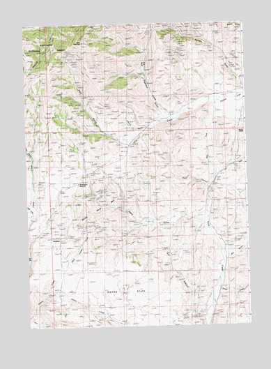
Richardson Summit, ID USGS Topographic Map
Click on map above to begin viewing in our Map Viewer.

This topographic map contains these locations and features:
Feature Name Type Latitude Longitude GNIS ID View Map
Apache MillLocaleN43.4830°W114.3842°376675View Map
Black Cinder GulchValleyN43.4002°W114.4792°377737View Map
BullionPopulated PlaceN43.4727°W114.3767°399372View Map
Bullion GulchValleyN43.4727°W114.3770°378491View Map
Camas FlatsFlatN43.3930°W114.4562°378737View Map
Camas MineMineN43.4118°W114.4776°378739View Map
DoniphanPopulated PlaceN43.4107°W114.4845°397636View Map
Doniphan Post Office (historical)Post OfficeN43.4107°W114.4845°2027029View Map
Dry GulchValleyN43.4027°W114.3878°380875View Map
Eagle CreekStreamN43.4221°W114.4967°380980View Map
East Fork Rock CreekStreamN43.4363°W114.3928°381164View Map
Elk CreekStreamN43.4646°W114.4089°381352View Map
Flat CreekStreamN43.4041°W114.4981°395389View Map
Gilman FlatFlatN43.4671°W114.3823°382274View Map
Golden Star MineMineN43.4010°W114.4628°382420View Map
Guy CanyonValleyN43.3791°W114.4003°382781View Map
Hatty GulchValleyN43.4193°W114.3998°382963View Map
Jumbo CanyonValleyN43.4457°W114.4964°395540View Map
Kelly GulchValleyN43.4507°W114.4431°384141View Map
Kelly MountainSummitN43.4924°W114.4673°392671View Map
Kent CanyonValleyN43.4330°W114.3970°384170View Map
Liberty Gem MineMineN43.4566°W114.4395°384601View Map
Liberty GulchValleyN43.4571°W114.4317°384602View Map
Long GulchValleyN43.4288°W114.3792°386053View Map
Red Elephant GulchValleyN43.4631°W114.4201°389191View Map
Red Elephant MineMineN43.4899°W114.4314°374617View Map
Richardson SummitSummitN43.4374°W114.4717°389350View Map
Rocky ButteSummitN43.4557°W114.3762°398063View Map
Smith CreekStreamN43.3916°W114.3937°390676View Map
Stewart RanchLocaleN43.4260°W114.3959°391455View Map
Tip Top MineMineN43.4155°W114.4553°392188View Map
Treasure Vault MineMineN43.4302°W114.4548°392372View Map
West Fork Rock CreekStreamN43.4363°W114.3931°393182View Map

Note: Coordinates in the location and feature list above are referenced to NAD83 datum.


Copyright (C) 2008-2024 Ryan Niemi / Sunset Dynamics ... All Rights Reserved