TopoQuest Logo
Do you find TopoQuest useful?
Help keep TopoQuest running and adding new maps/features by donating!
Bitcoin:  19c7KJd3qBynnjoSw5npx9KScwjBe4ifkT
Litecoin:  LXs6TkuXGGXo1vDsWCkWVdjQX94eUKd6ui
Home View Maps Find Maps Find Places Resources & Links


Maple Springs, North Carolina Topographic Map

USGS Map Title: Maple Springs, NC
USGS Map MRC: 36081B4
DRG (GeoTIFF) Download: o36081b4.tif


Neighboring USGS Topographic Map Quads:


  Todd, NC  
36081C5
 

  Glendale Springs, NC  
36081C4
 

  Horse Gap, NC  
36081C3
 

  Deep Gap, NC  
36081B5
 

  Maple Springs, NC  
36081B4
 

  Purlear, NC  
36081B3
 

  Buffalo Cove, NC  
36081A5
 

  Grandin, NC  
36081A4
 

  Boomer, NC  
36081A3


Map MRC Location:

N37°
W82°
N37°
W81°
H8 H7 H6 H5 H4 H3 H2 H1
G8 G7 G6 G5 G4 G3 G2 G1
F8 F7 F6 F5 F4 F3 F2 F1
E8 E7 E6 E5 E4 E3 E2 E1
D8 D7 D6 D5 D4 D3 D2 D1
C8 C7 C6 C5 C4 C3 C2 C1
B8 B7 B6 B5 B4 B3 B2 B1
A8 A7 A6 A5 A4 A3 A2 A1
N36°
W82°
N36°
W81°

Maple Springs, NC USGS 1:24K Topographic Map Preview:
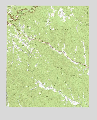
Maple Springs, NC USGS Topographic Map
Click on map above to begin viewing in our Map Viewer.

This topographic map contains these locations and features:
Feature Name Type Latitude Longitude GNIS ID View Map
Cascade FallsFallsN36.2492°W81.4541°982719View Map
Cascade OverlookLocaleN36.2454°W81.4576°982721View Map
Chestnut MountainSummitN36.2037°W81.4604°983118View Map
Dividing RidgeRidgeN36.1657°W81.4084°984214View Map
Elk RidgeRidgeN36.1535°W81.4782°984704View Map
Fall CreekStreamN36.1968°W81.4279°984972View Map
Fire Scale MountainSummitN36.2332°W81.4918°985075View Map
Fletcher CreekStreamN36.1935°W81.4126°985210View Map
Flint KnobSummitN36.1857°W81.4384°1020290View Map
Flowers BranchStreamN36.1896°W81.4670°1805909View Map
Fox BranchStreamN36.1485°W81.4420°985354View Map
Greens RidgeRidgeN36.1890°W81.4795°986111View Map
HarleyPopulated PlaceN36.1929°W81.4145°1020621View Map
Hendrix (historical)Populated PlaceN36.1379°W81.4082°1959845View Map
Highland View ChurchChurchN36.2065°W81.4618°986783View Map
Husons RidgeRidgeN36.2446°W81.4879°987292View Map
Ivy Point RidgeRidgeN36.2224°W81.4823°987457View Map
Jeffress ParkAreaN36.2417°W81.4833°2574474View Map
Johnson MountainSummitN36.1632°W81.4007°987684View Map
Laurel BranchStreamN36.1687°W81.4604°988178View Map
Laurel Spur RidgeRidgeN36.2190°W81.4659°988213View Map
Left Prong Stony ForkStreamN36.1499°W81.4454°988328View Map
Lewis Fork OverlookLocaleN36.2329°W81.4862°988399View Map
Little CreekStreamN36.1815°W81.3979°988594View Map
Maple SpringsPopulated PlaceN36.1749°W81.3784°989312View Map
Meadow BranchStreamN36.1468°W81.4268°989664View Map
Mill CreekStreamN36.1471°W81.4312°989931View Map
Miller MountainSummitN36.1737°W81.4204°1021467View Map
Mount ZionPopulated PlaceN36.1535°W81.4459°1006305View Map
Mount Zion Baptist ChurchChurchN36.1496°W81.4326°1959852View Map
Mountain View ChurchChurchN36.1810°W81.4762°990726View Map
Parmer MountainSummitN36.1387°W81.4401°1021821View Map
Pattons RidgePopulated PlaceN36.2312°W81.4370°1021833View Map
Pattons Ridge Church (historical)ChurchN36.2312°W81.4568°1959857View Map
Pumpkin RunStreamN36.1782°W81.3790°992902View Map
Shell CreekStreamN36.1296°W81.3929°994636View Map
Stony ForkPopulated PlaceN36.2112°W81.4859°1805925View Map
Stony Fork ChurchChurchN36.2118°W81.4865°995567View Map
Stony Fork School (historical)SchoolN36.2099°W81.4776°1805926View Map
SummitLocaleN36.2376°W81.4059°995689View Map
Thomkins Knob OverlookLocaleN36.2446°W81.4657°996044View Map
Tomkins KnobSummitN36.2407°W81.4773°1027470View Map
Township of Jobs CabinCivilN36.2256°W81.4128°1027327View Map
Wade Harris BridgeBridgeN36.2074°W81.4476°996658View Map
Wildcat CreekStreamN36.1804°W81.4907°997313View Map
Wolf KnobSummitN36.2171°W81.4643°997533View Map
Yates KnobSummitN36.1724°W81.4501°997694View Map
Yellow Hill ChurchChurchN36.2437°W81.4145°997710View Map

Note: Coordinates in the location and feature list above are referenced to NAD83 datum.


Copyright (C) 2008-2024 Ryan Niemi / Sunset Dynamics ... All Rights Reserved