TopoQuest Logo
Do you find TopoQuest useful?
Help keep TopoQuest running and adding new maps/features by donating!
Bitcoin:  19c7KJd3qBynnjoSw5npx9KScwjBe4ifkT
Litecoin:  LXs6TkuXGGXo1vDsWCkWVdjQX94eUKd6ui
Home View Maps Find Maps Find Places Resources & Links


Purlear, North Carolina Topographic Map

USGS Map Title: Purlear, NC
USGS Map MRC: 36081B3
DRG (GeoTIFF) Download: o36081b3.tif


Neighboring USGS Topographic Map Quads:


  Glendale Springs, NC  
36081C4
 

  Horse Gap, NC  
36081C3
 

  McGrady, NC  
36081C2
 

  Maple Springs, NC  
36081B4
 

  Purlear, NC  
36081B3
 

  Wilkesboro, NC  
36081B2
 

  Grandin, NC  
36081A4
 

  Boomer, NC  
36081A3
 

  Moravian Falls, NC  
36081A2


Map MRC Location:

N37°
W82°
N37°
W81°
H8 H7 H6 H5 H4 H3 H2 H1
G8 G7 G6 G5 G4 G3 G2 G1
F8 F7 F6 F5 F4 F3 F2 F1
E8 E7 E6 E5 E4 E3 E2 E1
D8 D7 D6 D5 D4 D3 D2 D1
C8 C7 C6 C5 C4 C3 C2 C1
B8 B7 B6 B5 B4 B3 B2 B1
A8 A7 A6 A5 A4 A3 A2 A1
N36°
W82°
N36°
W81°

Purlear, NC USGS 1:24K Topographic Map Preview:
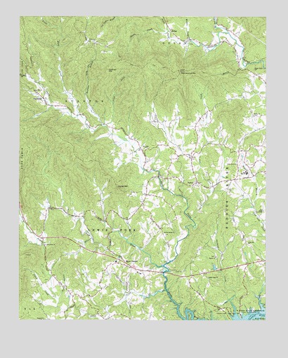
Purlear, NC USGS Topographic Map
Click on map above to begin viewing in our Map Viewer.

This topographic map contains these locations and features:
Feature Name Type Latitude Longitude GNIS ID View Map
Arbor Grove United Methodist ChurchChurchN36.1896°W81.2645°980272View Map
Boiling Springs ChurchChurchN36.1612°W81.3012°981690View Map
Bullis Tabernacle ChurchChurchN36.1704°W81.2506°982230View Map
Champion Volunteer Fire Department Main StationBuildingN36.1485°W81.3245°2638881View Map
Charity ChurchChurchN36.2099°W81.2559°983033View Map
Coal CreekStreamN36.1671°W81.2879°983307View Map
CongoLocaleN36.1574°W81.2598°1002159View Map
Congo Hill ChurchChurchN36.1568°W81.2587°983451View Map
Deep Ford HillSummitN36.2282°W81.2559°1019937View Map
Dicks Hollow School (historical)SchoolN36.1321°W81.3195°1959838View Map
Dunkirk ChurchChurchN36.1260°W81.3615°984433View Map
Hamby MountainSummitN36.1607°W81.2826°1959842View Map
Hays ArborPopulated PlaceN36.1846°W81.2556°1959843View Map
Hays MillLocaleN36.1862°W81.3040°1959844View Map
Hoover MountainSummitN36.1796°W81.3243°987036View Map
Huffman BranchStreamN36.2054°W81.3318°987218View Map
Huffman MountainSummitN36.2285°W81.3295°987220View Map
Jones CreekStreamN36.2051°W81.3306°987746View Map
Leather Hinge School (historical)SchoolN36.1521°W81.2606°1959848View Map
Lewis Fork ChurchChurchN36.1560°W81.3612°988398View Map
Little Fork CreekStreamN36.2093°W81.3448°988648View Map
Meadow BranchStreamN36.1721°W81.2562°989665View Map
Middle Fork Reddies RiverStreamN36.2404°W81.2881°989779View Map
Millers Creek Volunteer Fire Department Station 2BuildingN36.2237°W81.3661°2639514View Map
Mount PleasantPopulated PlaceN36.1490°W81.3206°990520View Map
Mount Pleasant ChurchChurchN36.1474°W81.3201°1959851View Map
Naked CreekStreamN36.1379°W81.3001°990845View Map
New Hope ChurchChurchN36.1962°W81.3098°991022View Map
North Fork Reddies RiverStreamN36.2435°W81.2684°991229View Map
North Prong Lewis ForkStreamN36.1476°W81.3012°991259View Map
ParsonvillePopulated PlaceN36.2162°W81.3623°1006324View Map
Pilgrim ChurchChurchN36.1518°W81.2751°992198View Map
PurlearPopulated PlaceN36.1821°W81.2843°992920View Map
Purlear ChurchChurchN36.1932°W81.2881°992921View Map
Purlear CreekStreamN36.1765°W81.2920°1022111View Map
Purlear Post OfficePost OfficeN36.1838°W81.2849°2774059View Map
Quarry BranchStreamN36.2299°W81.2598°992937View Map
Ready BranchPopulated PlaceN36.1404°W81.3540°1959860View Map
Ready BranchStreamN36.1343°W81.3543°993089View Map
Rendezvous MountainSummitN36.2274°W81.2929°1022219View Map
Rendezvous Mountain State ParkParkN36.2271°W81.2937°1023486View Map
Sandy CreekStreamN36.2443°W81.2987°994257View Map
Sharper MountainSummitN36.2093°W81.2670°1959863View Map
Smitheys CreekStreamN36.1260°W81.2637°994995View Map
Smitheys Creek Public Use AreaParkN36.1271°W81.2684°994996View Map
South Fork Reddies RiverStreamN36.2407°W81.2881°995160View Map
South Prong Lewis ForkStreamN36.1479°W81.3015°995198View Map
StauntonPopulated PlaceN36.1954°W81.3131°1959865View Map
Stony Hill ChurchChurchN36.2193°W81.3665°995572View Map
Township of Lewis ForkCivilN36.1522°W81.3351°1027328View Map
Township of StantonCivilN36.2166°W81.3348°1027337View Map
Twomile BranchStreamN36.2254°W81.3712°996393View Map
West High SchoolSchoolN36.1854°W81.2595°997023View Map
White Oak ChurchChurchN36.2401°W81.3376°997170View Map
WilbarPopulated PlaceN36.2446°W81.2981°1006407View Map
Yadkin Valley ChurchChurchN36.1426°W81.2787°997682View Map

Note: Coordinates in the location and feature list above are referenced to NAD83 datum.


Copyright (C) 2008-2025 Ryan Niemi / Sunset Dynamics ... All Rights Reserved