TopoQuest Logo
Do you find TopoQuest useful?
Help keep TopoQuest running and adding new maps/features by donating!
Bitcoin:  19c7KJd3qBynnjoSw5npx9KScwjBe4ifkT
Litecoin:  LXs6TkuXGGXo1vDsWCkWVdjQX94eUKd6ui
Home View Maps Find Maps Find Places Resources & Links


Sparta NE, Georgia Topographic Map

USGS Map Title: Sparta NE, GA
USGS Map MRC: 33082D7
DRG (GeoTIFF) Download: o33082d7.tif


Neighboring USGS Topographic Map Quads:


  Crawfordville, GA  
33082E8
 

  Sharon, GA  
33082E7
 

  Cadley, GA  
33082E6
 

  Sparta NW, GA  
33082D8
 

  Sparta NE, GA  
33082D7
 

  Warrenton, GA  
33082D6
 

  Sparta, GA  
33082C8
 

  Jewell, GA  
33082C7
 

  Beall Springs, GA  
33082C6


Map MRC Location:

N34°
W83°
N34°
W82°
H8 H7 H6 H5 H4 H3 H2 H1
G8 G7 G6 G5 G4 G3 G2 G1
F8 F7 F6 F5 F4 F3 F2 F1
E8 E7 E6 E5 E4 E3 E2 E1
D8 D7 D6 D5 D4 D3 D2 D1
C8 C7 C6 C5 C4 C3 C2 C1
B8 B7 B6 B5 B4 B3 B2 B1
A8 A7 A6 A5 A4 A3 A2 A1
N33°
W83°
N33°
W82°

Sparta NE, GA USGS 1:24K Topographic Map Preview:
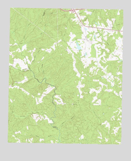
Sparta NE, GA USGS Topographic Map
Click on map above to begin viewing in our Map Viewer.

This topographic map contains these locations and features:
Feature Name Type Latitude Longitude GNIS ID View Map
Andrews ChapelChurchN33.4374°W82.7543°347660View Map
Andrews Chapel CemeteryCemeteryN33.4379°W82.7543°347661View Map
Barnett Lookout TowerTowerN33.4835°W82.7629°344186View Map
Battle - Cato CemeteryCemeteryN33.4267°W82.8726°348190View Map
Battle BranchStreamN33.4360°W82.8346°310863View Map
Beaverdam CreekStreamN33.3976°W82.8279°311003View Map
Burnley CemeteryCemeteryN33.4062°W82.8726°348196View Map
Chafin DamDamN33.4868°W82.7815°336410View Map
Chafin LakeReservoirN33.4869°W82.7795°336411View Map
Chapman BranchStreamN33.3768°W82.8179°312565View Map
Crenshaw CemeteryCemeteryN33.4819°W82.8128°347683View Map
Elim Baptist ChurchChurchN33.4113°W82.7668°347690View Map
Elim CemeteryCemeteryN33.4115°W82.7660°347691View Map
Ephraim Ivey CemeteryCemeteryN33.3876°W82.7568°347693View Map
Exit 56CrossingN33.4987°W82.8063°1705082View Map
George Turner CemeteryCemeteryN33.3904°W82.7774°347698View Map
Greenwood CemeteryCemeteryN33.4968°W82.7985°347701View Map
Greenwood ChurchChurchN33.4968°W82.7990°356107View Map
Harris CemeteryCemeteryN33.4990°W82.7562°347706View Map
Henry - Burnley Family CemeteryCemeteryN33.4293°W82.8720°1985812View Map
Hubert CemeteryCemeteryN33.4149°W82.7679°347712View Map
Ivey CemeteryCemeteryN33.3918°W82.7815°347714View Map
Neal LakeReservoirN33.4718°W82.7815°339508View Map
Neal Lake DamDamN33.4718°W82.7815°339507View Map
New Hope CemeteryCemeteryN33.4312°W82.8660°348236View Map
New Hope ChurchChurchN33.4310°W82.8668°319415View Map
Norwood DivisionCivilN33.4649°W82.7626°1936445View Map
Pilgrim ChurchChurchN33.4293°W82.7671°347747View Map
Potato Hill BranchStreamN33.4474°W82.8538°321092View Map
Powell CreekStreamN33.4435°W82.8518°321115View Map
PoweltonPopulated PlaceN33.4287°W82.8707°326479View Map
Powelton Baptist ChurchChurchN33.4287°W82.8704°348243View Map
Powelton Baptist Church CemeteryCemeteryN33.4301°W82.8704°1985885View Map
Powelton School (historical)SchoolN33.4310°W82.8674°348247View Map
Red Lick CreekStreamN33.4618°W82.8618°321393View Map
Reservoir LakeReservoirN33.4268°W82.8465°338557View Map
Reservoir Lake DamDamN33.4268°W82.8465°338556View Map
Rocky BranchStreamN33.3882°W82.8182°321786View Map
Rocky Branch CemeteryCemeteryN33.4118°W82.8043°347755View Map
Rocky Branch ChurchChurchN33.4115°W82.8038°321798View Map
Shivers Dam Number OneDamN33.4618°W82.7965°336408View Map
Shivers Dam TwoDamN33.4568°W82.7915°336406View Map
Shivers LakeReservoirN33.4817°W82.7910°339504View Map
Shivers Lake DamDamN33.4801°W82.7899°339503View Map
Shivers Lake Number OneReservoirN33.4652°W82.7987°336409View Map
Shivers Lake TwoReservoirN33.4582°W82.7907°336407View Map
Torrence CemeteryCemeteryN33.4932°W82.7668°347773View Map
Tucker CemeteryCemeteryN33.4876°W82.7651°347774View Map
Walker BranchStreamN33.4657°W82.8593°324764View Map
Whiteheads Mill (historical)LocaleN33.4368°W82.8471°348277View Map
William Rabun MonumentParkN33.3821°W82.8679°348279View Map

Note: Coordinates in the location and feature list above are referenced to NAD83 datum.


Copyright (C) 2008-2025 Ryan Niemi / Sunset Dynamics ... All Rights Reserved