TopoQuest Logo
Do you find TopoQuest useful?
Help keep TopoQuest running and adding new maps/features by donating!
Bitcoin:  19c7KJd3qBynnjoSw5npx9KScwjBe4ifkT
Litecoin:  LXs6TkuXGGXo1vDsWCkWVdjQX94eUKd6ui
Home View Maps Find Maps Find Places Resources & Links


Melvin, Alabama Topographic Map

USGS Map Title: Melvin, AL
USGS Map MRC: 31088H4
DRG (GeoTIFF) Download: o31088h4.tif


Neighboring USGS Topographic Map Quads:


  Sykes, MS  
32088A5
 

  Hinton, AL  
32088A4
 

  Land, AL  
32088A3
 

  Carmichael, MS  
31088H5
 

  Melvin, AL  
31088H4
 

  Toxey, AL  
31088H3
 

  Matherville, MS  
31088G5
 

  Isney, AL  
31088G4
 

  Silas, AL  
31088G3


Map MRC Location:

N32°
W89°
N32°
W88°
H8 H7 H6 H5 H4 H3 H2 H1
G8 G7 G6 G5 G4 G3 G2 G1
F8 F7 F6 F5 F4 F3 F2 F1
E8 E7 E6 E5 E4 E3 E2 E1
D8 D7 D6 D5 D4 D3 D2 D1
C8 C7 C6 C5 C4 C3 C2 C1
B8 B7 B6 B5 B4 B3 B2 B1
A8 A7 A6 A5 A4 A3 A2 A1
N31°
W89°
N31°
W88°

Melvin, AL USGS 1:24K Topographic Map Preview:
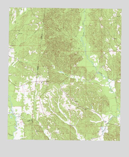
Melvin, AL USGS Topographic Map
Click on map above to begin viewing in our Map Viewer.

This topographic map contains these locations and features:
Feature Name Type Latitude Longitude GNIS ID View Map
Belmount Methodist ChurchChurchN31.9049°W88.4150°113862View Map
Biddys CreekStreamN31.9310°W88.3886°114212View Map
Brightwater CemeteryCemeteryN31.9724°W88.3850°1805636View Map
Brightwater Methodist ChurchChurchN31.9718°W88.3834°114916View Map
Bucatunna Creek Oil FieldOilfieldN31.9207°W88.4625°151156View Map
Church of GodChurchN31.8774°W88.4036°116132View Map
Creek (historical)Populated PlaceN31.9996°W88.4806°687501View Map
Ditch CreekStreamN31.8988°W88.3820°139992View Map
Donald Assembly of God ChurchChurchN31.8913°W88.4556°117366View Map
East Langsdale Oil FieldOilfieldN31.8960°W88.4873°669589View Map
EilerPopulated PlaceN31.9627°W88.4236°156302View Map
EvansboroPopulated PlaceN31.8838°W88.4681°156325View Map
Hanging Moss CreekStreamN31.8793°W88.4934°670882View Map
Hurricane Baptist ChurchChurchN31.8763°W88.4514°151831View Map
Little Double CreekStreamN31.9424°W88.4989°121779View Map
MelvinPopulated PlaceN31.9304°W88.4589°152299View Map
Melvin Junior High School (historical)SchoolN31.9293°W88.4631°149419View Map
Melvin Oil FieldOilfieldN31.9543°W88.4573°151159View Map
Melvin United Methodist ChurchChurchN31.9282°W88.4564°140052View Map
Miller BranchStreamN31.9727°W88.4195°140057View Map
Mount Mariah Baptist ChurchChurchN31.9121°W88.4253°152440View Map
Mount Pisgah Baptist ChurchChurchN31.9368°W88.4684°674197View Map
Mount Pisgah CemeteryCemeteryN31.9363°W88.4692°709449View Map
Mount Pisgah School (historical)SchoolN31.9371°W88.4686°709450View Map
OkatuppaPopulated PlaceN31.9449°W88.3961°156827View Map
Opossum BranchStreamN31.9599°W88.4253°140080View Map
Pierces Springs (historical)Populated PlaceN31.9752°W88.4898°709463View Map
Pierces Springs ChurchChurchN31.9754°W88.4892°675722View Map
Shady Grove ChurchChurchN31.9643°W88.4967°677566View Map
State Line Church (historical)ChurchN31.9849°W88.4611°140133View Map
State Line Methodist Church (historical)ChurchN31.9863°W88.4625°709478View Map
Stroud CemeteryCemeteryN31.9613°W88.4989°678372View Map
Stroud Line School (historical)SchoolN31.9335°W88.4848°709480View Map
Thornton BranchStreamN31.8965°W88.3953°140142View Map
Trotters Bridge (historical)BridgeN31.8882°W88.4895°684109View Map
TurnerPopulated PlaceN31.9951°W88.3811°140147View Map
Victory Grove Pentecostal Holiness ChurchChurchN31.9932°W88.3806°153845View Map
Water ValleyPopulated PlaceN31.8940°W88.3931°157218View Map
Zion Chapel (historical)ChurchN31.9296°W88.4745°687571View Map
Zion Chapel CemeteryCemeteryN31.9296°W88.4753°679990View Map

Note: Coordinates in the location and feature list above are referenced to NAD83 datum.


Copyright (C) 2008-2024 Ryan Niemi / Sunset Dynamics ... All Rights Reserved