TopoQuest Logo
Do you find TopoQuest useful?
Help keep TopoQuest running and adding new maps/features by donating!
Bitcoin:  19c7KJd3qBynnjoSw5npx9KScwjBe4ifkT
Litecoin:  LXs6TkuXGGXo1vDsWCkWVdjQX94eUKd6ui
Home View Maps Find Maps Find Places Resources & Links


Milltown, Alabama Topographic Map

USGS Map Title: Milltown, AL
USGS Map MRC: 33085A4
DRG (GeoTIFF) Download: o33085a4.tif


Neighboring USGS Topographic Map Quads:


  Wadley North, AL  
33085B5
 

  Roanoke West, AL  
33085B4
 

  Roanoke East, AL  
33085B3
 

  Wadley South, AL  
33085A5
 

  Milltown, AL  
33085A4
 

  Five Points, AL  
33085A3
 

  Dudleyville, AL  
32085H5
 

  Lafayette, AL  
32085H4
 

  Fredonia, AL  
32085H3


Map MRC Location:

N34°
W86°
N34°
W85°
H8 H7 H6 H5 H4 H3 H2 H1
G8 G7 G6 G5 G4 G3 G2 G1
F8 F7 F6 F5 F4 F3 F2 F1
E8 E7 E6 E5 E4 E3 E2 E1
D8 D7 D6 D5 D4 D3 D2 D1
C8 C7 C6 C5 C4 C3 C2 C1
B8 B7 B6 B5 B4 B3 B2 B1
A8 A7 A6 A5 A4 A3 A2 A1
N33°
W86°
N33°
W85°

Milltown, AL USGS 1:24K Topographic Map Preview:
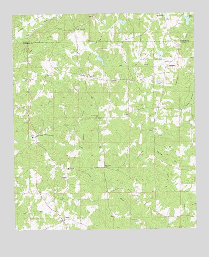
Milltown, AL USGS Topographic Map
Click on map above to begin viewing in our Map Viewer.

This topographic map contains these locations and features:
Feature Name Type Latitude Longitude GNIS ID View Map
Albany (historical)LocaleN33.0346°W85.4261°136009View Map
Antioch ChurchChurchN33.0968°W85.3916°113155View Map
Brown DamDamN33.0851°W85.3849°131197View Map
Brown LakeReservoirN33.0851°W85.3849°131198View Map
Carlisle CreekStreamN33.0435°W85.4538°115623View Map
Chambers County High SchoolSchoolN33.0540°W85.4875°136022View Map
Chappell CemeteryCemeteryN33.0173°W85.4680°147438View Map
ClackvillePopulated PlaceN33.0890°W85.4508°156181View Map
Crowder BranchStreamN33.0696°W85.3849°116921View Map
Davis CreekStreamN33.0596°W85.3841°117122View Map
DoubleheadPopulated PlaceN33.0943°W85.3941°156278View Map
Edge DamDamN33.0018°W85.5000°131139View Map
Edge LakeReservoirN33.0003°W85.4993°131140View Map
Higgins Family CemeteryCemeteryN33.0476°W85.3933°147441View Map
High PinePopulated PlaceN33.1229°W85.4430°140222View Map
High Pine Baptist ChurchChurchN33.1243°W85.4461°120057View Map
High Pine Creek Lake Number 10ReservoirN33.1199°W85.4245°131225View Map
High Pine Creek Watershed Dam Number 10DamN33.1201°W85.4266°131226View Map
High Pine Creek Watershed Dam Number 12DamN33.0985°W85.3983°131204View Map
High Pine Lake Number 11ReservoirN33.0982°W85.4395°131212View Map
High Pine Water Shed Dam Number 11DamN33.1001°W85.4416°131211View Map
Lake LouiseReservoirN33.1208°W85.3795°122048View Map
Lake Louise DamDamN33.1168°W85.3799°131223View Map
Langdon (historical)Populated PlaceN33.0093°W85.4547°136917View Map
Lee CreekStreamN33.0610°W85.3802°121470View Map
Mathews BranchStreamN33.0485°W85.4569°122375View Map
MilltownPopulated PlaceN33.0546°W85.4847°152338View Map
Milltown CemeteryCemeteryN33.0623°W85.4894°122851View Map
Milltown ChurchChurchN33.0571°W85.4813°136072View Map
Milltown ChurchChurchN33.0540°W85.4847°163381View Map
Mount Hickory ChurchChurchN33.0357°W85.4633°123216View Map
Mount Olive Community CenterLocaleN33.0865°W85.4205°123330View Map
Mount Olive Volunteer Fire DepartmentBuildingN33.0866°W85.4194°2691486View Map
New Harmony ChurchChurchN33.0657°W85.4425°152623View Map
New Hope ChurchChurchN33.0871°W85.4897°123825View Map
Peace and Goodwill ChurchChurchN33.1235°W85.3955°124537View Map
PentonPopulated PlaceN33.0065°W85.4655°124600View Map
Penton Census Designated PlaceCensusN33.0090°W85.4721°2582693View Map
Penton ChurchChurchN33.0065°W85.4661°136078View Map
Penton RacewayLocaleN33.0045°W85.4753°163383View Map
Pleasant Hill Baptist ChurchChurchN33.0860°W85.4341°152998View Map
Pooles CrossroadPopulated PlaceN33.1165°W85.4588°156916View Map
Red Caty CreekStreamN33.1037°W85.4522°125474View Map
Red LevelPopulated PlaceN33.0898°W85.4777°156950View Map
Rehope ChurchChurchN33.0573°W85.4041°125552View Map
Rock FencePopulated PlaceN33.0362°W85.4386°156978View Map
Rocky BranchStreamN33.0415°W85.4130°125829View Map
Royston DamDamN33.0835°W85.3883°131195View Map
Royston LakeReservoirN33.0835°W85.3883°131196View Map
Sanders CemeteryCemeteryN33.0559°W85.3772°147455View Map
Sharps CemeteryCemeteryN33.0071°W85.3930°163388View Map
Slaughter DamDamN33.0985°W85.4816°131206View Map
Slaughter LakeReservoirN33.0985°W85.4816°131205View Map
Smith and Norred LakeReservoirN33.1008°W85.3986°154117View Map
Tatum CemeteryCemeteryN33.0568°W85.4577°136096View Map
The Greater Pine Hill ChurchChurchN33.0304°W85.4644°127812View Map
Union Hill Volunteer Fire DepartmentBuildingN33.0061°W85.4668°2691481View Map
Welch DamDamN33.0985°W85.4816°131207View Map
Welch LakeReservoirN33.0985°W85.4816°131208View Map
Whatley CreekStreamN33.0485°W85.4094°128823View Map
Williams CreekStreamN33.0546°W85.4777°129018View Map

Note: Coordinates in the location and feature list above are referenced to NAD83 datum.


Copyright (C) 2008-2025 Ryan Niemi / Sunset Dynamics ... All Rights Reserved