TopoQuest Logo
Do you find TopoQuest useful?
Help keep TopoQuest running and adding new maps/features by donating!
Bitcoin:  19c7KJd3qBynnjoSw5npx9KScwjBe4ifkT
Litecoin:  LXs6TkuXGGXo1vDsWCkWVdjQX94eUKd6ui
Home View Maps Find Maps Find Places Resources & Links


Roanoke West, Alabama Topographic Map

USGS Map Title: Roanoke West, AL
USGS Map MRC: 33085B4
DRG (GeoTIFF) Download: o33085b4.tif


Neighboring USGS Topographic Map Quads:


  Ofelia, AL  
33085C5
 

  Wedowee, AL  
33085C4
 

  Napoleon, AL  
33085C3
 

  Wadley North, AL  
33085B5
 

  Roanoke West, AL  
33085B4
 

  Roanoke East, AL  
33085B3
 

  Wadley South, AL  
33085A5
 

  Milltown, AL  
33085A4
 

  Five Points, AL  
33085A3


Map MRC Location:

N34°
W86°
N34°
W85°
H8 H7 H6 H5 H4 H3 H2 H1
G8 G7 G6 G5 G4 G3 G2 G1
F8 F7 F6 F5 F4 F3 F2 F1
E8 E7 E6 E5 E4 E3 E2 E1
D8 D7 D6 D5 D4 D3 D2 D1
C8 C7 C6 C5 C4 C3 C2 C1
B8 B7 B6 B5 B4 B3 B2 B1
A8 A7 A6 A5 A4 A3 A2 A1
N33°
W86°
N33°
W85°

Roanoke West, AL USGS 1:24K Topographic Map Preview:
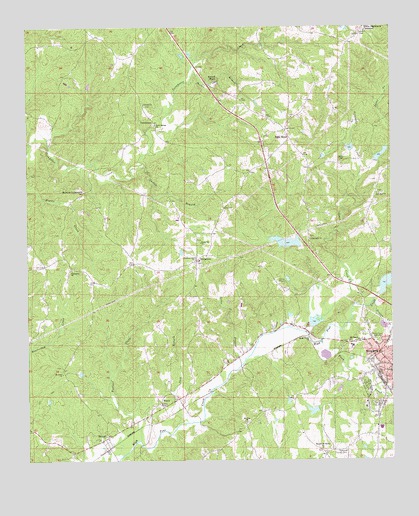
Roanoke West, AL USGS Topographic Map
Click on map above to begin viewing in our Map Viewer.

This topographic map contains these locations and features:
Feature Name Type Latitude Longitude GNIS ID View Map
Acts ChurchChurchN33.1337°W85.4983°163580View Map
Boatner CreekStreamN33.1307°W85.4622°114628View Map
BroughtonPopulated PlaceN33.1826°W85.4416°156119View Map
Camp HeardLocaleN33.1765°W85.4116°115464View Map
Canaan Missionary Baptist ChurchChurchN33.2276°W85.4594°115522View Map
CornhousePopulated PlaceN33.2226°W85.4558°156215View Map
Crystal LakeLakeN33.1879°W85.4110°140210View Map
DickertPopulated PlaceN33.1318°W85.4730°117270View Map
El Bethel ChurchChurchN33.2062°W85.4166°163582View Map
First Christian ChurchChurchN33.1510°W85.3769°140213View Map
FriendshipPopulated PlaceN33.1843°W85.4866°140218View Map
Friendship Baptist ChurchChurchN33.1801°W85.4850°118691View Map
Friendship CemeteryCemeteryN33.1804°W85.4841°1805731View Map
Gaston BranchStreamN33.2104°W85.4591°118861View Map
Graves CreekStreamN33.1704°W85.3819°119274View Map
Griswold CreekStreamN33.2076°W85.3844°119432View Map
Harmon CrossroadsPopulated PlaceN33.2026°W85.4802°156453View Map
High Pine Creek Lake Number 2ReservoirN33.1768°W85.3757°131267View Map
High Pine Creek Lake Number 4ReservoirN33.2131°W85.3782°131310View Map
High Pine Creek Lake Number 5ReservoirN33.2152°W85.3888°131313View Map
High Pine Creek Lake Number 6ReservoirN33.1851°W85.4066°131279View Map
High Pine Creek Watershed Dam Number 2DamN33.1718°W85.3783°131268View Map
High Pine Creek Watershed Dam Number 4DamN33.2118°W85.3799°131311View Map
High Pine Creek Watershed Dam Number 5DamN33.2135°W85.3883°131312View Map
High Pine Creek Watershed Dam Number 6DamN33.1851°W85.4066°131280View Map
Horton ShoalRapidsN33.2360°W85.4341°120444View Map
Horton Shoal BranchStreamN33.2371°W85.4422°120445View Map
Jack BranchStreamN33.1360°W85.4458°120740View Map
Jones CreekStreamN33.1621°W85.4055°149969View Map
Liles BranchStreamN33.1523°W85.4272°121614View Map
Lookout TowerTowerN33.2485°W85.3836°164364View Map
McMurray DamDamN33.1401°W85.3999°131239View Map
McMurray LakeReservoirN33.1394°W85.4022°131238View Map
Mission Mount Bethel ChurchChurchN33.1282°W85.3997°152347View Map
Mount OlivePopulated PlaceN33.1515°W85.4880°1805672View Map
Mount Olive ChurchChurchN33.1501°W85.4886°123310View Map
Mount Pisgah Baptist ChurchChurchN33.1590°W85.3899°152486View Map
Mount ZionPopulated PlaceN33.1357°W85.4186°140242View Map
Mount Zion ChurchChurchN33.1357°W85.4252°152529View Map
Mount Zion ChurchChurchN33.1321°W85.4049°140243View Map
PeavyPopulated PlaceN33.1432°W85.4541°156866View Map
Pleasant Grove Baptist ChurchChurchN33.1829°W85.4422°152979View Map
Radney ChapelChurchN33.1412°W85.4550°164109View Map
Randolph Medical CenterHospitalN33.1581°W85.3886°135805View Map
Riverside ChurchChurchN33.1337°W85.4963°135808View Map
Roanoke Church of ChristChurchN33.1562°W85.3788°135809View Map
Roanoke City LakeReservoirN33.1657°W85.4008°131256View Map
Roanoke City Reservoir DamDamN33.1635°W85.4033°131257View Map
Roanoke County ClubLocaleN33.1273°W85.3908°164405View Map
Roanoke Fire Department Station 1BuildingN33.1508°W85.3760°2682706View Map
Roanoke Sewage Disposal PlantLocaleN33.1657°W85.3986°135812View Map
Rock Springs ChurchChurchN33.2218°W85.4555°125779View Map
Rock StandLocaleN33.2179°W85.4094°125783View Map
Rock Stand Christian ChurchChurchN33.2240°W85.4088°135816View Map
Rock Stand Volunteer Fire DepartmentBuildingN33.2194°W85.4101°2682913View Map
Rocky Mount Primitive Baptist ChurchChurchN33.1879°W85.4405°125871View Map
Shady Creek ChurchChurchN33.1601°W85.4038°126584View Map
The Fire Baptizes Believers ChurchChurchN33.1690°W85.4386°135824View Map
Town CreekStreamN33.1593°W85.3997°128033View Map
Union Hill CemeteryCemeteryN33.1893°W85.4033°1805736View Map
Union Hill ChurchChurchN33.1890°W85.4030°128338View Map
WELR-FM (Roanoke)TowerN33.2207°W85.4102°161178View Map
White Signboard CrossroadPopulated PlaceN33.2498°W85.3841°157251View Map
Whites ChapelChurchN33.2110°W85.3919°164148View Map
Zion Rest ChurchChurchN33.2018°W85.3797°154067View Map

Note: Coordinates in the location and feature list above are referenced to NAD83 datum.


Copyright (C) 2008-2024 Ryan Niemi / Sunset Dynamics ... All Rights Reserved