TopoQuest Logo
Do you find TopoQuest useful?
Help keep TopoQuest running and adding new maps/features by donating!
Bitcoin:  19c7KJd3qBynnjoSw5npx9KScwjBe4ifkT
Litecoin:  LXs6TkuXGGXo1vDsWCkWVdjQX94eUKd6ui
Home View Maps Find Maps Find Places Resources & Links


Milton, Alabama Topographic Map

USGS Map Title: Milton, AL
USGS Map MRC: 32086E7
DRG (GeoTIFF) Download: o32086e7.tif


Neighboring USGS Topographic Map Quads:


  Plantersville, AL  
32086F8
 

  Pletcher, AL  
32086F7
 

  Billingsley, AL  
32086F6
 

  Jones, AL  
32086E8
 

  Milton, AL  
32086E7
 

  Vida, AL  
32086E6
 

  Burnsville, AL  
32086D8
 

  Durant Bend, AL  
32086D7
 

  Autaugaville, AL  
32086D6


Map MRC Location:

N33°
W87°
N33°
W86°
H8 H7 H6 H5 H4 H3 H2 H1
G8 G7 G6 G5 G4 G3 G2 G1
F8 F7 F6 F5 F4 F3 F2 F1
E8 E7 E6 E5 E4 E3 E2 E1
D8 D7 D6 D5 D4 D3 D2 D1
C8 C7 C6 C5 C4 C3 C2 C1
B8 B7 B6 B5 B4 B3 B2 B1
A8 A7 A6 A5 A4 A3 A2 A1
N32°
W87°
N32°
W86°

Milton, AL USGS 1:24K Topographic Map Preview:
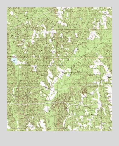
Milton, AL USGS Topographic Map
Click on map above to begin viewing in our Map Viewer.

This topographic map contains these locations and features:
Feature Name Type Latitude Longitude GNIS ID View Map
Bethel ChurchChurchN32.6007°W86.8230°114054View Map
Billingsley DivisionCivilN32.6089°W86.7563°165647View Map
Bishop CemeteryCemeteryN32.5368°W86.8241°147534View Map
BonitaPopulated PlaceN32.5446°W86.8283°156093View Map
Cavirs School (historical)SchoolN32.5246°W86.7789°147542View Map
Coee CemeteryCemeteryN32.6237°W86.8044°116346View Map
Coon CreekStreamN32.5804°W86.7792°116554View Map
Dawson MillLocaleN32.5896°W86.7847°154273View Map
EvergreenPopulated PlaceN32.5524°W86.7578°156327View Map
Evergreen Baptist ChurchChurchN32.5549°W86.7544°154275View Map
Evergreen Lookout TowerTowerN32.5585°W86.7594°164326View Map
Fig Tree Baptist ChurchChurchN32.5162°W86.8478°118271View Map
Friendship ChurchChurchN32.5890°W86.8255°147564View Map
Hamilton Post Office (historical)Post OfficeN32.5046°W86.8492°166197View Map
Harmony CemeteryCemeteryN32.5246°W86.7803°147575View Map
Harmony ChurchChurchN32.5246°W86.7805°151799View Map
Long BranchStreamN32.6135°W86.8519°152145View Map
MiltonPopulated PlaceN32.5587°W86.8072°156716View Map
Milton Baptist ChurchChurchN32.5529°W86.8144°122858View Map
Milton CemeteryCemeteryN32.5532°W86.8147°1730395View Map
Motley BranchStreamN32.5685°W86.7925°123131View Map
New Salem ChurchChurchN32.5799°W86.8200°147597View Map
New Salem SchoolSchoolN32.5899°W86.8242°123906View Map
Old Harmony CemeteryCemeteryN32.5229°W86.7764°124213View Map
Ousley Store (historical)LocaleN32.5757°W86.7992°151640View Map
Parker BranchStreamN32.5385°W86.8130°124436View Map
Parker MountainSummitN32.5637°W86.8428°147609View Map
Rutledge ChurchChurchN32.5512°W86.7605°147641View Map
Salem Church (historical)ChurchN32.6226°W86.7561°147645View Map
Sand BranchStreamN32.5662°W86.8653°126300View Map
Stockton (historical)LocaleN32.5846°W86.8667°140315View Map
Thompson MineMineN32.5654°W86.8305°140341View Map
Unity ChurchChurchN32.6021°W86.7736°128359View Map
Walkers LakeLakeN32.5716°W86.8661°128530View Map
WinslowPopulated PlaceN32.5162°W86.7700°157273View Map

Note: Coordinates in the location and feature list above are referenced to NAD83 datum.


Copyright (C) 2008-2025 Ryan Niemi / Sunset Dynamics ... All Rights Reserved