TopoQuest Logo
Do you find TopoQuest useful?
Help keep TopoQuest running and adding new maps/features by donating!
Bitcoin:  19c7KJd3qBynnjoSw5npx9KScwjBe4ifkT
Litecoin:  LXs6TkuXGGXo1vDsWCkWVdjQX94eUKd6ui
Home View Maps Find Maps Find Places Resources & Links


Pletcher, Alabama Topographic Map

USGS Map Title: Pletcher, AL
USGS Map MRC: 32086F7
DRG (GeoTIFF) Download: o32086f7.tif


Neighboring USGS Topographic Map Quads:


  Maplesville West, AL  
32086G8
 

  Maplesville East, AL  
32086G7
 

  Clanton West, AL  
32086G6
 

  Plantersville, AL  
32086F8
 

  Pletcher, AL  
32086F7
 

  Billingsley, AL  
32086F6
 

  Jones, AL  
32086E8
 

  Milton, AL  
32086E7
 

  Vida, AL  
32086E6


Map MRC Location:

N33°
W87°
N33°
W86°
H8 H7 H6 H5 H4 H3 H2 H1
G8 G7 G6 G5 G4 G3 G2 G1
F8 F7 F6 F5 F4 F3 F2 F1
E8 E7 E6 E5 E4 E3 E2 E1
D8 D7 D6 D5 D4 D3 D2 D1
C8 C7 C6 C5 C4 C3 C2 C1
B8 B7 B6 B5 B4 B3 B2 B1
A8 A7 A6 A5 A4 A3 A2 A1
N32°
W87°
N32°
W86°

Pletcher, AL USGS 1:24K Topographic Map Preview:
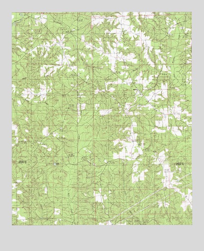
Pletcher, AL USGS Topographic Map
Click on map above to begin viewing in our Map Viewer.

This topographic map contains these locations and features:
Feature Name Type Latitude Longitude GNIS ID View Map
AdamsPopulated PlaceN32.7396°W86.8328°155977View Map
Alpine CemeteryCemeteryN32.6818°W86.8405°151490View Map
Alpine ChurchChurchN32.6824°W86.8403°113046View Map
Antioch CemeteryCemeteryN32.7323°W86.7714°151578View Map
Antioch Methodist ChurchChurchN32.7337°W86.7725°151660View Map
Beaver BranchStreamN32.7124°W86.7614°113711View Map
Beth Grove (historical)Populated PlaceN32.6279°W86.8667°147527View Map
Bethel GrovePopulated PlaceN32.6279°W86.8500°156060View Map
Broadhead CreekStreamN32.7474°W86.8661°114931View Map
Church of GodChurchN32.7137°W86.8283°116136View Map
Hillcrest Baptist ChurchChurchN32.7329°W86.8405°120105View Map
Hillcrest CemeteryCemeteryN32.7326°W86.8414°151492View Map
Lake PearlReservoirN32.6609°W86.8452°124550View Map
Mount Carmel Baptist ChurchChurchN32.7399°W86.8330°154137View Map
Mount Carmel CemeteryCemeteryN32.7398°W86.8322°151493View Map
Pilgrim Rest Baptist ChurchChurchN32.6787°W86.7922°152898View Map
PletcherPopulated PlaceN32.7029°W86.7850°125065View Map
Pletcher ChurchChurchN32.7029°W86.7847°149502View Map
South Chilton Fire and RescueBuildingN32.7324°W86.8435°2691116View Map
Spring BranchStreamN32.7440°W86.7600°127220View Map
Stillwells Mill (historical)LocaleN32.6260°W86.7842°147654View Map
University Highway CemeteryCemeteryN32.7140°W86.8289°151491View Map
University Highway ChurchChurchN32.7132°W86.8286°136724View Map
Vermont CemeteryCemeteryN32.7293°W86.7808°151494View Map
Vermont Holiness ChurchChurchN32.7296°W86.7805°154140View Map
Vermont SchoolSchoolN32.7343°W86.7986°128436View Map
Walker School (historical)SchoolN32.6279°W86.7958°147667View Map

Note: Coordinates in the location and feature list above are referenced to NAD83 datum.


Copyright (C) 2008-2025 Ryan Niemi / Sunset Dynamics ... All Rights Reserved