TopoQuest Logo
Do you find TopoQuest useful?
Help keep TopoQuest running and adding new maps/features by donating!
Bitcoin:  19c7KJd3qBynnjoSw5npx9KScwjBe4ifkT
Litecoin:  LXs6TkuXGGXo1vDsWCkWVdjQX94eUKd6ui
Home View Maps Find Maps Find Places Resources & Links


Mount Chestnut, Pennsylvania Topographic Map

USGS Map Title: Mount Chestnut, PA
USGS Map MRC: 40079H8
DRG (GeoTIFF) Download: o40079h8.tif


Neighboring USGS Topographic Map Quads:


  Slippery Rock, PA  
41080A1
 

  West Sunbury, PA  
41079A8
 

  Hilliards, PA  
41079A7
 

  Prospect, PA  
40080H1
 

  Mount Chestnut, PA  
40079H8
 

  East Butler, PA  
40079H7
 

  Evans City, PA  
40080G1
 

  Butler, PA  
40079G8
 

  Saxonburg, PA  
40079G7


Map MRC Location:

N41°
W80°
N41°
W79°
H8 H7 H6 H5 H4 H3 H2 H1
G8 G7 G6 G5 G4 G3 G2 G1
F8 F7 F6 F5 F4 F3 F2 F1
E8 E7 E6 E5 E4 E3 E2 E1
D8 D7 D6 D5 D4 D3 D2 D1
C8 C7 C6 C5 C4 C3 C2 C1
B8 B7 B6 B5 B4 B3 B2 B1
A8 A7 A6 A5 A4 A3 A2 A1
N40°
W80°
N40°
W79°

Mount Chestnut, PA USGS 1:24K Topographic Map Preview:
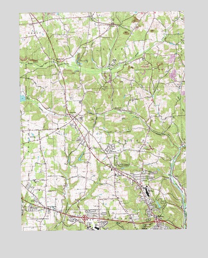
Mount Chestnut, PA USGS Topographic Map
Click on map above to begin viewing in our Map Viewer.

This topographic map contains these locations and features:
Feature Name Type Latitude Longitude GNIS ID View Map
Aubreys Golf CourseLocaleN40.8848°W79.9306°1206144View Map
Big RunStreamN40.9678°W79.9342°1201879View Map
Bon Aire SchoolSchoolN40.8828°W79.9017°1209236View Map
Bon Aire Shopping MallLocaleN40.8817°W79.8976°1209262View Map
Butler CountyCivilN40.9117°W79.9130°1213661View Map
Butler County Child Center, IncSchoolN40.8828°W79.9017°1209279View Map
Butler Shopping MallLocaleN40.8759°W79.9023°1209261View Map
Calvary CemeteryCemeteryN40.8753°W79.8980°1170922View Map
Camp AlamedaLocaleN40.8790°W79.9270°1209235View Map
Camp AlamedaLocaleN40.8795°W79.9273°1209291View Map
Camp WesleyLocaleN40.9084°W79.9153°1171114View Map
Center SchoolSchoolN40.9209°W79.9137°1206788View Map
Center Township Elementary SchoolSchoolN40.9065°W79.9281°1211760View Map
Clearview Shopping MallLocaleN40.8976°W79.9048°1209263View Map
Crooked RunStreamN40.8887°W79.9639°1172728View Map
Elliott School (historical)SchoolN40.9012°W79.9028°1206787View Map
EloraPopulated PlaceN40.9940°W79.9895°1174182View Map
EuclidPopulated PlaceN40.9934°W79.9289°1174333View Map
Fisher HeightsPopulated PlaceN40.9253°W79.9539°1174815View Map
Franklin Township Elementary SchoolSchoolN40.9037°W79.9898°1211759View Map
Greenlawn CemeteryCemeteryN40.8929°W79.9888°1176159View Map
Greenwood VillagePopulated PlaceN40.8806°W79.9564°1176210View Map
Greenwood Village Volunteer Fire Department Station 5BuildingN40.8830°W79.9551°2645674View Map
Hickory CornerLocaleN40.9326°W79.9984°1206784View Map
JamisonvillePopulated PlaceN40.9440°W79.9245°1177988View Map
Lake Arthur Country ClubLocaleN40.9295°W79.9928°1213256View Map
McCandless Airport (historical)AirportN40.9187°W79.9381°1194136View Map
Mercer Road Volunteer Fire Department Station 6BuildingN40.8814°W79.9144°2645672View Map
Mercer Road Volunteer Fire StationBuildingN40.8831°W79.8974°2645847View Map
Miller SchoolSchoolN40.9748°W79.8956°1206789View Map
Mount ChestnutPopulated PlaceN40.8878°W79.9806°1181679View Map
Mount Chestnut CemeteryCemeteryN40.8976°W79.9788°1181680View Map
Mount Chestnut SpringsPopulated PlaceN40.8865°W79.9914°1181681View Map
Muddy CreekPopulated PlaceN40.9723°W79.9712°1192993View Map
North ForkPopulated PlaceN40.9053°W79.8842°1209196View Map
NorthvuePopulated PlaceN40.9206°W79.9320°1182681View Map
Oakland Oneida Valley Volunteer Fire Department Station 35BuildingN40.8937°W79.8757°2644895View Map
OneidaPopulated PlaceN40.9217°W79.8798°1201877View Map
Queen JunctionPopulated PlaceN40.9692°W79.9289°1184541View Map
Rider ChurchChurchN40.9498°W79.9148°1185035View Map
Ridge SchoolSchoolN40.9134°W79.9837°1206785View Map
Saint Clair SchoolSchoolN40.8942°W79.9278°1206786View Map
Saint Peters CemeteryCemeteryN40.8762°W79.8989°1186650View Map
Shanor HeightsPopulated PlaceN40.9006°W79.9092°1187362View Map
Shanor-Northvue Census Designated PlaceCensusN40.9104°W79.9157°2390284View Map
SmithvillePopulated PlaceN40.9717°W79.9192°1201878View Map
Stony RunStreamN40.9209°W79.8795°1188791View Map
Stoughton Acres Golf CourseLocaleN40.9301°W79.9414°1205255View Map
Thompson SchoolSchoolN40.9865°W79.9945°1206783View Map
Thorn CreekStreamN40.8840°W79.8756°1189521View Map
Thorn CrossingLocaleN40.9867°W79.8870°1206790View Map
Thorn Run DamDamN40.8951°W79.8831°1195133View Map
Thorn Run ReservoirReservoirN40.8951°W79.8831°1195132View Map
Thorn Station (historical)LocaleN40.9856°W79.8873°1212909View Map
Timberly HeightsPopulated PlaceN40.9123°W79.9256°1189574View Map
Township of CenterCivilN40.9218°W79.9253°1216045View Map
Township of ClayCivilN40.9924°W79.9290°1216047View Map
UnionvillePopulated PlaceN40.9415°W79.9620°1190193View Map
Unionville Census Designated PlaceCensusN40.9423°W79.9613°2633671View Map
Unionville Volunteer Fire Company Station 14BuildingN40.9385°W79.9593°1209260View Map
WBUT-AM (Butler)TowerN40.8976°W79.8892°1200464View Map
Windward HeightsPopulated PlaceN40.9042°W79.9070°1191588View Map
WISR-AM (Butler)TowerN40.8776°W79.9023°1200461View Map
WLER-FM (Butler)TowerN40.8976°W79.8892°1200264View Map

Note: Coordinates in the location and feature list above are referenced to NAD83 datum.


Copyright (C) 2008-2025 Ryan Niemi / Sunset Dynamics ... All Rights Reserved