TopoQuest Logo
Do you find TopoQuest useful?
Help keep TopoQuest running and adding new maps/features by donating!
Bitcoin:  19c7KJd3qBynnjoSw5npx9KScwjBe4ifkT
Litecoin:  LXs6TkuXGGXo1vDsWCkWVdjQX94eUKd6ui
Home View Maps Find Maps Find Places Resources & Links


Saxonburg, Pennsylvania Topographic Map

USGS Map Title: Saxonburg, PA
USGS Map MRC: 40079G7
DRG (GeoTIFF) Download: o40079g7.tif


Neighboring USGS Topographic Map Quads:


  Mount Chestnut, PA  
40079H8
 

  East Butler, PA  
40079H7
 

  Chicora, PA  
40079H6
 

  Butler, PA  
40079G8
 

  Saxonburg, PA  
40079G7
 

  Worthington, PA  
40079G6
 

  Valencia, PA  
40079F8
 

  Curtisville, PA  
40079F7
 

  Freeport, PA  
40079F6


Map MRC Location:

N41°
W80°
N41°
W79°
H8 H7 H6 H5 H4 H3 H2 H1
G8 G7 G6 G5 G4 G3 G2 G1
F8 F7 F6 F5 F4 F3 F2 F1
E8 E7 E6 E5 E4 E3 E2 E1
D8 D7 D6 D5 D4 D3 D2 D1
C8 C7 C6 C5 C4 C3 C2 C1
B8 B7 B6 B5 B4 B3 B2 B1
A8 A7 A6 A5 A4 A3 A2 A1
N40°
W80°
N40°
W79°

Saxonburg, PA USGS 1:24K Topographic Map Preview:
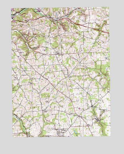
Saxonburg, PA USGS Topographic Map
Click on map above to begin viewing in our Map Viewer.

This topographic map contains these locations and features:
Feature Name Type Latitude Longitude GNIS ID View Map
B'nai Abraham CemeteryCemeteryN40.8582°W79.8605°1168541View Map
Bonnie BrookPopulated PlaceN40.8665°W79.8292°1169980View Map
Bonnie BrookStreamN40.8684°W79.8748°1169981View Map
Borough of SaxonburgCivilN40.7510°W79.8150°1215002View Map
BrinkerPopulated PlaceN40.8295°W79.8298°1170263View Map
Brinker SchoolSchoolN40.8345°W79.8303°1214049View Map
CabotPopulated PlaceN40.7648°W79.7664°1170861View Map
Cabot Post OfficePost OfficeN40.7639°W79.7671°2779804View Map
Calvary ChurchChurchN40.7840°W79.8289°1170942View Map
Carbon CenterPopulated PlaceN40.8731°W79.7934°1171189View Map
Crosswinds AllianceChurchN40.8082°W79.8350°2504754View Map
Frazier MillPopulated PlaceN40.7531°W79.8545°1175187View Map
Great BeltPopulated PlaceN40.8087°W79.8031°1176038View Map
Gruenwalt CemeteryCemeteryN40.8507°W79.8258°1176292View Map
HannahstownPopulated PlaceN40.7701°W79.7903°1176466View Map
HermanPopulated PlaceN40.8301°W79.8112°1176869View Map
Herman Post OfficePost OfficeN40.8304°W79.8110°2773155View Map
Herman Volunteer Fire Company Station 10BuildingN40.8299°W79.8209°2645824View Map
Jefferson CenterPopulated PlaceN40.7756°W79.8348°1178013View Map
Jefferson Center CemeteryCemeteryN40.7717°W79.8248°1178014View Map
Jefferson Elementary SchoolSchoolN40.8023°W79.8501°1210633View Map
Knox ChapelChurchN40.7601°W79.7787°1178621View Map
Lake SaxonyReservoirN40.7517°W79.7931°1195013View Map
Lake Saxony DamDamN40.7517°W79.7931°1195012View Map
Lindsey SchoolSchoolN40.8326°W79.8648°1214080View Map
MarwoodPopulated PlaceN40.7790°W79.7731°1180514View Map
Mitchell SchoolSchoolN40.8623°W79.8548°1214082View Map
Pape CemeteryCemeteryN40.7685°W79.7868°1183272View Map
Saint Josephs ChurchChurchN40.7651°W79.7626°1186233View Map
Saint Luke Lutheran CemeteryCemeteryN40.7715°W79.8001°1186286View Map
Saint Marys CemeteryCemeteryN40.8314°W79.8180°1186393View Map
Saint Michael CemeteryCemeteryN40.8446°W79.8720°1186468View Map
SaxonburgPopulated PlaceN40.7540°W79.8101°1187046View Map
Saxonburg Borough Police DepartmentBuildingN40.7509°W79.8174°2780511View Map
Saxonburg Elementary SchoolSchoolN40.7526°W79.8112°1211580View Map
Shiloh ChurchChurchN40.7992°W79.8648°1206010View Map
Summit CemeteryCemeteryN40.8069°W79.8506°1189040View Map
Summit ChurchChurchN40.8067°W79.8498°1206009View Map
Summit Elementary SchoolSchoolN40.8417°W79.8281°1210761View Map
Thorn Creek ChurchChurchN40.7948°W79.8684°1189522View Map
Township of JeffersonCivilN40.7804°W79.8303°1216058View Map
Township of SummitCivilN40.8496°W79.8282°1216067View Map
Vaur RunStreamN40.7631°W79.8339°1212706View Map
VogleyvillePopulated PlaceN40.8492°W79.8612°1190450View Map
WadsworthPopulated PlaceN40.8631°W79.8159°1190463View Map
Winfield Elementary SchoolSchoolN40.7751°W79.7578°1210784View Map
Winfield Township Volunteer Fire Department Station 46BuildingN40.7739°W79.7625°2645023View Map

Note: Coordinates in the location and feature list above are referenced to NAD83 datum.


Copyright (C) 2008-2025 Ryan Niemi / Sunset Dynamics ... All Rights Reserved