TopoQuest Logo
Do you find TopoQuest useful?
Help keep TopoQuest running and adding new maps/features by donating!
Bitcoin:  19c7KJd3qBynnjoSw5npx9KScwjBe4ifkT
Litecoin:  LXs6TkuXGGXo1vDsWCkWVdjQX94eUKd6ui
Home View Maps Find Maps Find Places Resources & Links


Mount Holly, Arkansas Topographic Map

USGS Map Title: Mount Holly, AR
USGS Map MRC: 33092C8
DRG (GeoTIFF) Download: o33092c8.tif


Neighboring USGS Topographic Map Quads:


  Stephens, AR  
33093D1
 

  Buena Vista, AR  
33092D8
 

  Louann, AR  
33092D7
 

  Village, AR  
33093C1
 

  Mount Holly, AR  
33092C8
 

  Lisbon, AR  
33092C7
 

  Spotville, AR  
33093B1
 

  Marysville, AR  
33092B8
 

  Newell, AR  
33092B7


Map MRC Location:

N34°
W93°
N34°
W92°
H8 H7 H6 H5 H4 H3 H2 H1
G8 G7 G6 G5 G4 G3 G2 G1
F8 F7 F6 F5 F4 F3 F2 F1
E8 E7 E6 E5 E4 E3 E2 E1
D8 D7 D6 D5 D4 D3 D2 D1
C8 C7 C6 C5 C4 C3 C2 C1
B8 B7 B6 B5 B4 B3 B2 B1
A8 A7 A6 A5 A4 A3 A2 A1
N33°
W93°
N33°
W92°

Mount Holly, AR USGS 1:24K Topographic Map Preview:
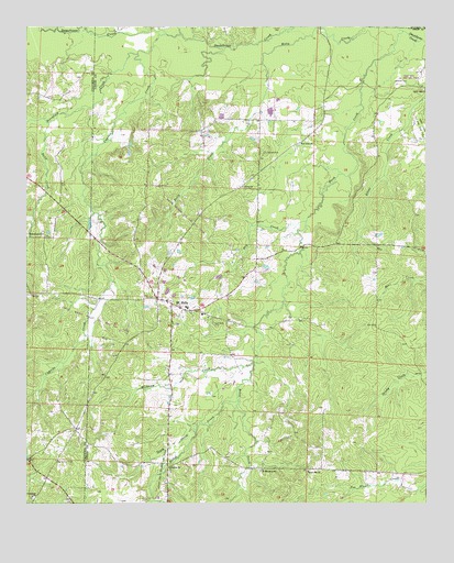
Mount Holly, AR USGS Topographic Map
Click on map above to begin viewing in our Map Viewer.

This topographic map contains these locations and features:
Feature Name Type Latitude Longitude GNIS ID View Map
Beech CreekStreamN33.3737°W92.8821°46320View Map
Beech Hill CemeteryCemeteryN33.2573°W92.9124°59591View Map
Beech Hill ChurchChurchN33.2585°W92.9121°46331View Map
Bethel CemeteryCemeteryN33.2582°W92.9549°59594View Map
Bethel CreekStreamN33.2771°W92.9341°46460View Map
Bethel Methodist ChurchChurchN33.2593°W92.9552°76312View Map
Big Hickory CemeteryCemeteryN33.2615°W92.9910°46559View Map
Birchfield CreekStreamN33.3735°W92.9563°76147View Map
Cypress CreekStreamN33.3735°W92.9563°48300View Map
Damascus ChurchChurchN33.2518°W92.9985°48341View Map
Dry CreekStreamN33.3243°W92.9121°48638View Map
Friendship ChurchChurchN33.3207°W92.9952°49257View Map
Mont Holly Elementary SchoolSchoolN33.2998°W92.9452°59751View Map
Mount HollyPopulated PlaceN33.3026°W92.9549°77717View Map
Mount Holly CemeteryCemeteryN33.3004°W92.9485°59750View Map
Mount Holly Elementary SchoolSchoolN33.3015°W92.9498°2039371View Map
Mount Holly High SchoolSchoolN33.3016°W92.9513°59752View Map
Mount Holly Oil and Gas FieldOilfieldN33.2587°W92.9577°52301View Map
Mount Holly Post OfficePost OfficeN33.3032°W92.9571°83884View Map
Mount Holly Volunteer Fire DepartmentBuildingN33.3050°W92.9587°2116819View Map
New Hope CemeteryCemeteryN33.2973°W92.9418°52658View Map
Pace City Oil and Gas FieldOilfieldN33.3623°W92.8793°59787View Map
Saint Luke ChurchChurchN33.3446°W92.9138°54381View Map
Saint Matthew ChurchChurchN33.2587°W92.9266°54423View Map
Salem Church (historical)ChurchN33.3123°W92.9999°59926View Map
Salem Church Oil and Gas FieldOilfieldN33.3257°W92.9504°59829View Map
Sand CreekStreamN33.3501°W92.9935°54532View Map
Silver Hill CemeteryCemeteryN33.3587°W92.8760°59837View Map
Silver Hill United Methodist ChurchChurchN33.3587°W92.8752°78367View Map
Smackover CreekStreamN33.3710°W92.8752°54921View Map
Smeed CemeteryCemeteryN33.3423°W92.9252°78385View Map
South CreekStreamN33.2693°W92.9477°55016View Map
Township of BooneCivilN33.3149°W92.9416°69743View Map
Union ChurchChurchN33.3332°W92.9321°55794View Map
Watson CemeteryCemeteryN33.3607°W92.8846°78705View Map
West Mount Holly Oil and Gas FieldOilfieldN33.2982°W92.9777°59892View Map
Wickham CreekStreamN33.2868°W92.9293°56342View Map

Note: Coordinates in the location and feature list above are referenced to NAD83 datum.


Copyright (C) 2008-2025 Ryan Niemi / Sunset Dynamics ... All Rights Reserved