TopoQuest Logo
Do you find TopoQuest useful?
Help keep TopoQuest running and adding new maps/features by donating!
Bitcoin:  19c7KJd3qBynnjoSw5npx9KScwjBe4ifkT
Litecoin:  LXs6TkuXGGXo1vDsWCkWVdjQX94eUKd6ui
Home View Maps Find Maps Find Places Resources & Links


Mountain View, Arkansas Topographic Map

USGS Map Title: Mountain View, AR
USGS Map MRC: 35092G1
DRG (GeoTIFF) Download: o35092g1.tif


Neighboring USGS Topographic Map Quads:


  Fiftysix, AR  
35092H2
 

  Sylamore, AR  
35092H1
 

  Guion, AR  
35091H8
 

  Mountain View SW, AR  
35092G2
 

  Mountain View, AR  
35092G1
 

  Marcella, AR  
35091G8
 

  Parma, AR  
35092F2
 

  Prim, AR  
35092F1
 

  Drasco, AR  
35091F8


Map MRC Location:

N36°
W93°
N36°
W92°
H8 H7 H6 H5 H4 H3 H2 H1
G8 G7 G6 G5 G4 G3 G2 G1
F8 F7 F6 F5 F4 F3 F2 F1
E8 E7 E6 E5 E4 E3 E2 E1
D8 D7 D6 D5 D4 D3 D2 D1
C8 C7 C6 C5 C4 C3 C2 C1
B8 B7 B6 B5 B4 B3 B2 B1
A8 A7 A6 A5 A4 A3 A2 A1
N35°
W93°
N35°
W92°

Mountain View, AR USGS 1:24K Topographic Map Preview:
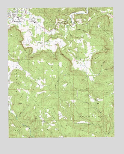
Mountain View, AR USGS Topographic Map
Click on map above to begin viewing in our Map Viewer.

This topographic map contains these locations and features:
Feature Name Type Latitude Longitude GNIS ID View Map
Big Gum HollowValleyN35.7517°W92.0565°46558View Map
Big HollowValleyN35.8734°W92.0321°46562View Map
Case CemeteryCemeteryN35.8226°W92.1132°47509View Map
Case ChurchChurchN35.8254°W92.1124°47510View Map
Cave HollowValleyN35.8134°W92.0160°47544View Map
Cedar MountainSummitN35.8284°W92.0138°47620View Map
City of Mountain ViewCivilN35.8639°W92.1044°2404333View Map
Clark HollowValleyN35.8692°W92.0354°47807View Map
Cooper PointSummitN35.8337°W92.1027°48015View Map
Cove CemeteryCemeteryN35.8262°W92.0429°48096View Map
Cove ProngStreamN35.8470°W92.0593°48109View Map
Dodd MountainSummitN35.8504°W92.1157°48546View Map
Dodd Mountain Fire Department Station 1BuildingN35.8217°W92.1122°2116367View Map
Dodd Mountain Fire Department Station 2BuildingN35.7538°W92.0301°2116366View Map
Flat Rock HollowValleyN35.7920°W92.0688°49119View Map
Flatwoods CemeteryCemeteryN35.8545°W92.0710°49122View Map
Hanes HollowValleyN35.8142°W92.0274°49819View Map
HanoverPopulated PlaceN35.8034°W92.1238°57877View Map
Harrigan HollowValleyN35.7665°W92.1140°49887View Map
Hill HollowValleyN35.8340°W92.0176°50122View Map
Hinkle HollowValleyN35.8526°W92.0543°50145View Map
Holt HollowValleyN35.8020°W92.1243°50268View Map
Hub HollowValleyN35.8004°W92.0879°50373View Map
Ike Brown HollowValleyN35.8559°W92.0465°50481View Map
Irons MountainSummitN35.8595°W92.0171°50523View Map
Kemp HillSummitN35.7890°W92.0929°58011View Map
Little Raccoon CreekStreamN35.7517°W92.0096°77524View Map
LuberPopulated PlaceN35.7656°W92.0838°58097View Map
Lute HollowValleyN35.8679°W92.0518°72520View Map
Mill ProngStreamN35.8473°W92.0593°52047View Map
Mountain ViewPopulated PlaceN35.8684°W92.1177°77769View Map
Mountain View Elementary SchoolSchoolN35.8604°W92.0870°65837View Map
Mountain View Fire Department City Hall StationBuildingN35.8687°W92.1209°2116834View Map
Mountain View Fire Department East End Station (historical)BuildingN35.8569°W92.0847°2116835View Map
MOUNTAIN VIEW HIGH SCHOOLSchoolN35.8598°W92.0851°65838View Map
Mountain View Police DepartmentBuildingN35.8678°W92.1180°2118838View Map
Mountain View Wilcox Memorial FieldAirportN35.8646°W92.0934°83790View Map
Norkes ChapelChurchN35.7854°W92.0204°52794View Map
North Corn CreekStreamN35.8237°W92.0368°52813View Map
Possum CreekStreamN35.7595°W92.0129°53708View Map
Prince HillSummitN35.7962°W92.1127°53806View Map
Ripley HollowValleyN35.8401°W92.0827°54047View Map
Round MountainSummitN35.7829°W92.1127°54241View Map
Simpson PointCliffN35.8404°W92.0665°54865View Map
Stack RockPillarN35.8298°W92.0638°55143View Map
Star GapGapN35.8342°W92.1065°55162View Map
Stone County CourthouseBuildingN35.8690°W92.1182°65844View Map
Stone County Medical CenterHospitalN35.8565°W92.0828°2092911View Map
Stone County Medical Center HeliportAirportN35.7929°W92.1174°83791View Map
Tater HillSummitN35.7615°W92.0551°58732View Map
Township of Blue MountainCivilN35.8672°W92.0975°69717View Map
Township of BryanCivilN35.7701°W92.0700°69718View Map
Township of Chalybeate Springs (historical)CivilN35.7709°W92.0029°69719View Map
Township of Cove (historical)CivilN35.8251°W92.0293°69720View Map
Vital Link - Mountain ViewBuildingN35.8543°W92.0823°2119171View Map
Wade HollowValleyN35.8679°W92.0518°73976View Map
Whitefield CemeteryCemeteryN35.8415°W92.0871°56313View Map

Note: Coordinates in the location and feature list above are referenced to NAD83 datum.


Copyright (C) 2008-2024 Ryan Niemi / Sunset Dynamics ... All Rights Reserved