TopoQuest Logo
Do you find TopoQuest useful?
Help keep TopoQuest running and adding new maps/features by donating!
Bitcoin:  19c7KJd3qBynnjoSw5npx9KScwjBe4ifkT
Litecoin:  LXs6TkuXGGXo1vDsWCkWVdjQX94eUKd6ui
Home View Maps Find Maps Find Places Resources & Links


Fruitvale, Texas Topographic Map

USGS Map Title: Fruitvale, TX
USGS Map MRC: 32095F7
DRG (GeoTIFF) Download: o32095f7.tif


Neighboring USGS Topographic Map Quads:


  Iron Bridge Dam, TX  
32095G8
 

  Emory South, TX  
32095G7
 

  Alba, TX  
32095G6
 

  Edgewood, TX  
32095F8
 

  Fruitvale, TX  
32095F7
 

  Grand Saline, TX  
32095F6
 

  Myrtle Springs, TX  
32095E8
 

  Canton, TX  
32095E7
 

  Van, TX  
32095E6


Map MRC Location:

N33°
W96°
N33°
W95°
H8 H7 H6 H5 H4 H3 H2 H1
G8 G7 G6 G5 G4 G3 G2 G1
F8 F7 F6 F5 F4 F3 F2 F1
E8 E7 E6 E5 E4 E3 E2 E1
D8 D7 D6 D5 D4 D3 D2 D1
C8 C7 C6 C5 C4 C3 C2 C1
B8 B7 B6 B5 B4 B3 B2 B1
A8 A7 A6 A5 A4 A3 A2 A1
N32°
W96°
N32°
W95°

Fruitvale, TX USGS 1:24K Topographic Map Preview:
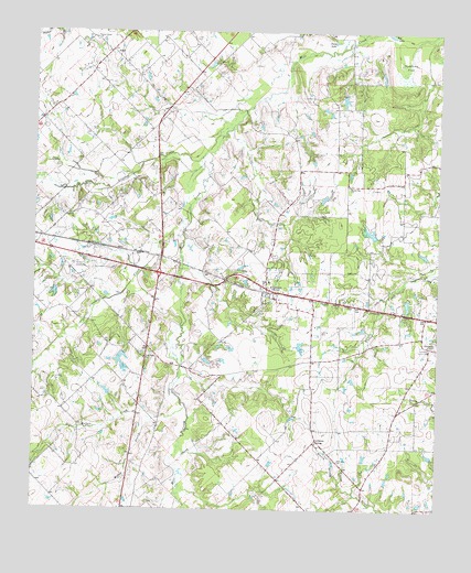
Fruitvale, TX USGS Topographic Map
Click on map above to begin viewing in our Map Viewer.

This topographic map contains these locations and features:
Feature Name Type Latitude Longitude GNIS ID View Map
Barrett CemeteryCemeteryN32.7210°W95.8441°1330083View Map
Bog LakeLakeN32.7494°W95.7653°1330987View Map
Bratcher CemeteryCemeteryN32.6379°W95.7805°1331203View Map
Buffalo CreekStreamN32.6526°W95.8289°1331560View Map
City of FruitvaleCivilN32.6834°W95.8035°2410555View Map
Creagleville ChurchChurchN32.6682°W95.7530°1333641View Map
Crooked CreekStreamN32.7040°W95.8272°1333705View Map
Edgewood DivisionCivilN32.7089°W95.8702°1938711View Map
FruitvalePopulated PlaceN32.6832°W95.8033°1336284View Map
Fruitvale High SchoolSchoolN32.6857°W95.8036°2008976View Map
Fruitvale Middle SchoolSchoolN32.6857°W95.8036°2008977View Map
Fruitvale Oil FieldOilfieldN32.6765°W95.7916°1336283View Map
Fruitvale Post OfficePost OfficeN32.6838°W95.8036°2732018View Map
Fruitvale Volunteer Fire DepartmentBuildingN32.6813°W95.7995°2655153View Map
Giladon CreekStreamN32.7298°W95.8094°1336518View Map
Good Hope ChurchChurchN32.6646°W95.8408°1336692View Map
Herrin BranchStreamN32.6299°W95.7755°1337655View Map
Lawrence SpringsPopulated PlaceN32.6426°W95.7875°1378569View Map
Musslewhite LakeReservoirN32.6703°W95.8007°1859882View Map
Musslewhite Lake DamDamN32.6718°W95.8019°1859881View Map
Overcup FlatFlatN32.7418°W95.7600°1343365View Map
Pleasant Union ChurchChurchN32.7482°W95.8572°1344247View Map
Posey LakeLakeN32.7476°W95.7828°1344380View Map
Round Flat ChurchChurchN32.7099°W95.7777°1345657View Map
SmallPopulated PlaceN32.7451°W95.8519°1347245View Map
Toombies CemeteryCemeteryN32.7482°W95.8264°1348644View Map
Willow BranchStreamN32.6485°W95.8375°1350170View Map

Note: Coordinates in the location and feature list above are referenced to NAD83 datum.


Copyright (C) 2008-2025 Ryan Niemi / Sunset Dynamics ... All Rights Reserved