TopoQuest Logo
Do you find TopoQuest useful?
Help keep TopoQuest running and adding new maps/features by donating!
Bitcoin:  19c7KJd3qBynnjoSw5npx9KScwjBe4ifkT
Litecoin:  LXs6TkuXGGXo1vDsWCkWVdjQX94eUKd6ui
Home View Maps Find Maps Find Places Resources & Links


Nathan, Arkansas Topographic Map

USGS Map Title: Nathan, AR
USGS Map MRC: 34093A7
DRG (GeoTIFF) Download: o34093a7.tif


Neighboring USGS Topographic Map Quads:


  Newhope, AR  
34093B8
 

  Center Point NE, AR  
34093B7
 

  Narrows Dam, AR  
34093B6
 

  Center Point, AR  
34093A8
 

  Nathan, AR  
34093A7
 

  Murfreesboro, AR  
34093A6
 

  Mineral Springs North, AR  
33093H8
 

  Nashville, AR  
33093H7
 

  McCaskill, AR  
33093H6


Map MRC Location:

N35°
W94°
N35°
W93°
H8 H7 H6 H5 H4 H3 H2 H1
G8 G7 G6 G5 G4 G3 G2 G1
F8 F7 F6 F5 F4 F3 F2 F1
E8 E7 E6 E5 E4 E3 E2 E1
D8 D7 D6 D5 D4 D3 D2 D1
C8 C7 C6 C5 C4 C3 C2 C1
B8 B7 B6 B5 B4 B3 B2 B1
A8 A7 A6 A5 A4 A3 A2 A1
N34°
W94°
N34°
W93°

Nathan, AR USGS 1:24K Topographic Map Preview:
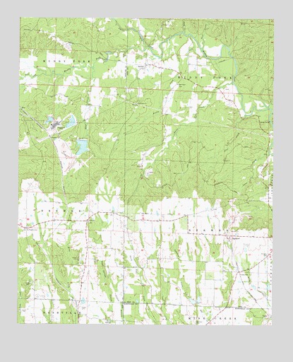
Nathan, AR USGS Topographic Map
Click on map above to begin viewing in our Map Viewer.

This topographic map contains these locations and features:
Feature Name Type Latitude Longitude GNIS ID View Map
Bacon CreekStreamN34.0990°W93.7707°46002View Map
Biggs Chapel Methodist ChurchChurchN34.0984°W93.7977°76347View Map
Bluff CreekStreamN34.1054°W93.8391°46773View Map
BriarPopulated PlaceN34.0879°W93.8738°57433View Map
Briar CreekStreamN34.1018°W93.8627°46931View Map
Briar Plant Lake OneReservoirN34.0726°W93.8440°80659View Map
Briar Plant Lake One DamDamN34.0751°W93.8435°80658View Map
Briar Plant Lake ThreeReservoirN34.0833°W93.8602°80655View Map
Briar Plant Lake Three DamDamN34.0834°W93.8585°80654View Map
Briar Plant Lake TwoReservoirN34.0824°W93.8495°80657View Map
Briar Plant Lake Two DamDamN34.0834°W93.8485°80656View Map
Brushy CreekStreamN34.1168°W93.8016°47062View Map
Buck CreekStreamN34.1121°W93.7857°47124View Map
CooleyvillePopulated PlaceN34.0218°W93.7668°57581View Map
CorinthPopulated PlaceN34.0429°W93.8413°56969View Map
Corinth CemeteryCemeteryN34.0440°W93.8402°62558View Map
Corinth Church of Christ (historical)ChurchN34.0423°W93.8405°62559View Map
Davis LakeReservoirN34.0096°W93.8429°80663View Map
Davis Lake DamDamN34.0101°W93.8419°80662View Map
Ebenezer CemeteryCemeteryN34.0012°W93.7877°48798View Map
Fallen CreekStreamN34.1126°W93.8135°48998View Map
Gypsum TrailTrailN34.0618°W93.7974°49749View Map
HighlandPopulated PlaceN34.0354°W93.7721°57924View Map
Kizzia TrailTrailN34.0723°W93.7694°50892View Map
Lynn CreekStreamN34.0704°W93.7519°51526View Map
McClure LakeReservoirN34.0118°W93.8419°80661View Map
McClure Lake DamDamN34.0118°W93.8419°80660View Map
Mount Pleasant CemeteryCemeteryN34.0393°W93.8707°52383View Map
Mount Pleasant School (historical)SchoolN34.0387°W93.8707°62626View Map
Mount Tabor CemeteryCemeteryN34.0279°W93.7530°52419View Map
Mount Tabor Methodist Church (historical)ChurchN34.0287°W93.7518°64628View Map
NathanPopulated PlaceN34.1062°W93.8138°58241View Map
Nathan Church of ChristChurchN34.1065°W93.8135°64634View Map
Nathan Volunteer Fire DepartmentBuildingN34.1057°W93.8142°2116839View Map
North Fork Ozan Creek Site Four DamDamN34.0018°W93.8302°80652View Map
North Fork Ozan Creek Site Four ReservoirReservoirN34.0018°W93.8302°80653View Map
North Fork Ozan Creek Site One DamDamN34.0151°W93.7718°80674View Map
North Fork Ozan Creek Site Two DamDamN34.0084°W93.7885°80672View Map
North Fork Ozan Creek Watershed Number One ReservoirReservoirN34.0151°W93.7718°80675View Map
North Fork Ozan Creek Watershed Number Two ReservoirReservoirN34.0094°W93.7882°80673View Map
Norvelle (historical)Populated PlaceN34.0782°W93.7519°64635View Map
PerkinsPopulated PlaceN34.0768°W93.8599°58347View Map
Pine CreekStreamN34.0859°W93.7635°53409View Map
Polk CemeteryCemeteryN34.1204°W93.8696°53661View Map
Pump SpringSpringN34.0013°W93.8286°53838View Map
Pump Springs (historical)Populated PlaceN34.0018°W93.8269°62660View Map
ReedPopulated PlaceN34.0929°W93.8519°62662View Map
Reed School (historical)SchoolN34.0929°W93.8524°75270View Map
Sanford CreekStreamN34.0109°W93.7907°54585View Map
Stony CreekStreamN34.1193°W93.7946°55249View Map
Sweet Home Missionary Baptist ChurchChurchN34.0907°W93.8174°78512View Map
Teeter LakeReservoirN34.0157°W93.7594°80677View Map
Teeter Lake DamDamN34.0151°W93.7585°80676View Map
Tetter Lake TwoReservoirN34.0158°W93.7521°80679View Map
Tetter Lake Two DamDamN34.0151°W93.7518°80678View Map
TokioPopulated PlaceN34.0034°W93.7510°78562View Map
Township of BrewerCivilN34.0429°W93.8667°66674View Map
Township of BrewerCivilN34.0365°W93.7868°68961View Map
Township of Muddy ForkCivilN34.1232°W93.7699°68966View Map

Note: Coordinates in the location and feature list above are referenced to NAD83 datum.


Copyright (C) 2008-2024 Ryan Niemi / Sunset Dynamics ... All Rights Reserved