TopoQuest Logo
Do you find TopoQuest useful?
Help keep TopoQuest running and adding new maps/features by donating!
Bitcoin:  19c7KJd3qBynnjoSw5npx9KScwjBe4ifkT
Litecoin:  LXs6TkuXGGXo1vDsWCkWVdjQX94eUKd6ui
Home View Maps Find Maps Find Places Resources & Links


New Auburn, Minnesota Topographic Map

USGS Map Title: New Auburn, MN
USGS Map MRC: 44094F2
DRG (GeoTIFF) Download: o44094f2.tif


Neighboring USGS Topographic Map Quads:


  Biscay, MN  
44094G3
 

  Glencoe, MN  
44094G2
 

  Plato, MN  
44094G1
 

  Brownton, MN  
44094F3
 

  New Auburn, MN  
44094F2
 

  Green Isle, MN  
44094F1
 

  Winthrop, MN  
44094E3
 

  Gaylord, MN  
44094E2
 

  Arlington, MN  
44094E1


Map MRC Location:

N45°
W95°
N45°
W94°
H8 H7 H6 H5 H4 H3 H2 H1
G8 G7 G6 G5 G4 G3 G2 G1
F8 F7 F6 F5 F4 F3 F2 F1
E8 E7 E6 E5 E4 E3 E2 E1
D8 D7 D6 D5 D4 D3 D2 D1
C8 C7 C6 C5 C4 C3 C2 C1
B8 B7 B6 B5 B4 B3 B2 B1
A8 A7 A6 A5 A4 A3 A2 A1
N44°
W95°
N44°
W94°

New Auburn, MN USGS 1:24K Topographic Map Preview:
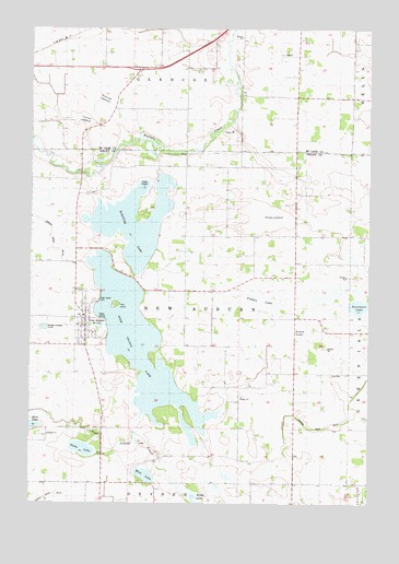
New Auburn, MN USGS Topographic Map
Click on map above to begin viewing in our Map Viewer.

This topographic map contains these locations and features:
Feature Name Type Latitude Longitude GNIS ID View Map
Berge LakebedFlatN44.7000°W94.1614°1817735View Map
Brewster LakebedFlatN44.7311°W94.2233°1817737View Map
City of New AuburnCivilN44.6728°W94.2320°2395184View Map
Fadden LakeLakeN44.6791°W94.1678°643485View Map
Grack LakeSwampN44.6705°W94.1511°644311View Map
Hahn LakeLakeN44.6391°W94.2315°644568View Map
High IslandIslandN44.6773°W94.2189°2784926View Map
High Island LakeLakeN44.6683°W94.2113°644940View Map
Immanuel Lutheran ChurchChurchN44.6714°W94.2311°2065134View Map
Judicial Ditch Number NineteenCanalN44.7005°W94.2497°1817741View Map
Judicial Ditch Number TwelveCanalN44.6455°W94.1486°1817733View Map
Kirby LakeLakeN44.6262°W94.1896°646177View Map
Mud LakeLakeN44.6324°W94.2074°648209View Map
New AuburnPopulated PlaceN44.6736°W94.2297°648503View Map
New Auburn Fire DepartmentBuildingN44.6721°W94.2313°2666614View Map
New Auburn Post OfficePost OfficeN44.6704°W94.2308°2065109View Map
Ringo Mobile Home ParkPopulated PlaceN44.6736°W94.2294°2065135View Map
Schilling LakeLakeN44.6968°W94.2139°651284View Map
Sunshine DairyLocaleN44.6567°W94.1408°2674527View Map
Thoneys LakebedFlatN44.7255°W94.2308°1817736View Map
Township of New AuburnCivilN44.6740°W94.1928°665088View Map
Zion ChurchChurchN44.6589°W94.1403°654461View Map

Note: Coordinates in the location and feature list above are referenced to NAD83 datum.


Copyright (C) 2008-2025 Ryan Niemi / Sunset Dynamics ... All Rights Reserved