TopoQuest Logo
Do you find TopoQuest useful?
Help keep TopoQuest running and adding new maps/features by donating!
Bitcoin:  19c7KJd3qBynnjoSw5npx9KScwjBe4ifkT
Litecoin:  LXs6TkuXGGXo1vDsWCkWVdjQX94eUKd6ui
Home View Maps Find Maps Find Places Resources & Links


Noble, Illinois Topographic Map

USGS Map Title: Noble, IL
USGS Map MRC: 38088F2
DRG (GeoTIFF) Download: o38088f2.tif


Neighboring USGS Topographic Map Quads:


  Sailor Springs, IL  
38088G3
 

  Wakefield, IL  
38088G2
 

  Dundas, IL  
38088G1
 

  Clay City, IL  
38088F3
 

  Noble, IL  
38088F2
 

  Olney, IL  
38088F1
 

  Enterprise, IL  
38088E3
 

  Mount Erie, IL  
38088E2
 

  West Salem, IL  
38088E1


Map MRC Location:

N39°
W89°
N39°
W88°
H8 H7 H6 H5 H4 H3 H2 H1
G8 G7 G6 G5 G4 G3 G2 G1
F8 F7 F6 F5 F4 F3 F2 F1
E8 E7 E6 E5 E4 E3 E2 E1
D8 D7 D6 D5 D4 D3 D2 D1
C8 C7 C6 C5 C4 C3 C2 C1
B8 B7 B6 B5 B4 B3 B2 B1
A8 A7 A6 A5 A4 A3 A2 A1
N38°
W89°
N38°
W88°

Noble, IL USGS 1:24K Topographic Map Preview:
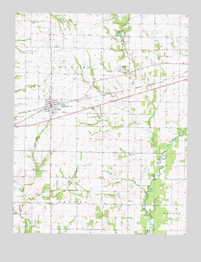
Noble, IL USGS Topographic Map
Click on map above to begin viewing in our Map Viewer.

This topographic map contains these locations and features:
Feature Name Type Latitude Longitude GNIS ID View Map
Antioch ChurchChurchN38.6439°W88.1673°403557View Map
Barlow School (historical)SchoolN38.7137°W88.1795°1736780View Map
Blain CemeteryCemeteryN38.7264°W88.1417°404534View Map
Blue Ridge School (historical)SchoolN38.7450°W88.2056°1736785View Map
Brown CreekStreamN38.6434°W88.2414°404947View Map
Cornerstone Community ChurchChurchN38.6995°W88.2217°1962632View Map
Decker CemeteryCemeteryN38.6498°W88.2114°407048View Map
Decker TownhallBuildingN38.6492°W88.2231°1736795View Map
Elston CemeteryCemeteryN38.7367°W88.1709°407971View Map
Elwood School (historical)SchoolN38.7181°W88.1317°1736798View Map
First Christian ChurchChurchN38.6981°W88.2267°1962635View Map
Fransonia (historical)Populated PlaceN38.6456°W88.1581°1820897View Map
Fransonia School (historical)SchoolN38.6573°W88.1678°1736801View Map
Freedom School (historical)SchoolN38.7459°W88.2384°1736802View Map
GallagherPopulated PlaceN38.6345°W88.1673°422725View Map
Gallagher School (historical)SchoolN38.6275°W88.1667°1736803View Map
Green Hill CemeteryCemeteryN38.6467°W88.2328°409382View Map
McCarthy LakeReservoirN38.7385°W88.1750°413188View Map
McCauley School (historical)SchoolN38.6609°W88.2417°1736813View Map
NoblePopulated PlaceN38.6975°W88.2237°414542View Map
Noble Post OfficePost OfficeN38.6977°W88.2241°2788546View Map
Noble United Methodist ChurchChurchN38.7000°W88.2250°1962646View Map
Noble Wakefield Fire Protection DistrictBuildingN38.6981°W88.2230°2681936View Map
North Freedom CemeteryCemeteryN38.7445°W88.2381°1820904View Map
North Freedom ChurchChurchN38.7448°W88.2387°414613View Map
Olive Branch CemeteryCemeteryN38.6703°W88.1675°415084View Map
Olive Branch Church (historical)ChurchN38.6709°W88.1670°1736819View Map
Olney-Noble AirportAirportN38.7193°W88.1743°427632View Map
Pleasant View Church (historical)ChurchN38.6420°W88.2045°1736825View Map
PuretonPopulated PlaceN38.7306°W88.2245°423093View Map
Rock BranchStreamN38.7425°W88.1745°416790View Map
Rock Branch School (historical)SchoolN38.7442°W88.1684°1736831View Map
SchnellPopulated PlaceN38.6359°W88.2495°423163View Map
Schnell East Oil FieldOilfieldN38.6570°W88.2092°425453View Map
Shields CemeteryCemeteryN38.6881°W88.1628°418389View Map
Shields School (historical)SchoolN38.6853°W88.1678°1736836View Map
Shiloh Number 2 CemeteryCemeteryN38.7162°W88.1720°418400View Map
Sugar CreekStreamN38.6681°W88.1448°419276View Map
Sugar Creek ChurchChurchN38.7264°W88.1412°419292View Map
Sunnyside School (historical)SchoolN38.7448°W88.1270°1736838View Map
Susan BranchStreamN38.6523°W88.1525°419432View Map
Taylor School (historical)SchoolN38.6273°W88.2042°1736839View Map
Totten School (historical)SchoolN38.6895°W88.1317°1736840View Map
Township of DeckerCivilN38.6359°W88.2139°428878View Map
Township of NobleCivilN38.7137°W88.2128°429450View Map
Turkey CreekStreamN38.6367°W88.1514°419927View Map
Van Matre School (historical)SchoolN38.6284°W88.2495°1736843View Map
Village of NobleCivilN38.6974°W88.2233°2399500View Map
Village of Noble CemeteryCemeteryN38.6987°W88.2153°1820912View Map
West Richland Elementary SchoolSchoolN38.6931°W88.2223°1820916View Map
West Richland High SchoolSchoolN38.6992°W88.2181°1820917View Map

Note: Coordinates in the location and feature list above are referenced to NAD83 datum.


Copyright (C) 2008-2025 Ryan Niemi / Sunset Dynamics ... All Rights Reserved