TopoQuest Logo
Do you find TopoQuest useful?
Help keep TopoQuest running and adding new maps/features by donating!
Bitcoin:  19c7KJd3qBynnjoSw5npx9KScwjBe4ifkT
Litecoin:  LXs6TkuXGGXo1vDsWCkWVdjQX94eUKd6ui
Home View Maps Find Maps Find Places Resources & Links


Wakefield, Illinois Topographic Map

USGS Map Title: Wakefield, IL
USGS Map MRC: 38088G2
DRG (GeoTIFF) Download: o38088g2.tif


Neighboring USGS Topographic Map Quads:


  Latona, IL  
38088H3
 

  Newton, IL  
38088H2
 

  Sainte Marie, IL  
38088H1
 

  Sailor Springs, IL  
38088G3
 

  Wakefield, IL  
38088G2
 

  Dundas, IL  
38088G1
 

  Clay City, IL  
38088F3
 

  Noble, IL  
38088F2
 

  Olney, IL  
38088F1


Map MRC Location:

N39°
W89°
N39°
W88°
H8 H7 H6 H5 H4 H3 H2 H1
G8 G7 G6 G5 G4 G3 G2 G1
F8 F7 F6 F5 F4 F3 F2 F1
E8 E7 E6 E5 E4 E3 E2 E1
D8 D7 D6 D5 D4 D3 D2 D1
C8 C7 C6 C5 C4 C3 C2 C1
B8 B7 B6 B5 B4 B3 B2 B1
A8 A7 A6 A5 A4 A3 A2 A1
N38°
W89°
N38°
W88°

Wakefield, IL USGS 1:24K Topographic Map Preview:
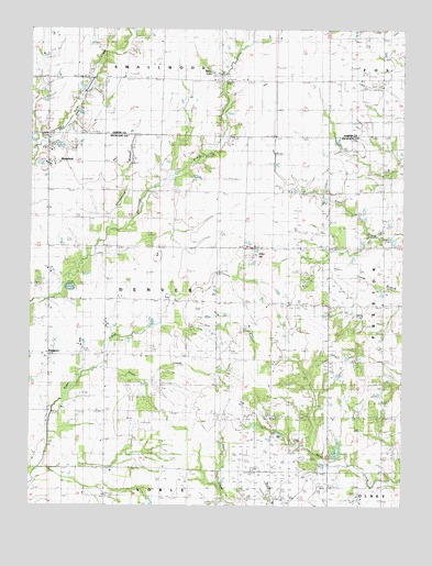
Wakefield, IL USGS Topographic Map
Click on map above to begin viewing in our Map Viewer.

This topographic map contains these locations and features:
Feature Name Type Latitude Longitude GNIS ID View Map
Amity School (historical)SchoolN38.8612°W88.1678°403491View Map
Berry LakeReservoirN38.8637°W88.1893°404223View Map
Blair School (historical)SchoolN38.8620°W88.2059°404544View Map
Blue Jean School (historical)SchoolN38.7742°W88.1673°404593View Map
Brown School (historical)SchoolN38.8612°W88.2442°404954View Map
Brush College School (historical)SchoolN38.8320°W88.2064°405013View Map
Denver School (historical)SchoolN38.8031°W88.2050°407137View Map
Greenwood BranchStreamN38.8223°W88.2234°409452View Map
Gumble School (historical)SchoolN38.7745°W88.2445°409566View Map
Hankins CemeteryCemeteryN38.8639°W88.2311°1923113View Map
Hawthorne School (historical)SchoolN38.8320°W88.1684°409949View Map
Hazel Dell School (historical)SchoolN38.8337°W88.1273°409976View Map
Houser CemeteryCemeteryN38.7678°W88.1648°1820899View Map
Jesse CreekStreamN38.7856°W88.2273°411107View Map
Kinkade School (historical)SchoolN38.7742°W88.2062°411522View Map
Kuhl Brothers FarmLocaleN38.8736°W88.2428°2724432View Map
Maple Grove School (historical)SchoolN38.8617°W88.1331°412927View Map
Mount Olive Church (historical)ChurchN38.8403°W88.1731°414017View Map
Nix LakeReservoirN38.8072°W88.2366°1691352View Map
Nix Lake DamDamN38.8084°W88.2350°1691351View Map
Noble - Wakefield Fire Protection District Wakefield StationBuildingN38.8404°W88.2440°2681931View Map
Onion HillSummitN38.8162°W88.1748°415128View Map
PassportPopulated PlaceN38.7892°W88.2437°415427View Map
Pleasant Ridge ChurchChurchN38.7514°W88.1692°415884View Map
Pleasant Valley Church (historical)ChurchN38.7742°W88.2250°415905View Map
Pleasant View CemeteryCemeteryN38.7964°W88.1792°1820907View Map
Pleasant View Church (historical)ChurchN38.7962°W88.1787°415919View Map
Pleasant View School (historical)SchoolN38.8039°W88.1684°415924View Map
Shady Grove School (historical)SchoolN38.8034°W88.1259°418257View Map
Township of DenverCivilN38.8033°W88.2040°428889View Map
Trobaugh CemeteryCemeteryN38.7953°W88.1270°419887View Map
WakefieldPopulated PlaceN38.8400°W88.2439°420382View Map
Wakefield CemeteryCemeteryN38.8431°W88.2356°1820913View Map
Wakefield Mill ElevatorLocaleN38.8394°W88.2450°2706249View Map
Wakefield School (historical)SchoolN38.8323°W88.2448°420383View Map
Walnut Grove School (historical)SchoolN38.8050°W88.2406°420461View Map
Wilson School (historical)SchoolN38.7734°W88.1261°421297View Map
Wilsonburg (historical)Populated PlaceN38.7598°W88.2389°1820918View Map
WUSI-TV (Olney)TowerN38.8384°W88.1295°428557View Map

Note: Coordinates in the location and feature list above are referenced to NAD83 datum.


Copyright (C) 2008-2024 Ryan Niemi / Sunset Dynamics ... All Rights Reserved