TopoQuest Logo
Do you find TopoQuest useful?
Help keep TopoQuest running and adding new maps/features by donating!
Bitcoin:  19c7KJd3qBynnjoSw5npx9KScwjBe4ifkT
Litecoin:  LXs6TkuXGGXo1vDsWCkWVdjQX94eUKd6ui
Home View Maps Find Maps Find Places Resources & Links


North Sanford, New York Topographic Map

USGS Map Title: North Sanford, NY
USGS Map MRC: 42075B4
DRG (GeoTIFF) Download: o42075b4.tif


Neighboring USGS Topographic Map Quads:


  West Bainbridge, NY  
42075C5
 

  Sidney, NY  
42075C4
 

  Unadilla, NY  
42075C3
 

  Afton, NY  
42075B5
 

  North Sanford, NY  
42075B4
 

  Trout Creek, NY  
42075B3
 

  Gulf Summit, NY  
42075A5
 

  Deposit, NY  
42075A4
 

  Cannonsville Reservoir, NY  
42075A3


Map MRC Location:

N43°
W76°
N43°
W75°
H8 H7 H6 H5 H4 H3 H2 H1
G8 G7 G6 G5 G4 G3 G2 G1
F8 F7 F6 F5 F4 F3 F2 F1
E8 E7 E6 E5 E4 E3 E2 E1
D8 D7 D6 D5 D4 D3 D2 D1
C8 C7 C6 C5 C4 C3 C2 C1
B8 B7 B6 B5 B4 B3 B2 B1
A8 A7 A6 A5 A4 A3 A2 A1
N42°
W76°
N42°
W75°

North Sanford, NY USGS 1:24K Topographic Map Preview:
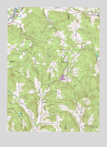
North Sanford, NY USGS Topographic Map
Click on map above to begin viewing in our Map Viewer.

This topographic map contains these locations and features:
Feature Name Type Latitude Longitude GNIS ID View Map
Anthony CemeteryCemeteryN42.1331°W75.4558°942499View Map
ArcticPopulated PlaceN42.1856°W75.4143°972173View Map
Arctic CemeteryCemeteryN42.1812°W75.4265°942541View Map
Balls IslandIslandN42.2473°W75.4880°942931View Map
Baxters Tree Farm And NurseryLocaleN42.1861°W75.4444°2517010View Map
Beach Hill CemeteryCemeteryN42.2431°W75.4064°943514View Map
Beales PondLakeN42.2020°W75.3788°943235View Map
Broome State ForestForestN42.1704°W75.4363°944895View Map
Burnside HillSummitN42.1690°W75.3791°945242View Map
Camp AmahamiLocaleN42.1412°W75.4810°945543View Map
Chenango State ForestForestN42.2242°W75.4580°946490View Map
ChinaPopulated PlaceN42.1448°W75.4002°972319View Map
China Road CemeteryCemeteryN42.1474°W75.4023°2548282View Map
Clarks PondLakeN42.1713°W75.4097°946787View Map
Dry BrookStreamN42.1306°W75.4632°948672View Map
East AftonPopulated PlaceN42.2070°W75.4235°972405View Map
Federated Church of MasonvilleChurchN42.2417°W75.3768°2615937View Map
Landers CreekStreamN42.2381°W75.4952°955017View Map
Lord Road CemeteryCemeteryN42.1636°W75.4833°2542984View Map
MasonvillePopulated PlaceN42.2420°W75.3774°956646View Map
Masonville Elementary SchoolSchoolN42.2442°W75.3772°2496806View Map
Masonville Fire DepartmentBuildingN42.2426°W75.3774°2718666View Map
Masonville Post OfficePost OfficeN42.2428°W75.3781°2618013View Map
Melondy Hill CemeteryCemeteryN42.2028°W75.4648°956927View Map
Michigan HillSummitN42.1337°W75.3752°957071View Map
Middle BridgePopulated PlaceN42.2454°W75.4880°957088View Map
North SanfordPopulated PlaceN42.1548°W75.4524°958906View Map
North Sanford United Methodist ChurchChurchN42.1553°W75.4523°2597344View Map
Page PondLakeN42.1427°W75.4822°959754View Map
Page Pond HillSummitN42.1476°W75.4955°959755View Map
Sidney Memorial Public Library Masonville BranchBuildingN42.2434°W75.3789°2617427View Map
Stilson PondLakeN42.1887°W75.4388°966448View Map
WhitmanPopulated PlaceN42.1954°W75.3755°973266View Map

Note: Coordinates in the location and feature list above are referenced to NAD83 datum.


Copyright (C) 2008-2025 Ryan Niemi / Sunset Dynamics ... All Rights Reserved