TopoQuest Logo
Do you find TopoQuest useful?
Help keep TopoQuest running and adding new maps/features by donating!
Bitcoin:  19c7KJd3qBynnjoSw5npx9KScwjBe4ifkT
Litecoin:  LXs6TkuXGGXo1vDsWCkWVdjQX94eUKd6ui
Home View Maps Find Maps Find Places Resources & Links


Unadilla, New York Topographic Map

USGS Map Title: Unadilla, NY
USGS Map MRC: 42075C3
DRG (GeoTIFF) Download: o42075c3.tif


Neighboring USGS Topographic Map Quads:


  Guilford, NY  
42075D4
 

  Gilbertsville, NY  
42075D3
 

  Otego, NY  
42075D2
 

  Sidney, NY  
42075C4
 

  Unadilla, NY  
42075C3
 

  Franklin, NY  
42075C2
 

  North Sanford, NY  
42075B4
 

  Trout Creek, NY  
42075B3
 

  Walton West, NY  
42075B2


Map MRC Location:

N43°
W76°
N43°
W75°
H8 H7 H6 H5 H4 H3 H2 H1
G8 G7 G6 G5 G4 G3 G2 G1
F8 F7 F6 F5 F4 F3 F2 F1
E8 E7 E6 E5 E4 E3 E2 E1
D8 D7 D6 D5 D4 D3 D2 D1
C8 C7 C6 C5 C4 C3 C2 C1
B8 B7 B6 B5 B4 B3 B2 B1
A8 A7 A6 A5 A4 A3 A2 A1
N42°
W76°
N42°
W75°

Unadilla, NY USGS 1:24K Topographic Map Preview:
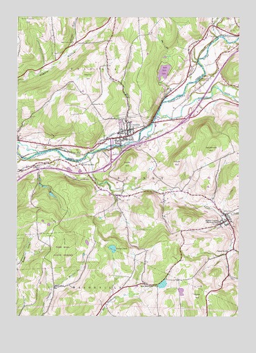
Unadilla, NY USGS Topographic Map
Click on map above to begin viewing in our Map Viewer.

This topographic map contains these locations and features:
Feature Name Type Latitude Longitude GNIS ID View Map
Barnes Trailer ParkPopulated PlaceN42.3444°W75.2725°2516338View Map
Bishop FarmLocaleN42.3167°W75.3544°2560302View Map
Carrs CreekStreamN42.3170°W75.3355°945918View Map
Chestnut Hill CemeteryCemeteryN42.3330°W75.3128°946549View Map
Couse HillSummitN42.2562°W75.2727°947568View Map
Crane HillSummitN42.3140°W75.2846°947696View Map
East MasonvillePopulated PlaceN42.2637°W75.3024°949165View Map
East Masonville CemeteryCemeteryN42.2627°W75.2954°2548269View Map
Evergreen Hill CemeteryCemeteryN42.3198°W75.3182°949771View Map
First Presbyterian ChurchChurchN42.3242°W75.3189°2497797View Map
Gillette School (historical)SchoolN42.3129°W75.3627°951123View Map
Highland CemeteryCemeteryN42.2937°W75.2535°952777View Map
Hotel Bishop (historical)BuildingN42.3258°W75.3111°2497897View Map
Ideuma BrookStreamN42.3590°W75.3474°953584View Map
Kilkenny HillSummitN42.3504°W75.3349°954602View Map
Martin BrookStreamN42.3231°W75.3116°956579View Map
Olmstead Landing StripAirportN42.2657°W75.3102°2443684View Map
Ouleout CreekStreamN42.3342°W75.2955°959586View Map
Pine HillSummitN42.2823°W75.3435°960464View Map
Pond View Koi FarmLocaleN42.3181°W75.2508°2557742View Map
Poplar HillSummitN42.3159°W75.3110°960933View Map
Rogers Hollow CemeteryCemeteryN42.3647°W75.3436°962819View Map
S S North Fire Company Number 1BuildingN42.3250°W75.3169°2497837View Map
Saint Ambrose Roman Catholic ChurchChurchN42.3244°W75.3211°2497777View Map
Saint Matthew's Episcopal ChurchChurchN42.3253°W75.3111°2497937View Map
Sand Hill CreekStreamN42.3667°W75.2621°964380View Map
School Number 12 (historical)SchoolN42.3387°W75.3327°975013View Map
School Number 15 (historical)SchoolN42.2904°W75.2557°975101View Map
School Number 6 (historical)SchoolN42.2623°W75.3530°975459View Map
School Number 8 (historical)SchoolN42.2642°W75.3025°2376993View Map
Sidney Assembly of GodChurchN42.3117°W75.3733°2616262View Map
Sidney CenterPopulated PlaceN42.2906°W75.2557°965213View Map
Sidney Center Baptist ChurchChurchN42.2925°W75.2569°2497977View Map
Sidney Center Elementary SchoolSchoolN42.2950°W75.2603°2496805View Map
Sidney Center Post OfficePost OfficeN42.2908°W75.2567°2618123View Map
Sidney Center Volunteer Fire DepartmentBuildingN42.2907°W75.2565°2735064View Map
Sidney Memorial Public Library Sidney Center BranchBuildingN42.2928°W75.2582°2617428View Map
Skytop QuarryMineN42.2822°W75.2722°2567145View Map
South UnadillaPopulated PlaceN42.3134°W75.3385°973101View Map
The FlyLakeN42.3528°W75.2923°967239View Map
Town of SidneyCivilN42.3073°W75.2772°979495View Map
Town of UnadillaCivilN42.3709°W75.3266°979571View Map
UnadillaPopulated PlaceN42.3254°W75.3124°968118View Map
Unadilla Baptist ChurchChurchN42.3237°W75.3099°2497957View Map
Unadilla Drive-InLocaleN42.3450°W75.2836°2558425View Map
Unadilla Eastbound Rest AreaLocaleN42.3255°W75.2899°2615131View Map
Unadilla Elementary SchoolSchoolN42.3267°W75.3092°2497817View Map
Unadilla Fire DepartmentBuildingN42.3303°W75.3179°2497877View Map
Unadilla HouseBuildingN42.3244°W75.3158°2497917View Map
Unadilla Post OfficePost OfficeN42.3243°W75.3168°1782021View Map
Unadilla Public LibraryBuildingN42.3254°W75.3158°2497857View Map
Unadilla United Methodist ChurchChurchN42.3253°W75.3109°2667494View Map
Unadilla Westbound Rest AreaLocaleN42.3584°W75.2574°2598943View Map
Union CemeteryCemeteryN42.3214°W75.3592°968152View Map
Vandervort HillSummitN42.3201°W75.2646°968460View Map
Village of UnadillaCivilN42.3273°W75.3155°2391174View Map
WCDO-FM (Sidney)TowerN42.2926°W75.3671°978604View Map
YoungsPopulated PlaceN42.3001°W75.3182°971852View Map
Youngs PondLakeN42.2783°W75.3207°971859View Map

Note: Coordinates in the location and feature list above are referenced to NAD83 datum.


Copyright (C) 2008-2025 Ryan Niemi / Sunset Dynamics ... All Rights Reserved