TopoQuest Logo
Do you find TopoQuest useful?
Help keep TopoQuest running and adding new maps/features by donating!
Bitcoin:  19c7KJd3qBynnjoSw5npx9KScwjBe4ifkT
Litecoin:  LXs6TkuXGGXo1vDsWCkWVdjQX94eUKd6ui
Home View Maps Find Maps Find Places Resources & Links


Sutton Mountain, Oregon Topographic Map

USGS Map Title: Sutton Mountain, OR
USGS Map MRC: 44120F2
DRG (GeoTIFF) Download: o44120f2.tif


Neighboring USGS Topographic Map Quads:


  Jennies Peak, OR  
44120G3
 

  Rowe Creek, OR  
44120G2
 

  Service Creek, OR  
44120G1
 

  Painted Hills, OR  
44120F3
 

  Sutton Mountain, OR  
44120F2
 

  Toney Butte, OR  
44120F1
 

  Lawson Mountain, OR  
44120E3
 

  Mitchell, OR  
44120E2
 

  Keyes Mountain, OR  
44120E1


Map MRC Location:

N45°
W121°
N45°
W120°
H8 H7 H6 H5 H4 H3 H2 H1
G8 G7 G6 G5 G4 G3 G2 G1
F8 F7 F6 F5 F4 F3 F2 F1
E8 E7 E6 E5 E4 E3 E2 E1
D8 D7 D6 D5 D4 D3 D2 D1
C8 C7 C6 C5 C4 C3 C2 C1
B8 B7 B6 B5 B4 B3 B2 B1
A8 A7 A6 A5 A4 A3 A2 A1
N44°
W121°
N44°
W120°

Sutton Mountain, OR USGS 1:24K Topographic Map Preview:
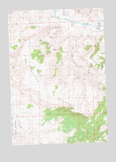
Sutton Mountain, OR USGS Topographic Map
Click on map above to begin viewing in our Map Viewer.

This topographic map contains these locations and features:
Feature Name Type Latitude Longitude GNIS ID View Map
Big CanyonValleyN44.7282°W120.1333°1133218View Map
Black CanyonValleyN44.7065°W120.1720°1117752View Map
Chapman SpringSpringN44.7186°W120.2087°1118834View Map
Collins Landing StripAirportN44.7326°W120.1627°1158820View Map
Gilchrist ValleyValleyN44.6610°W120.1983°1851697View Map
Girds CreekStreamN44.7349°W120.1470°1121147View Map
Goose PaintRidgeN44.7340°W120.1350°1161679View Map
James CanyonValleyN44.7376°W120.1489°1122375View Map
Packsaddle MountainSummitN44.7126°W120.1886°1125117View Map
Rocky TopSummitN44.7415°W120.1984°1132495View Map
Sutton MountainRidgeN44.6749°W120.2125°1127777View Map
TwickenhamPopulated PlaceN44.7437°W120.1720°1128336View Map
Twickenham Boat LaunchLocaleN44.7367°W120.1655°2700110View Map
Twickenham Post Office (historical)Post OfficeN44.7437°W120.1720°1166073View Map

Note: Coordinates in the location and feature list above are referenced to NAD83 datum.


Copyright (C) 2008-2025 Ryan Niemi / Sunset Dynamics ... All Rights Reserved