TopoQuest Logo
Do you find TopoQuest useful?
Help keep TopoQuest running and adding new maps/features by donating!
Bitcoin:  19c7KJd3qBynnjoSw5npx9KScwjBe4ifkT
Litecoin:  LXs6TkuXGGXo1vDsWCkWVdjQX94eUKd6ui
Home View Maps Find Maps Find Places Resources & Links


Beachton, Georgia Topographic Map

USGS Map Title: Beachton, GA
USGS Map MRC: 30084F2
DRG (GeoTIFF) Download: o30084f2.tif


Neighboring USGS Topographic Map Quads:


  Reno, GA  
30084G3
 

  Cairo South, GA  
30084G2
 

  Pine Park, GA  
30084G1
 

  Calvary, GA  
30084F3
 

  Beachton, GA  
30084F2
 

  Miccosukee NE, GA  
30084F1
 

  Lake Jackson, FL  
30084E3
 

  Bradfordville, FL  
30084E2
 

  Miccosukee, FL  
30084E1


Map MRC Location:

N31°
W85°
N31°
W84°
H8 H7 H6 H5 H4 H3 H2 H1
G8 G7 G6 G5 G4 G3 G2 G1
F8 F7 F6 F5 F4 F3 F2 F1
E8 E7 E6 E5 E4 E3 E2 E1
D8 D7 D6 D5 D4 D3 D2 D1
C8 C7 C6 C5 C4 C3 C2 C1
B8 B7 B6 B5 B4 B3 B2 B1
A8 A7 A6 A5 A4 A3 A2 A1
N30°
W85°
N30°
W84°

Beachton, GA USGS 1:24K Topographic Map Preview:
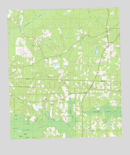
Beachton, GA USGS Topographic Map
Click on map above to begin viewing in our Map Viewer.

This topographic map contains these locations and features:
Feature Name Type Latitude Longitude GNIS ID View Map
Anders FlatFlatN30.6455°W84.2405°277850View Map
BeachtonPopulated PlaceN30.7271°W84.1396°326174View Map
Beth Page ChurchChurchN30.6844°W84.2060°342445View Map
Buck CreekStreamN30.7319°W84.2382°311961View Map
Buzzard IslandIslandN30.6271°W84.2432°279765View Map
Carns PondLakeN30.6368°W84.1375°280050View Map
Copeland CemeteryCemeteryN30.7252°W84.1652°312962View Map
Evergreen CemeteryCemeteryN30.7160°W84.1363°314000View Map
Floyd ChapelChurchN30.6605°W84.1616°282634View Map
Foshalee SloughLakeN30.6495°W84.1511°282723View Map
Good Shepherd Catholic ChurchChurchN30.6960°W84.2332°300608View Map
Grady County Volunteer Fire Department Beachton StationBuildingN30.7298°W84.1406°2604192View Map
Hadley CreekStreamN30.7174°W84.2496°315007View Map
Hall IslandIslandN30.6396°W84.2332°283623View Map
Hawkins LakeReservoirN30.7454°W84.1840°342016View Map
Hawkins Lake DamDamN30.7452°W84.1882°342015View Map
Hickory Hill ChurchChurchN30.6621°W84.1902°283963View Map
IamoniaPopulated PlaceN30.6683°W84.1635°295372View Map
Jake HoleBayN30.6434°W84.2197°284709View Map
Jerusalem ChurchChurchN30.7138°W84.1782°316089View Map
Lake IamoniaLakeN30.6312°W84.2390°284452View Map
Lester IslandIslandN30.6258°W84.2241°285470View Map
Mitchell IslandIslandN30.6294°W84.2355°287010View Map
Mitchell PointCapeN30.6252°W84.2302°287013View Map
Mitchell PondLakeN30.7090°W84.1524°317775View Map
MoncriefPopulated PlaceN30.7127°W84.1374°342501View Map
Moncriefs StoreLocaleN30.7127°W84.1380°318387View Map
New Ochlocknee Baptist ChurchChurchN30.7299°W84.1396°342505View Map
New Ochlocknee CemeteryCemeteryN30.7299°W84.1393°342506View Map
Page ChurchChurchN30.6844°W84.2057°320156View Map
Pleasant Hill (historical)Populated PlaceN30.7210°W84.1666°342524View Map
Pleasant Hill ChurchChurchN30.7224°W84.1391°320861View Map
Rocky HillPopulated PlaceN30.7027°W84.2102°326495View Map
Rocky Hill School (historical)SchoolN30.7030°W84.2096°342530View Map
Sheep IslandIslandN30.6419°W84.2157°290957View Map
Southeast Grady DivisionCivilN30.7371°W84.1517°1936234View Map
Strickland ArmBayN30.6535°W84.1815°291748View Map
Strickland SchoolSchoolN30.6683°W84.1810°291752View Map
Tired CreekStreamN30.7421°W84.2174°324195View Map
Twin IslandIslandN30.6363°W84.2455°292599View Map
Van Brunt ArmBayN30.6473°W84.2092°292729View Map
Van Brunt CemeteryCemeteryN30.6580°W84.2013°292730View Map
Wyche ArmBayN30.6420°W84.2297°293551View Map

Note: Coordinates in the location and feature list above are referenced to NAD83 datum.


Copyright (C) 2008-2025 Ryan Niemi / Sunset Dynamics ... All Rights Reserved