TopoQuest Logo
Do you find TopoQuest useful?
Help keep TopoQuest running and adding new maps/features by donating!
Bitcoin:  19c7KJd3qBynnjoSw5npx9KScwjBe4ifkT
Litecoin:  LXs6TkuXGGXo1vDsWCkWVdjQX94eUKd6ui
Home View Maps Find Maps Find Places Resources & Links


Pinto, Utah Topographic Map

USGS Map Title: Pinto, UT
USGS Map MRC: 37113E5
DRG (GeoTIFF) Download: o37113e5.tif


Neighboring USGS Topographic Map Quads:


  Beryl Junction, UT  
37113F6
 

  Newcastle, UT  
37113F5
 

  Silver Peak, UT  
37113F4
 

  Enterprise, UT  
37113E6
 

  Pinto, UT  
37113E5
 

  Page Ranch, UT  
37113E4
 

  Central West, UT  
37113D6
 

  Central East, UT  
37113D5
 

  Grass Valley, UT  
37113D4


Map MRC Location:

N38°
W114°
N38°
W113°
H8 H7 H6 H5 H4 H3 H2 H1
G8 G7 G6 G5 G4 G3 G2 G1
F8 F7 F6 F5 F4 F3 F2 F1
E8 E7 E6 E5 E4 E3 E2 E1
D8 D7 D6 D5 D4 D3 D2 D1
C8 C7 C6 C5 C4 C3 C2 C1
B8 B7 B6 B5 B4 B3 B2 B1
A8 A7 A6 A5 A4 A3 A2 A1
N37°
W114°
N37°
W113°

Pinto, UT USGS 1:24K Topographic Map Preview:
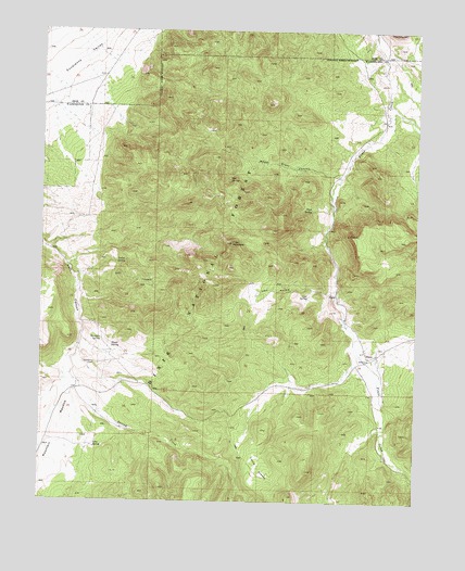
Pinto, UT USGS Topographic Map
Click on map above to begin viewing in our Map Viewer.

This topographic map contains these locations and features:
Feature Name Type Latitude Longitude GNIS ID View Map
Big CanyonValleyN37.5622°W113.6177°1454663View Map
Cove HollowValleyN37.5564°W113.5280°1440067View Map
Cove MountainSummitN37.5686°W113.5625°1440070View Map
Cove SpringSpringN37.5546°W113.5369°1440074View Map
Death Valley Party MonumentPillarN37.5872°W113.6105°1448330View Map
Hamblin CemeteryCemeteryN37.5364°W113.6077°1441556View Map
Hamblin Historical SiteLocaleN37.5439°W113.6066°1451257View Map
Hamblin SpringSpringN37.5427°W113.6054°1441557View Map
Hyatt SpringSpringN37.5411°W113.6020°1441963View Map
Jefferson Hunt MonumentLocaleN37.6039°W113.6039°1455697View Map
Little GrassyFlatN37.5083°W113.5522°1442722View Map
Lone SpringSpringN37.5143°W113.6075°1442883View Map
Meadow Valley CreekStreamN37.5416°W113.6125°1448653View Map
Mountain MeadowFlatN37.5175°W113.6214°1438093View Map
Oak SpringSpringN37.5855°W113.5635°1430920View Map
PintoLocaleN37.5383°W113.5166°1444429View Map
Pinto CemeteryCemeteryN37.5409°W113.5134°1448843View Map
Platt SpringSpringN37.5778°W113.5361°1444475View Map
Spring CreekStreamN37.5416°W113.6127°1446007View Map
Wheat Grass CanyonValleyN37.5866°W113.5275°1447204View Map
Yellow SpringSpringN37.5634°W113.6006°1447560View Map

Note: Coordinates in the location and feature list above are referenced to NAD83 datum.


Copyright (C) 2008-2025 Ryan Niemi / Sunset Dynamics ... All Rights Reserved