TopoQuest Logo
Do you find TopoQuest useful?
Help keep TopoQuest running and adding new maps/features by donating!
Bitcoin:  19c7KJd3qBynnjoSw5npx9KScwjBe4ifkT
Litecoin:  LXs6TkuXGGXo1vDsWCkWVdjQX94eUKd6ui
Home View Maps Find Maps Find Places Resources & Links


Washington, Arkansas Topographic Map

USGS Map Title: Washington, AR
USGS Map MRC: 33093G6
DRG (GeoTIFF) Download: o33093g6.tif


Neighboring USGS Topographic Map Quads:


  Nashville, AR  
33093H7
 

  McCaskill, AR  
33093H6
 

  Pisgah, AR  
33093H5
 

  Columbus, AR  
33093G7
 

  Washington, AR  
33093G6
 

  Blevins, AR  
33093G5
 

  McNab, AR  
33093F7
 

  Sheppard, AR  
33093F6
 

  Hope, AR  
33093F5


Map MRC Location:

N34°
W94°
N34°
W93°
H8 H7 H6 H5 H4 H3 H2 H1
G8 G7 G6 G5 G4 G3 G2 G1
F8 F7 F6 F5 F4 F3 F2 F1
E8 E7 E6 E5 E4 E3 E2 E1
D8 D7 D6 D5 D4 D3 D2 D1
C8 C7 C6 C5 C4 C3 C2 C1
B8 B7 B6 B5 B4 B3 B2 B1
A8 A7 A6 A5 A4 A3 A2 A1
N33°
W94°
N33°
W93°

Washington, AR USGS 1:24K Topographic Map Preview:
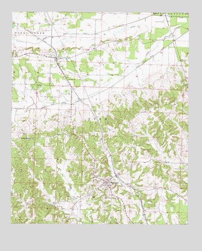
Washington, AR USGS Topographic Map
Click on map above to begin viewing in our Map Viewer.

This topographic map contains these locations and features:
Feature Name Type Latitude Longitude GNIS ID View Map
Academy (historical)Populated PlaceN33.8007°W93.7335°61438View Map
Belk CemeteryCemeteryN33.8323°W93.7321°46342View Map
City of WashingtonCivilN33.7730°W93.6834°2405680View Map
Confederate State CapitolParkN33.7760°W93.6805°75265View Map
Hickory Grove School (historical)SchoolN33.8562°W93.6868°61436View Map
Holts Store (historical)LocaleN33.8093°W93.6432°61443View Map
Hope State Wildlife Management AreaParkN33.7565°W93.6349°61442View Map
Jakajones (historical)Populated PlaceN33.8282°W93.6268°61445View Map
Lincoln Elementary SchoolSchoolN33.7671°W93.6955°61441View Map
Lincoln High SchoolSchoolN33.7673°W93.6946°61440View Map
Middle Fork Ozan CreekStreamN33.8734°W93.6455°51932View Map
Mount Moriah Home ChurchChurchN33.8004°W93.7360°52323View Map
New Hope Church (historical)ChurchN33.7676°W93.6313°61446View Map
North Fork Ozan CreekStreamN33.8734°W93.6455°52824View Map
Old ChannelChannelN33.8718°W93.6560°52988View Map
Old ChannelChannelN33.8726°W93.6257°52989View Map
Old Washington Historic State ParkParkN33.7740°W93.6832°61439View Map
OzanPopulated PlaceN33.8479°W93.7191°53119View Map
Ozan Post OfficePost OfficeN33.8488°W93.7236°2781943View Map
Ozan Volunteer Fire DepartmentBuildingN33.8494°W93.7236°2116921View Map
Rikes Chapel (historical)ChurchN33.8154°W93.6382°61444View Map
Saint Annies Church (historical)ChurchN33.8009°W93.6738°61437View Map
Saint Marks ChurchChurchN33.8351°W93.7105°54400View Map
Saint Peter CemeteryCemeteryN33.8748°W93.7343°54462View Map
Town of OzanCivilN33.8479°W93.7204°2407061View Map
Township of OzanCivilN33.7846°W93.6807°66645View Map
Walnut Grove Church (historical)ChurchN33.8748°W93.7046°61549View Map
WashingtonPopulated PlaceN33.7740°W93.6827°78702View Map
Washington Fire DepartmentBuildingN33.7753°W93.6828°2117275View Map
Washington Historic DistrictParkN33.7748°W93.6830°81926View Map
Washington Post OfficePost OfficeN33.7753°W93.6819°2740752View Map

Note: Coordinates in the location and feature list above are referenced to NAD83 datum.


Copyright (C) 2008-2025 Ryan Niemi / Sunset Dynamics ... All Rights Reserved