TopoQuest Logo
Do you find TopoQuest useful?
Help keep TopoQuest running and adding new maps/features by donating!
Bitcoin:  19c7KJd3qBynnjoSw5npx9KScwjBe4ifkT
Litecoin:  LXs6TkuXGGXo1vDsWCkWVdjQX94eUKd6ui
Home View Maps Find Maps Find Places Resources & Links


Portland, Florida Topographic Map

USGS Map Title: Portland, FL
USGS Map MRC: 30086E2
DRG (GeoTIFF) Download: o30086e2.tif


Neighboring USGS Topographic Map Quads:


  Mossy Head, FL  
30086F3
 

  De Funiak Springs West, FL  
30086F2
 

  De Funiak Springs East, FL  
30086F1
 

  Niceville SE, FL  
30086E3
 

  Portland, FL  
30086E2
 

  Rock Hill, FL  
30086E1
 

  Choctaw Beach, FL  
30086D3
 

  Freeport, FL  
30086D2
 

  Bunker, FL  
30086D1


Map MRC Location:

N31°
W87°
N31°
W86°
H8 H7 H6 H5 H4 H3 H2 H1
G8 G7 G6 G5 G4 G3 G2 G1
F8 F7 F6 F5 F4 F3 F2 F1
E8 E7 E6 E5 E4 E3 E2 E1
D8 D7 D6 D5 D4 D3 D2 D1
C8 C7 C6 C5 C4 C3 C2 C1
B8 B7 B6 B5 B4 B3 B2 B1
A8 A7 A6 A5 A4 A3 A2 A1
N30°
W87°
N30°
W86°

Portland, FL USGS 1:24K Topographic Map Preview:
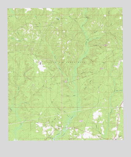
Portland, FL USGS Topographic Map
Click on map above to begin viewing in our Map Viewer.

This topographic map contains these locations and features:
Feature Name Type Latitude Longitude GNIS ID View Map
Alice CreekStreamN30.5916°W86.1627°277745View Map
Basin CreekStreamN30.5005°W86.2419°278149View Map
Bear BranchStreamN30.5296°W86.2458°278294View Map
Beaver PondLakeN30.6145°W86.1934°278365View Map
Blount CreekStreamN30.6235°W86.1638°279001View Map
Blount Mill CreekStreamN30.5916°W86.2083°279004View Map
Brier CreekStreamN30.5957°W86.2324°279391View Map
Brushy HeadValleyN30.5444°W86.1730°279522View Map
City of FreeportCivilN30.5030°W86.1409°2403663View Map
College HeadValleyN30.5877°W86.1608°280648View Map
Counterfeit Mill CreekStreamN30.5208°W86.1827°280891View Map
Damascus ChurchChurchN30.5013°W86.1808°281267View Map
Davis BranchStreamN30.6052°W86.1691°281319View Map
Davis Mill CreekStreamN30.5077°W86.1933°281329View Map
East Branch Fourmile CreekStreamN30.5455°W86.1336°281952View Map
Eglin Air Force Base Fire Station C6BuildingN30.5734°W86.2145°2644695View Map
Flat HeadValleyN30.5155°W86.2027°282561View Map
Fox BranchStreamN30.5510°W86.2380°282759View Map
Hatcher CemeteryCemeteryN30.5044°W86.1766°283800View Map
Hobbs BridgeBridgeN30.5952°W86.1638°284060View Map
Little Alaqua CreekStreamN30.5477°W86.1752°285580View Map
Little Basin CreekStreamN30.5269°W86.2411°285589View Map
Long BranchStreamN30.6177°W86.2424°285972View Map
McQuage BranchStreamN30.5966°W86.1633°286652View Map
New HomePopulated PlaceN30.6091°W86.2197°295484View Map
New Home CemeteryCemeteryN30.6116°W86.2005°287617View Map
Pine Allen BridgeBridgeN30.6160°W86.1638°288819View Map
PortlandPopulated PlaceN30.5124°W86.1958°289253View Map
Scrub HillSummitN30.5732°W86.1444°290772View Map
Steep HeadValleyN30.5415°W86.1748°291664View Map
Sweetwater BranchStreamN30.5613°W86.1752°291947View Map
Thomas BranchStreamN30.5038°W86.1458°292200View Map
Walton CountyCivilN30.6185°W86.1715°295727View Map
Ward BranchStreamN30.5785°W86.1666°292866View Map
White BranchStreamN30.6019°W86.1399°293198View Map
WTNK-TV (Destin)TowerN30.5144°W86.2199°309171View Map

Note: Coordinates in the location and feature list above are referenced to NAD83 datum.


Copyright (C) 2008-2024 Ryan Niemi / Sunset Dynamics ... All Rights Reserved