TopoQuest Logo
Do you find TopoQuest useful?
Help keep TopoQuest running and adding new maps/features by donating!
Bitcoin:  19c7KJd3qBynnjoSw5npx9KScwjBe4ifkT
Litecoin:  LXs6TkuXGGXo1vDsWCkWVdjQX94eUKd6ui
Home View Maps Find Maps Find Places Resources & Links


Reedsburg West, Wisconsin Topographic Map

USGS Map Title: Reedsburg West, WI
USGS Map MRC: 43090E1
DRG (GeoTIFF) Download: o43090e1.tif


Neighboring USGS Topographic Map Quads:


  Wonewoc, WI  
43090F2
 

  Potato Hill, WI  
43090F1
 

  Lyndon Station, WI  
43089F8
 

  La Valle, WI  
43090E2
 

  Reedsburg West, WI  
43090E1
 

  Reedsburg East, WI  
43089E8
 

  Lime Ridge, WI  
43090D2
 

  Loganville, WI  
43090D1
 

  Rock Springs, WI  
43089D8


Map MRC Location:

N44°
W91°
N44°
W90°
H8 H7 H6 H5 H4 H3 H2 H1
G8 G7 G6 G5 G4 G3 G2 G1
F8 F7 F6 F5 F4 F3 F2 F1
E8 E7 E6 E5 E4 E3 E2 E1
D8 D7 D6 D5 D4 D3 D2 D1
C8 C7 C6 C5 C4 C3 C2 C1
B8 B7 B6 B5 B4 B3 B2 B1
A8 A7 A6 A5 A4 A3 A2 A1
N43°
W91°
N43°
W90°

Reedsburg West, WI USGS 1:24K Topographic Map Preview:
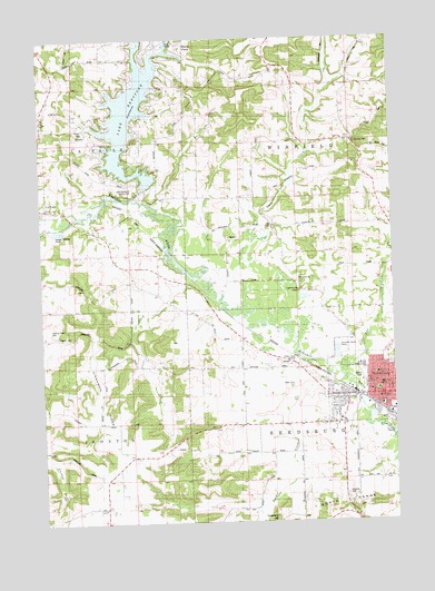
Reedsburg West, WI USGS Topographic Map
Click on map above to begin viewing in our Map Viewer.

This topographic map contains these locations and features:
Feature Name Type Latitude Longitude GNIS ID View Map
Babb CemeteryCemeteryN43.5353°W90.0360°1561046View Map
Babb CreekStreamN43.5369°W90.0179°1581145View Map
Babbs PrairieFlatN43.5330°W90.0439°2760496View Map
Big CreekStreamN43.5836°W90.0904°1561697View Map
Calvary CemeteryCemeteryN43.5483°W90.1198°1562537View Map
Community Church of NazareneChurchN43.5325°W90.0146°1846819View Map
East Branch Big CreekStreamN43.6158°W90.0865°1564282View Map
First Baptist ChurchChurchN43.5347°W90.0054°1846832View Map
First Presbyterian ChurchChurchN43.5333°W90.0062°1846837View Map
Hay CreekStreamN43.5366°W90.0157°1566175View Map
Hickory Grove School (historical)SchoolN43.5336°W90.1037°1846853View Map
Jackson School (historical)SchoolN43.6233°W90.1137°1846858View Map
Kelley School (historical)SchoolN43.6014°W90.0160°1846847View Map
Kinnamon RidgeRidgeN43.5328°W90.1043°1567516View Map
Lake RedstoneReservoirN43.6067°W90.0925°1572166View Map
Lake Redstone 2WP1970 DamDamN43.5869°W90.0882°1792895View Map
Lake Redstone County ParkParkN43.5866°W90.0915°1567750View Map
Lighthouse RockPillarN43.5597°W90.0340°1568030View Map
Lighthouse Rock CampgroundLocaleN43.5633°W90.0326°1846862View Map
Maple Grove School (historical)SchoolN43.6233°W90.0826°1851435View Map
Norman Rockwell MuseumBuildingN43.5311°W90.0062°1846876View Map
Oak Hill School (historical)SchoolN43.5625°W90.0915°1846881View Map
Oakland School (historical)SchoolN43.5036°W90.1037°1846882View Map
Pierce ParkParkN43.6019°W90.1096°1571352View Map
Pleasant View School (historical)SchoolN43.5841°W90.0546°1846897View Map
Prairie View School (historical)SchoolN43.5180°W90.0437°1846901View Map
Ramsey ParkParkN43.5286°W90.0221°1846902View Map
Reed ParkParkN43.5339°W90.0057°1846903View Map
ReedsburgPopulated PlaceN43.5325°W90.0026°1572172View Map
Reedsburg Area Ambulance ServiceBuildingN43.5299°W90.0069°2698366View Map
Reedsburg Area High SchoolSchoolN43.5225°W90.0210°2573543View Map
Reedsburg Campus Madison Area Technical CollegeSchoolN43.5478°W90.0257°1846904View Map
Reedsburg Fire DepartmentBuildingN43.5318°W90.0063°2697983View Map
Reedsburg Municipal BuildingBuildingN43.5316°W90.0054°1846905View Map
Reedsburg Police DepartmentBuildingN43.5312°W90.0069°2759500View Map
Reedsburg Post OfficePost OfficeN43.5339°W90.0085°1846906View Map
Reedsburg Public LibraryBuildingN43.5316°W90.0060°1846907View Map
Resting Green CemeteryCemeteryN43.5489°W90.1210°1572216View Map
Saint Johns Lutheran ChurchChurchN43.5380°W90.0062°1846921View Map
Saint Johns SchoolSchoolN43.5380°W90.0060°1573129View Map
Saint Patricks CemeteryCemeteryN43.5977°W90.0146°1573403View Map
Saint Peter's Lutheran SchoolSchoolN43.5351°W90.0045°1573542View Map
Saint Peters Lutheran ChurchChurchN43.5347°W90.0048°1846932View Map
Sand Hill School (historical)SchoolN43.6161°W90.0426°1846934View Map
Sand School (historical)SchoolN43.6019°W90.1226°1846933View Map
Silver CreekStreamN43.5630°W90.0696°1574101View Map
South Elementary SchoolSchoolN43.5301°W90.0049°1574493View Map
South ParkParkN43.5228°W90.0012°1574473View Map
Stone ParkParkN43.5339°W90.0179°1846957View Map
Stony PointCapeN43.6236°W90.0729°1574958View Map
Thieman HillSummitN43.5011°W90.0432°1575350View Map
Town of ReedsburgCivilN43.5071°W90.0170°1584006View Map
Town of WinfieldCivilN43.5984°W90.0142°1584455View Map
Twin CreekStreamN43.5539°W90.0521°1575773View Map
Twin Pine School (historical)SchoolN43.5397°W90.0546°1846967View Map
Webb Middle SchoolSchoolN43.5400°W90.0112°1576367View Map
Webb Middle SchoolSchoolN43.5401°W90.0113°2573544View Map
Webb ParkParkN43.5372°W90.0121°1576372View Map
West Branch Big CreekStreamN43.6155°W90.0865°1576459View Map
West Side Elementary SchoolSchoolN43.5298°W90.0245°2573549View Map
Westside Elementary SchoolSchoolN43.5472°W90.0248°1846975View Map
WNFM-FM (Reedsburg)TowerN43.5416°W90.0348°1582444View Map
WNFM-FM (Reedsburg)TowerN43.5922°W90.0118°1582445View Map
WRDB-AM (Reedsburg)TowerN43.5416°W90.0348°1582342View Map

Note: Coordinates in the location and feature list above are referenced to NAD83 datum.


Copyright (C) 2008-2024 Ryan Niemi / Sunset Dynamics ... All Rights Reserved