TopoQuest Logo
Do you find TopoQuest useful?
Help keep TopoQuest running and adding new maps/features by donating!
Bitcoin:  19c7KJd3qBynnjoSw5npx9KScwjBe4ifkT
Litecoin:  LXs6TkuXGGXo1vDsWCkWVdjQX94eUKd6ui
Home View Maps Find Maps Find Places Resources & Links


Schellsburg, Pennsylvania Topographic Map

USGS Map Title: Schellsburg, PA
USGS Map MRC: 40078A6
DRG (GeoTIFF) Download: o40078a6.tif


Neighboring USGS Topographic Map Quads:


  Windber, PA  
40078B7
 

  Ogletown, PA  
40078B6
 

  Alum Bank, PA  
40078B5
 

  Central City, PA  
40078A7
 

  Schellsburg, PA  
40078A6
 

  Bedford, PA  
40078A5
 

  New Baltimore, PA  
39078H7
 

  Buffalo Mills, PA  
39078H6
 

  Rainsburg, PA  
39078H5


Map MRC Location:

N41°
W79°
N41°
W78°
H8 H7 H6 H5 H4 H3 H2 H1
G8 G7 G6 G5 G4 G3 G2 G1
F8 F7 F6 F5 F4 F3 F2 F1
E8 E7 E6 E5 E4 E3 E2 E1
D8 D7 D6 D5 D4 D3 D2 D1
C8 C7 C6 C5 C4 C3 C2 C1
B8 B7 B6 B5 B4 B3 B2 B1
A8 A7 A6 A5 A4 A3 A2 A1
N40°
W79°
N40°
W78°

Schellsburg, PA USGS 1:24K Topographic Map Preview:
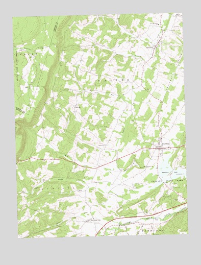
Schellsburg, PA USGS Topographic Map
Click on map above to begin viewing in our Map Viewer.

This topographic map contains these locations and features:
Feature Name Type Latitude Longitude GNIS ID View Map
Allison School (historical)SchoolN40.0867°W78.6634°1206836View Map
Bentz RunStreamN40.0731°W78.6611°1169284View Map
Borough of New ParisCivilN40.1084°W78.6431°1214901View Map
Borough of SchellsburgCivilN40.0482°W78.6434°1214906View Map
Burns CreekStreamN40.0384°W78.6747°1170732View Map
Clay SchoolSchoolN40.0259°W78.7409°1206835View Map
Colvin Covered BridgeBridgeN40.0381°W78.6542°1954954View Map
Cuppett's Covered BridgeBridgeN40.1092°W78.6436°1954955View Map
DaleyPopulated PlaceN40.0859°W78.7381°1172894View Map
HelixvillePopulated PlaceN40.0742°W78.7045°1176789View Map
Helixville CemeteryCemeteryN40.0743°W78.7043°2776085View Map
Hull Baptist Church CemeteryCemeteryN40.0940°W78.6476°2776092View Map
Kegg RunStreamN40.0259°W78.6522°1178300View Map
Linng Water SpringSpringN40.0337°W78.6634°1202429View Map
Mountain Calvary ChurchChurchN40.1076°W78.7275°1181944View Map
Negro HollowValleyN40.0287°W78.6978°1182226View Map
Negro Hollow RunStreamN40.0279°W78.6975°1212992View Map
New Buena VistaPopulated PlaceN40.0090°W78.6984°1182294View Map
New ParisPopulated PlaceN40.1065°W78.6447°1182354View Map
New Paris Central SchoolSchoolN40.1187°W78.6417°1182355View Map
New Paris Community CemeteryCemeteryN40.1118°W78.6405°2776068View Map
New Paris Post OfficePost OfficeN40.1037°W78.6463°2777416View Map
Pleasant View ChurchChurchN40.0517°W78.6828°1184087View Map
Rocklick CreekStreamN40.1081°W78.6456°1185317View Map
SchellsburgPopulated PlaceN40.0490°W78.6442°1187075View Map
Schellsburg CemeteryCemeteryN40.0482°W78.6550°2776158View Map
Schellsburg Post OfficePost OfficeN40.0490°W78.6428°2777429View Map
Shawnee LakeReservoirN40.0327°W78.6351°1193334View Map
Shawnee State ParkParkN40.0262°W78.6356°1193335View Map
Shawnee Valley Ambulance Service - Station 17BuildingN40.0560°W78.6401°2719501View Map
Shawnee Valley Volunteer Fire Company - Station 37BuildingN40.0492°W78.6384°2645532View Map
Spicer BrookStreamN40.0070°W78.6750°1193418View Map
Township of NapierCivilN40.0744°W78.6461°1215904View Map
Turner's Covered BridgeBridgeN40.0092°W78.6484°1954952View Map
United New Paris Cuppett / Cuppett Family CemeteryCemeteryN40.1110°W78.6393°2776067View Map
Wilt SchoolSchoolN40.0959°W78.7022°1206837View Map

Note: Coordinates in the location and feature list above are referenced to NAD83 datum.


Copyright (C) 2008-2024 Ryan Niemi / Sunset Dynamics ... All Rights Reserved