TopoQuest Logo
Do you find TopoQuest useful?
Help keep TopoQuest running and adding new maps/features by donating!
Bitcoin:  19c7KJd3qBynnjoSw5npx9KScwjBe4ifkT
Litecoin:  LXs6TkuXGGXo1vDsWCkWVdjQX94eUKd6ui
Home View Maps Find Maps Find Places Resources & Links


Raleigh, Mississippi Topographic Map

USGS Map Title: Raleigh, MS
USGS Map MRC: 32089A5
DRG (GeoTIFF) Download: o32089a5.tif


Neighboring USGS Topographic Map Quads:


  Polkville, MS  
32089B6
 

  Homewood, MS  
32089B5
 

  Pineville, MS  
32089B4
 

  White Oak, MS  
32089A6
 

  Raleigh, MS  
32089A5
 

  Louin SW, MS  
32089A4
 

  Magee North, MS  
31089H6
 

  Cohay, MS  
31089H5
 

  Center Ridge, MS  
31089H4


Map MRC Location:

N33°
W90°
N33°
W89°
H8 H7 H6 H5 H4 H3 H2 H1
G8 G7 G6 G5 G4 G3 G2 G1
F8 F7 F6 F5 F4 F3 F2 F1
E8 E7 E6 E5 E4 E3 E2 E1
D8 D7 D6 D5 D4 D3 D2 D1
C8 C7 C6 C5 C4 C3 C2 C1
B8 B7 B6 B5 B4 B3 B2 B1
A8 A7 A6 A5 A4 A3 A2 A1
N32°
W90°
N32°
W89°

Raleigh, MS USGS 1:24K Topographic Map Preview:
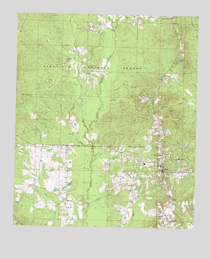
Raleigh, MS USGS Topographic Map
Click on map above to begin viewing in our Map Viewer.

This topographic map contains these locations and features:
Feature Name Type Latitude Longitude GNIS ID View Map
Austin CemeteryCemeteryN32.0877°W89.5234°692427View Map
Barber CemeteryCemeteryN32.1035°W89.5076°692455View Map
Barnes CemeteryCemeteryN32.0947°W89.5072°692459View Map
Boykin ChurchChurchN32.0988°W89.5895°692682View Map
Boykin Church cemeteryCemeteryN32.0986°W89.5899°2781343View Map
Boykin Church Oil FieldOilfieldN32.0960°W89.5937°707240View Map
Cantwell BranchStreamN32.0802°W89.5667°692838View Map
Chisolm PitMineN32.1174°W89.5751°707246View Map
Craft CemeteryCemeteryN32.0777°W89.5462°692999View Map
Crossroads ChurchChurchN32.0238°W89.6115°693017View Map
Crumpton Lake DamDamN32.0202°W89.5867°695412View Map
East Side ChurchChurchN32.0352°W89.5065°693153View Map
First Baptist ChurchChurchN32.0360°W89.5220°704924View Map
Gordan CemeteryCemeteryN32.0953°W89.5941°693328View Map
Grandsir BranchStreamN32.0749°W89.5017°693335View Map
Harrison BranchStreamN32.0877°W89.5834°693424View Map
Henderson Family CemeteryCemeteryN32.1208°W89.5180°693163View Map
Hordville (historical)LocaleN32.0943°W89.5740°704927View Map
Indian Charlie BranchStreamN32.0735°W89.5648°693581View Map
Little Oakohay CreekStreamN32.0560°W89.5748°693774View Map
Mile BranchStreamN32.1249°W89.5523°693964View Map
Moss CemeteryCemeteryN32.1066°W89.5924°694045View Map
Moulder CemeteryCemeteryN32.1240°W89.6009°694047View Map
Mount Pisgah CemeteryCemeteryN32.0590°W89.5261°694087View Map
Myers CemeteryCemeteryN32.0950°W89.5736°694140View Map
North Raleigh CemeteryCemeteryN32.0430°W89.5222°694212View Map
Page CemeteryCemeteryN32.0892°W89.5437°694294View Map
RaleighPopulated PlaceN32.0335°W89.5223°694503View Map
Raleigh CemeteryCemeteryN32.0309°W89.5230°707260View Map
Raleigh Elementary SchoolSchoolN32.0377°W89.5242°707261View Map
Raleigh Fire DepartmentBuildingN32.0323°W89.5221°2667797View Map
Raleigh High SchoolSchoolN32.0368°W89.5240°707262View Map
Raleigh Police DepartmentBuildingN32.0329°W89.5229°2754205View Map
Raleigh Post OfficePost OfficeN32.0327°W89.5236°2768756View Map
Raleigh United Methodist ChurchChurchN32.0368°W89.5228°704933View Map
Roberts CreekStreamN32.0479°W89.5709°694578View Map
Saint Paul ChurchChurchN32.0127°W89.5184°694666View Map
Salem ChurchChurchN32.0154°W89.5884°694680View Map
Salem School (historical)SchoolN32.0057°W89.5870°704934View Map
Sharon Baptist Church CemeteryCemeteryN32.0911°W89.5742°2781342View Map
Sharon ChurchChurchN32.0899°W89.5737°694753View Map
ShongeloPopulated PlaceN32.1029°W89.5131°694776View Map
Shongelo LakeLakeN32.0987°W89.5127°694778View Map
Shongelo School (historical)SchoolN32.0988°W89.5153°707268View Map
Smith CountyCivilN32.0177°W89.5067°695785View Map
Smith County Sheriff's OfficeBuildingN32.0340°W89.5234°2754182View Map
State Roadside Park Picnic AreaParkN32.0954°W89.5178°705648View Map
Town of RaleighCivilN32.0322°W89.5247°2407171View Map
Turner Chapel Elementary SchoolSchoolN32.0407°W89.5126°707279View Map
Turner Chapel SchoolSchoolN32.0413°W89.5112°695027View Map
Twomile CreekStreamN32.0421°W89.5692°695034View Map
Upper Leaf River Number 9 DamDamN32.0335°W89.5001°695413View Map
Yellow Bill CreekStreamN32.1160°W89.5573°695223View Map

Note: Coordinates in the location and feature list above are referenced to NAD83 datum.


Copyright (C) 2008-2024 Ryan Niemi / Sunset Dynamics ... All Rights Reserved