TopoQuest Logo
Do you find TopoQuest useful?
Help keep TopoQuest running and adding new maps/features by donating!
Bitcoin:  19c7KJd3qBynnjoSw5npx9KScwjBe4ifkT
Litecoin:  LXs6TkuXGGXo1vDsWCkWVdjQX94eUKd6ui
Home View Maps Find Maps Find Places Resources & Links


Rentz, Georgia Topographic Map

USGS Map Title: Rentz, GA
USGS Map MRC: 32082D8
DRG (GeoTIFF) Download: o32082d8.tif


Neighboring USGS Topographic Map Quads:


  Dudley, GA  
32083E1
 

  Dublin, GA  
32082E8
 

  East Dublin, GA  
32082E7
 

  Dexter, GA  
32083D1
 

  Rentz, GA  
32082D8
 

  Minter, GA  
32082D7
 

  Cadwell, GA  
32083C1
 

  Five Points, GA  
32082C8
 

  Lowery, GA  
32082C7


Map MRC Location:

N33°
W83°
N33°
W82°
H8 H7 H6 H5 H4 H3 H2 H1
G8 G7 G6 G5 G4 G3 G2 G1
F8 F7 F6 F5 F4 F3 F2 F1
E8 E7 E6 E5 E4 E3 E2 E1
D8 D7 D6 D5 D4 D3 D2 D1
C8 C7 C6 C5 C4 C3 C2 C1
B8 B7 B6 B5 B4 B3 B2 B1
A8 A7 A6 A5 A4 A3 A2 A1
N32°
W83°
N32°
W82°

Rentz, GA USGS 1:24K Topographic Map Preview:
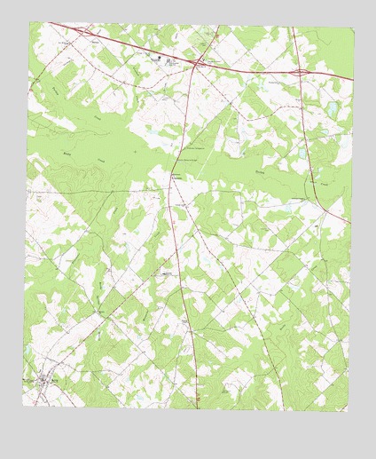
Rentz, GA USGS Topographic Map
Click on map above to begin viewing in our Map Viewer.

This topographic map contains these locations and features:
Feature Name Type Latitude Longitude GNIS ID View Map
Bailey LakeReservoirN32.4625°W82.8775°340313View Map
Bailey Lake DamDamN32.4618°W82.8782°340312View Map
Bluewater ChurchChurchN32.4516°W82.9443°354794View Map
Bluewater CreekStreamN32.4516°W82.9574°311567View Map
Cheeks Still (historical)LocaleN32.4752°W82.9435°346512View Map
City of RentzCivilN32.3835°W82.9917°2404607View Map
Claxton Memorial BridgeBridgeN32.4557°W82.9424°355180View Map
Colter LakeReservoirN32.3936°W82.9983°341268View Map
Colter Lake DamDamN32.3952°W82.9982°341267View Map
Crooked CreekStreamN32.4660°W82.9649°313132View Map
Exit 13CrossingN32.4971°W82.9788°1705029View Map
Exit 14CrossingN32.4879°W82.9351°1705030View Map
Exit 15CrossingN32.4854°W82.8957°1705031View Map
Fleming ChapelChurchN32.4032°W82.9368°355839View Map
Freeman LakeReservoirN32.4669°W82.8791°340311View Map
Freeman Lake DamDamN32.4652°W82.8782°340310View Map
GarrettaPopulated PlaceN32.4502°W82.9440°355980View Map
Georgia State Patrol Troop F Post 20 DublinBuildingN32.4956°W82.9202°2734010View Map
Gilders LandingLocaleN32.4560°W82.9188°346544View Map
Greene LakeReservoirN32.4407°W82.8994°341266View Map
Greene Lake DamDamN32.4418°W82.8982°341265View Map
Hardin LakeReservoirN32.4808°W82.9098°341264View Map
Hardin Lake DamDamN32.4802°W82.9082°341263View Map
HarlowPopulated PlaceN32.4941°W82.9763°331915View Map
Lamar Smith LakeReservoirN32.4752°W82.9365°341534View Map
Lamar Smith Lake DamDamN32.4752°W82.9365°341533View Map
Laurens CountyCivilN32.4637°W82.9222°346568View Map
Laurens County JailBuildingN32.4967°W82.9224°346570View Map
Laurens County Sheriff's DepartmentBuildingN32.4966°W82.9222°2733621View Map
Laurens High SchoolSchoolN32.4191°W82.9463°316683View Map
Mayberry (historical)Populated PlaceN32.4063°W82.9721°346581View Map
McLendon School (historical)SchoolN32.4274°W82.9118°346582View Map
Mosquito CreekStreamN32.4574°W82.9571°318526View Map
Mount Zion ChurchChurchN32.4063°W82.9713°318976View Map
New Bethel ChurchChurchN32.4935°W82.9849°319278View Map
Olivet ChurchChurchN32.4768°W82.8951°320059View Map
Pearson CemeteryCemeteryN32.3810°W82.9226°320324View Map
Pine Hill ChurchChurchN32.4863°W82.9357°320597View Map
Pinetucky CampgroundLocaleN32.4602°W82.9396°320668View Map
Reedy Spring ChurchChurchN32.3838°W82.9976°321475View Map
Reedy Springs BranchStreamN32.4260°W82.9735°321476View Map
RentzPopulated PlaceN32.3835°W82.9913°321523View Map
Rentz DivisionCivilN32.3913°W82.9247°1936490View Map
Rentz Fire DepartmentBuildingN32.3843°W82.9927°2604487View Map
Robertson ChapelChurchN32.4441°W82.8929°321678View Map
Rocky CreekStreamN32.4596°W82.9618°321813View Map
Spring Hill Church (historical)ChurchN32.4113°W82.9449°346627View Map
Turkey Creek ChurchChurchN32.4418°W82.9388°324389View Map
West Laurens High SchoolSchoolN32.4882°W82.9465°325058View Map
West Laurens Junior High SchoolSchoolN32.4893°W82.9496°325059View Map
Woodard Grove ChurchChurchN32.4821°W82.9032°325525View Map

Note: Coordinates in the location and feature list above are referenced to NAD83 datum.


Copyright (C) 2008-2024 Ryan Niemi / Sunset Dynamics ... All Rights Reserved