TopoQuest Logo
Do you find TopoQuest useful?
Help keep TopoQuest running and adding new maps/features by donating!
Bitcoin:  19c7KJd3qBynnjoSw5npx9KScwjBe4ifkT
Litecoin:  LXs6TkuXGGXo1vDsWCkWVdjQX94eUKd6ui
Home View Maps Find Maps Find Places Resources & Links


Reynoldsville, Pennsylvania Topographic Map

USGS Map Title: Reynoldsville, PA
USGS Map MRC: 41078A8
DRG (GeoTIFF) Download: o41078a8.tif


Neighboring USGS Topographic Map Quads:


  Brookville, PA  
41079B1
 

  Hazen, PA  
41078B8
 

  Falls Creek, PA  
41078B7
 

  Coolspring, PA  
41079A1
 

  Reynoldsville, PA  
41078A8
 

  Du Bois, PA  
41078A7
 

  Valier, PA  
40079H1
 

  Punxsutawney, PA  
40078H8
 

  McGees Mills, PA  
40078H7


Map MRC Location:

N42°
W79°
N42°
W78°
H8 H7 H6 H5 H4 H3 H2 H1
G8 G7 G6 G5 G4 G3 G2 G1
F8 F7 F6 F5 F4 F3 F2 F1
E8 E7 E6 E5 E4 E3 E2 E1
D8 D7 D6 D5 D4 D3 D2 D1
C8 C7 C6 C5 C4 C3 C2 C1
B8 B7 B6 B5 B4 B3 B2 B1
A8 A7 A6 A5 A4 A3 A2 A1
N41°
W79°
N41°
W78°

Reynoldsville, PA USGS 1:24K Topographic Map Preview:
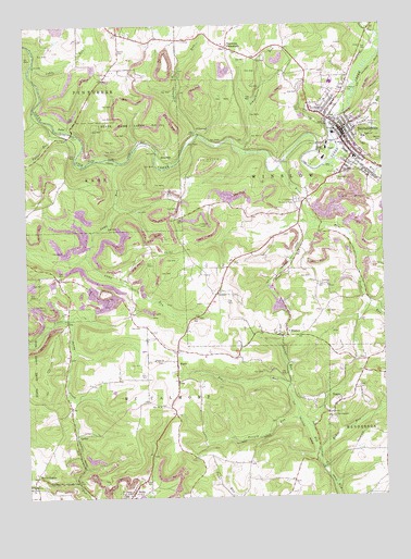
Reynoldsville, PA USGS Topographic Map
Click on map above to begin viewing in our Map Viewer.

This topographic map contains these locations and features:
Feature Name Type Latitude Longitude GNIS ID View Map
AnitaPopulated PlaceN41.0015°W78.9631°1168314View Map
Anita Station (historical)LocaleN41.0020°W78.9575°1206422View Map
Battle HollowPopulated PlaceN41.0059°W78.9967°1203031View Map
Battle Hollow School (historical)SchoolN41.0042°W78.9984°1206415View Map
Baum SchoolSchoolN41.1231°W78.9670°1206421View Map
Bolinger School (historical)SchoolN41.0537°W78.9334°1206412View Map
Bollinger ChurchChurchN41.0540°W78.9323°1169966View Map
Borough of ReynoldsvilleCivilN41.0946°W78.8880°1215302View Map
Cable RunStreamN41.1145°W78.9967°1170860View Map
Camp RunStreamN41.0887°W78.9667°1171079View Map
CortezPopulated PlaceN41.0170°W78.9825°1203344View Map
Cortez School (historical)SchoolN41.0178°W78.9842°1206414View Map
Deemers CrossroadsPopulated PlaceN41.1187°W78.9278°1173053View Map
DesirePopulated PlaceN41.0253°W78.8903°1173179View Map
EleanorLocaleN41.0262°W78.9034°1212737View Map
Eleanor Post Office (historical)Post OfficeN41.0262°W78.9034°1214309View Map
Front RunStreamN41.0715°W78.8981°1175296View Map
FullerPopulated PlaceN41.0981°W78.9845°1203643View Map
Fuller RunStreamN41.0976°W78.9892°1175327View Map
Hemlock School (historical)SchoolN41.0495°W78.9642°1206413View Map
High Florence School (historical)SchoolN41.0009°W78.9436°1206416View Map
Jenks SchoolSchoolN41.0751°W78.9042°1206419View Map
Johnson Elementary SchoolSchoolN41.1095°W78.8923°1211694View Map
Lakelawn Memorial Park and MausoleumCemeteryN41.0780°W78.9044°1178793View Map
Laurel RunStreamN41.0295°W78.9078°1178990View Map
Mary School (historical)SchoolN41.1123°W78.9075°1206420View Map
McKee RunStreamN41.0120°W78.8973°1180739View Map
MeredithPopulated PlaceN41.0892°W78.9503°1204155View Map
Moore CemeteryCemeteryN41.1182°W78.9670°1181504View Map
Mount Tabor ChurchChurchN41.0034°W78.9984°1181862View Map
O'DonnellPopulated PlaceN41.0962°W78.9381°1204310View Map
O'Donnell RunStreamN41.0962°W78.9395°1182728View Map
PanicPopulated PlaceN41.0362°W78.9473°1183237View Map
Panic ChurchChurchN41.0367°W78.9553°1183238View Map
Paradise ChurchChurchN41.0559°W78.8942°1183281View Map
Phillippi School (historical)SchoolN41.0526°W78.8859°1206411View Map
Pifer School (historical)SchoolN41.0051°W78.9217°1206417View Map
Pitchpine RunStreamN41.0965°W78.8925°1183974View Map
ReynoldsvillePopulated PlaceN41.0970°W78.8886°1198316View Map
Reynoldsville Area Ambulance Service Station 60BuildingN41.0983°W78.8908°2719489View Map
Reynoldsville CemeteryCemeteryN41.0836°W78.8922°1184973View Map
Reynoldsville Fire TowerTowerN41.0723°W78.9386°1212738View Map
Reynoldsville Post OfficePost OfficeN41.0973°W78.8888°2772941View Map
Reynoldsville Volunteer Fire Department Station 6BuildingN41.0957°W78.8899°2645161View Map
Saint Christophers ChurchChurchN41.0209°W78.8936°1185873View Map
Saint Josephs ChurchChurchN41.0009°W78.9645°1186234View Map
Schoolhouse RunStreamN41.0915°W78.9234°1187119View Map
Soldier RunStreamN41.0892°W78.8925°1193390View Map
State Game Lands Number 244ParkN41.0987°W78.9556°1188503View Map
Township of McCalmontCivilN41.0274°W78.9602°1216564View Map
Township of WinslowCivilN41.0618°W78.8755°1216576View Map
Trinity ChurchChurchN41.0965°W78.8903°1189805View Map
Trout RunStreamN41.0873°W78.9098°1189866View Map
Turnip RunStreamN41.0212°W78.9045°1189968View Map
Wayne School (historical)SchoolN41.0087°W78.8750°1206418View Map
WishawPopulated PlaceN41.0428°W78.9084°1191623View Map
Zion ChurchChurchN41.0242°W78.9534°1192011View Map

Note: Coordinates in the location and feature list above are referenced to NAD83 datum.


Copyright (C) 2008-2025 Ryan Niemi / Sunset Dynamics ... All Rights Reserved