TopoQuest Logo
Do you find TopoQuest useful?
Help keep TopoQuest running and adding new maps/features by donating!
Bitcoin:  19c7KJd3qBynnjoSw5npx9KScwjBe4ifkT
Litecoin:  LXs6TkuXGGXo1vDsWCkWVdjQX94eUKd6ui
Home View Maps Find Maps Find Places Resources & Links


Hazen, Pennsylvania Topographic Map

USGS Map Title: Hazen, PA
USGS Map MRC: 41078B8
DRG (GeoTIFF) Download: o41078b8.tif


Neighboring USGS Topographic Map Quads:


  Sigel, PA  
41079C1
 

  Munderf, PA  
41078C8
 

  Carman, PA  
41078C7
 

  Brookville, PA  
41079B1
 

  Hazen, PA  
41078B8
 

  Falls Creek, PA  
41078B7
 

  Coolspring, PA  
41079A1
 

  Reynoldsville, PA  
41078A8
 

  Du Bois, PA  
41078A7


Map MRC Location:

N42°
W79°
N42°
W78°
H8 H7 H6 H5 H4 H3 H2 H1
G8 G7 G6 G5 G4 G3 G2 G1
F8 F7 F6 F5 F4 F3 F2 F1
E8 E7 E6 E5 E4 E3 E2 E1
D8 D7 D6 D5 D4 D3 D2 D1
C8 C7 C6 C5 C4 C3 C2 C1
B8 B7 B6 B5 B4 B3 B2 B1
A8 A7 A6 A5 A4 A3 A2 A1
N41°
W79°
N41°
W78°

Hazen, PA USGS 1:24K Topographic Map Preview:
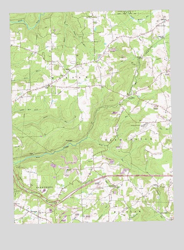
Hazen, PA USGS Topographic Map
Click on map above to begin viewing in our Map Viewer.

This topographic map contains these locations and features:
Feature Name Type Latitude Longitude GNIS ID View Map
Allen School (historical)SchoolN41.2023°W78.9186°1206429View Map
Allen Station (historical)LocaleN41.2001°W78.9075°1206428View Map
Allens MillsPopulated PlaceN41.1995°W78.9075°1168198View Map
Beaver RunStreamN41.2423°W78.9564°1169029View Map
Bower SchoolSchoolN41.2009°W78.9923°1206434View Map
Britten School (historical)SchoolN41.1287°W78.9936°1206423View Map
Dubois Regional AirportAirportN41.1823°W78.8942°1194187View Map
EgyptPopulated PlaceN41.2462°W78.9373°1174044View Map
EmerickvillePopulated PlaceN41.1326°W78.9881°1174217View Map
HazenPopulated PlaceN41.2067°W78.9703°1176717View Map
Horm RunStreamN41.1753°W78.9406°1177411View Map
Horm Run School (historical)SchoolN41.1676°W78.9273°1206426View Map
HormtownPopulated PlaceN41.1465°W78.9192°1177412View Map
Interchange 15CrossingN41.1370°W78.9670°1209129View Map
Jefferson CountyCivilN41.1281°W78.9994°1213674View Map
Keys RunStreamN41.1695°W78.9242°1178431View Map
Mason School (historical)SchoolN41.2209°W78.9664°1206433View Map
McAninch SchoolSchoolN41.1445°W78.9628°1206425View Map
McIntosh SchoolSchoolN41.2342°W78.9164°1206431View Map
Mile Hill SchoolSchoolN41.1356°W78.9956°1206424View Map
Morrison School (historical)SchoolN41.2109°W78.8850°1206430View Map
North Sulger (historical)Populated PlaceN41.1734°W78.9545°1204306View Map
PardusPopulated PlaceN41.1459°W78.8870°1204360View Map
Raught School (historical)SchoolN41.2053°W78.9478°1206432View Map
ReitzPopulated PlaceN41.2217°W78.8998°1204486View Map
Saint Pauls ChurchChurchN41.1453°W78.9198°1186627View Map
Sandy ValleyPopulated PlaceN41.1301°W78.8864°1204583View Map
Sandy Valley Post Office (historical)Post OfficeN41.1259°W78.8764°1214310View Map
Snyder School (historical)SchoolN41.1345°W78.9386°1206690View Map
Sugar HillPopulated PlaceN41.2431°W78.8778°1188941View Map
Sugar Hill StationLocaleN41.2334°W78.8789°1188946View Map
Sulger (historical)Populated PlaceN41.1662°W78.9839°1204766View Map
Township of WarsawCivilN41.2298°W78.9865°1216573View Map
WarsawPopulated PlaceN41.2151°W78.9534°1190612View Map
Warsaw SchoolSchoolN41.2123°W78.9575°1190613View Map
Warsaw Township Volunteer Fire Company Station 15BuildingN41.2121°W78.9591°2645316View Map
Wray SchoolSchoolN41.1834°W78.8875°1206427View Map

Note: Coordinates in the location and feature list above are referenced to NAD83 datum.


Copyright (C) 2008-2024 Ryan Niemi / Sunset Dynamics ... All Rights Reserved