TopoQuest Logo
Do you find TopoQuest useful?
Help keep TopoQuest running and adding new maps/features by donating!
Bitcoin:  19c7KJd3qBynnjoSw5npx9KScwjBe4ifkT
Litecoin:  LXs6TkuXGGXo1vDsWCkWVdjQX94eUKd6ui
Home View Maps Find Maps Find Places Resources & Links


Brookville, Pennsylvania Topographic Map

USGS Map Title: Brookville, PA
USGS Map MRC: 41079B1
DRG (GeoTIFF) Download: o41079b1.tif


Neighboring USGS Topographic Map Quads:


  Cooksburg, PA  
41079C2
 

  Sigel, PA  
41079C1
 

  Munderf, PA  
41078C8
 

  Corsica, PA  
41079B2
 

  Brookville, PA  
41079B1
 

  Hazen, PA  
41078B8
 

  Summerville, PA  
41079A2
 

  Coolspring, PA  
41079A1
 

  Reynoldsville, PA  
41078A8


Map MRC Location:

N42°
W80°
N42°
W79°
H8 H7 H6 H5 H4 H3 H2 H1
G8 G7 G6 G5 G4 G3 G2 G1
F8 F7 F6 F5 F4 F3 F2 F1
E8 E7 E6 E5 E4 E3 E2 E1
D8 D7 D6 D5 D4 D3 D2 D1
C8 C7 C6 C5 C4 C3 C2 C1
B8 B7 B6 B5 B4 B3 B2 B1
A8 A7 A6 A5 A4 A3 A2 A1
N41°
W80°
N41°
W79°

Brookville, PA USGS 1:24K Topographic Map Preview:
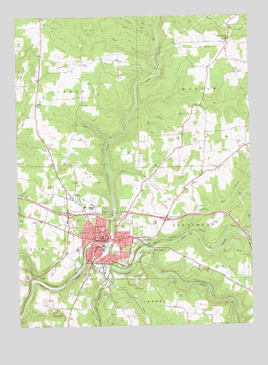
Brookville, PA USGS Topographic Map
Click on map above to begin viewing in our Map Viewer.

This topographic map contains these locations and features:
Feature Name Type Latitude Longitude GNIS ID View Map
AlaskaPopulated PlaceN41.1776°W79.0959°1168111View Map
Bethel ChurchChurchN41.1890°W79.0486°1169400View Map
Borough of BrookvilleCivilN41.1615°W79.0827°1215299View Map
BrookvillePopulated PlaceN41.1612°W79.0831°1170350View Map
Brookville Borough Police DepartmentBuildingN41.1512°W79.0802°2776968View Map
Brookville HospitalHospitalN41.1565°W79.0932°2718056View Map
Brookville Junior Senior High SchoolSchoolN41.1726°W79.0859°1211633View Map
Brookville Post OfficePost OfficeN41.1603°W79.0842°2779814View Map
Brookville ReservoirReservoirN41.1701°W79.0731°1195319View Map
Brookville Volunteer Fire Company Station 2BuildingN41.1598°W79.0808°2645160View Map
Brookville Waterworks DamDamN41.1701°W79.0731°1195320View Map
Burns RunStreamN41.2140°W79.0564°1170738View Map
Butler CemeteryCemeteryN41.1754°W79.0414°1170791View Map
Calvary ChurchChurchN41.1601°W79.0709°1170944View Map
Clement RunStreamN41.1437°W79.1156°1171983View Map
CoderPopulated PlaceN41.1448°W79.1134°1203298View Map
Coder RunStreamN41.1453°W79.1150°1172119View Map
Craft RunStreamN41.2345°W79.0417°1172591View Map
Crate SchoolSchoolN41.1326°W79.0889°1201059View Map
Fivemile RunStreamN41.1484°W79.0756°1174878View Map
Fivemile RunStreamN41.1612°W79.0011°1192470View Map
Free ChurchChurchN41.1631°W79.0786°1175199View Map
Grace ChurchChurchN41.1612°W79.0761°1175905View Map
Green SchoolSchoolN41.1648°W79.1050°1201060View Map
Hall SchoolSchoolN41.2042°W79.1139°1201061View Map
Hickory Grove Elementary SchoolSchoolN41.1728°W79.0892°1211657View Map
HowePopulated PlaceN41.2151°W79.1023°1177521View Map
Jefferson County Emergency Medical Services BrookvilleBuildingN41.1687°W79.0528°2719670View Map
Jefferson County Sheriff's OfficeBuildingN41.1608°W79.0797°2777160View Map
Kirkman ChurchChurchN41.1831°W79.0192°1178546View Map
Laurel RunStreamN41.1837°W79.0036°1179020View Map
Little Mill CreekStreamN41.1623°W79.0336°1179600View Map
Longview SchoolSchoolN41.1551°W79.0706°1179928View Map
Matthews SchoolSchoolN41.1420°W79.0553°1201058View Map
Mill CreekStreamN41.1562°W79.0531°1192935View Map
Miller School (historical)SchoolN41.1834°W79.0561°1201055View Map
Moore BridgeBridgeN41.2287°W79.0489°1201054View Map
Moorhead CemeteryCemeteryN41.2397°W79.0116°1181520View Map
North Fork Redbank CreekStreamN41.1584°W79.0767°1209864View Map
Northside East SchoolSchoolN41.1634°W79.0803°1182674View Map
Northside West SchoolSchoolN41.1642°W79.0817°1182676View Map
Oaks SchoolSchoolN41.2303°W79.0895°1201062View Map
Pekin RunStreamN41.2140°W79.0564°1183450View Map
Pine Creek Volunteer Fire Department Station 10BuildingN41.1601°W79.0599°2645472View Map
PinecreekPopulated PlaceN41.1592°W79.0586°1183922View Map
Pinecreek Elementary SchoolSchoolN41.1484°W79.0278°1213893View Map
Port BarnettPopulated PlaceN41.1565°W79.0509°1184276View Map
Red Lick RunStreamN41.1998°W79.0664°1184763View Map
RichardsvillePopulated PlaceN41.2401°W79.0123°1185005View Map
Russell SchoolSchoolN41.2034°W79.0356°1201056View Map
Saint Marys Catholic Cemetery OriginalCemeteryN41.1472°W79.0878°1186404View Map
Saint Marys ChurchChurchN41.1559°W79.0828°1186421View Map
Sandy Lick CreekStreamN41.1584°W79.0767°1193288View Map
Shippen RunStreamN41.2448°W79.0492°1210209View Map
South BulgarLocaleN41.1637°W79.0031°1201057View Map
South Sulger (historical)Populated PlaceN41.1634°W79.0082°2749715View Map
Steele RunStreamN41.1978°W79.1189°1202278View Map
Sugar Camp RunStreamN41.1770°W79.0739°1201957View Map
Sugarcamp RunStreamN41.1853°W79.0748°1188989View Map
Swamp RunStreamN41.1448°W79.0770°1189135View Map
Township of Pine CreekCivilN41.1487°W79.0019°1216567View Map
Township of RoseCivilN41.1329°W79.1094°1216571View Map
West Warsaw - Riggs CemeteryCemeteryN41.2273°W79.0062°1185064View Map
Yeomans RunStreamN41.1876°W79.0764°1201956View Map
Zion ChurchChurchN41.1967°W79.1075°1192013View Map

Note: Coordinates in the location and feature list above are referenced to NAD83 datum.


Copyright (C) 2008-2025 Ryan Niemi / Sunset Dynamics ... All Rights Reserved