TopoQuest Logo
Do you find TopoQuest useful?
Help keep TopoQuest running and adding new maps/features by donating!
Bitcoin:  19c7KJd3qBynnjoSw5npx9KScwjBe4ifkT
Litecoin:  LXs6TkuXGGXo1vDsWCkWVdjQX94eUKd6ui
Home View Maps Find Maps Find Places Resources & Links


Loganville, Wisconsin Topographic Map

USGS Map Title: Loganville, WI
USGS Map MRC: 43090D1
DRG (GeoTIFF) Download: o43090d1.tif


Neighboring USGS Topographic Map Quads:


  La Valle, WI  
43090E2
 

  Reedsburg West, WI  
43090E1
 

  Reedsburg East, WI  
43089E8
 

  Lime Ridge, WI  
43090D2
 

  Loganville, WI  
43090D1
 

  Rock Springs, WI  
43089D8
 

  Bear Valley, WI  
43090C2
 

  Plain, WI  
43090C1
 

  Black Hawk, WI  
43089C8


Map MRC Location:

N44°
W91°
N44°
W90°
H8 H7 H6 H5 H4 H3 H2 H1
G8 G7 G6 G5 G4 G3 G2 G1
F8 F7 F6 F5 F4 F3 F2 F1
E8 E7 E6 E5 E4 E3 E2 E1
D8 D7 D6 D5 D4 D3 D2 D1
C8 C7 C6 C5 C4 C3 C2 C1
B8 B7 B6 B5 B4 B3 B2 B1
A8 A7 A6 A5 A4 A3 A2 A1
N43°
W91°
N43°
W90°

Loganville, WI USGS 1:24K Topographic Map Preview:
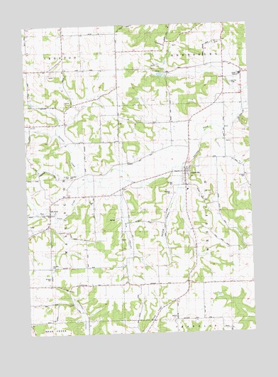
Loganville, WI USGS Topographic Map
Click on map above to begin viewing in our Map Viewer.

This topographic map contains these locations and features:
Feature Name Type Latitude Longitude GNIS ID View Map
1 ReservoirReservoirN43.4816°W90.0501°1793359View Map
Allen SchoolSchoolN43.4564°W90.1010°1560779View Map
County Farm SchoolSchoolN43.4814°W90.0040°1563447View Map
Ela ValleyValleyN43.4339°W90.0720°1564485View Map
Friendship SchoolSchoolN43.3950°W90.0443°1565335View Map
Hill PointPopulated PlaceN43.4244°W90.1126°1578567View Map
Hill Point CreekStreamN43.4375°W90.0898°1566421View Map
LoganvillePopulated PlaceN43.4403°W90.0360°1568495View Map
Loganville Area Fire DepartmentBuildingN43.4410°W90.0383°2697687View Map
Loganville Elementary SchoolSchoolN43.4329°W90.0356°2573546View Map
Open View SchoolSchoolN43.4564°W90.0137°1570844View Map
Prairie View SchoolSchoolN43.4536°W90.0435°1571897View Map
Saint Johns CemeteryCemeteryN43.4366°W90.0032°1573038View Map
Saint Johns CemeteryCemeteryN43.4378°W90.1023°1846918View Map
Saint Johns ChurchChurchN43.4369°W90.1012°1573084View Map
Saint Pauls CemeteryCemeteryN43.4022°W90.1115°1846927View Map
Saint Pauls CemeteryCemeteryN43.3980°W90.1129°1846928View Map
Saint Pauls ChurchChurchN43.4019°W90.1123°1573479View Map
Saint Peter CemeteryCemeteryN43.4355°W90.0429°1846931View Map
Spring ValleyValleyN43.4326°W90.0415°1574700View Map
Stolte G-9668 DamDamN43.4816°W90.0501°1793358View Map
Town of WestfieldCivilN43.4238°W90.0133°1584405View Map
Tri-Center Airport (historical)AirportN43.3792°W90.0154°1581031View Map
Tuckertown CemeteryCemeteryN43.4378°W90.1004°1846966View Map
Tuckertown SchoolSchoolN43.4311°W90.1021°1575704View Map
Village of LoganvilleCivilN43.4389°W90.0370°1583591View Map
Washington Township Volunteer Fire DepartmentBuildingN43.4235°W90.1127°2697626View Map
Westfield CemeteryCemeteryN43.4314°W90.0440°1846974View Map

Note: Coordinates in the location and feature list above are referenced to NAD83 datum.


Copyright (C) 2008-2025 Ryan Niemi / Sunset Dynamics ... All Rights Reserved