TopoQuest Logo
Do you find TopoQuest useful?
Help keep TopoQuest running and adding new maps/features by donating!
Bitcoin:  19c7KJd3qBynnjoSw5npx9KScwjBe4ifkT
Litecoin:  LXs6TkuXGGXo1vDsWCkWVdjQX94eUKd6ui
Home View Maps Find Maps Find Places Resources & Links


Rockledge, Georgia Topographic Map

USGS Map Title: Rockledge, GA
USGS Map MRC: 32082D6
DRG (GeoTIFF) Download: o32082d6.tif


Neighboring USGS Topographic Map Quads:


  East Dublin, GA  
32082E7
 

  Scott, GA  
32082E6
 

  Adrian, GA  
32082E5
 

  Minter, GA  
32082D7
 

  Rockledge, GA  
32082D6
 

  Soperton North, GA  
32082D5
 

  Lowery, GA  
32082C7
 

  Lothair, GA  
32082C6
 

  Soperton South, GA  
32082C5


Map MRC Location:

N33°
W83°
N33°
W82°
H8 H7 H6 H5 H4 H3 H2 H1
G8 G7 G6 G5 G4 G3 G2 G1
F8 F7 F6 F5 F4 F3 F2 F1
E8 E7 E6 E5 E4 E3 E2 E1
D8 D7 D6 D5 D4 D3 D2 D1
C8 C7 C6 C5 C4 C3 C2 C1
B8 B7 B6 B5 B4 B3 B2 B1
A8 A7 A6 A5 A4 A3 A2 A1
N32°
W83°
N32°
W82°

Rockledge, GA USGS 1:24K Topographic Map Preview:
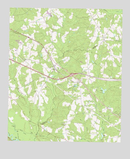
Rockledge, GA USGS Topographic Map
Click on map above to begin viewing in our Map Viewer.

This topographic map contains these locations and features:
Feature Name Type Latitude Longitude GNIS ID View Map
Beacham LakeLakeN32.3888°W82.7421°310909View Map
Big BranchStreamN32.3777°W82.6665°311314View Map
Blue Spring ChurchChurchN32.4518°W82.7315°311557View Map
Blue Spring School (historical)SchoolN32.4516°W82.7321°346494View Map
Cross SloughStreamN32.3766°W82.7382°313165View Map
Elias BranchStreamN32.4574°W82.6879°313901View Map
Exit 17CrossingN32.4379°W82.6801°1705071View Map
Gay LakeLakeN32.3824°W82.7243°314546View Map
Graham PondReservoirN32.4931°W82.7042°341270View Map
Graham PondsLakeN32.4954°W82.7071°314764View Map
Grahams Pond DamDamN32.4941°W82.7043°341269View Map
Harmony Church (historical)ChurchN32.4827°W82.7312°346549View Map
Hurricane BranchStreamN32.4232°W82.6996°315838View Map
Hurricane CreekStreamN32.3821°W82.7168°315845View Map
Jack LakeLakeN32.3840°W82.7408°315984View Map
Jam LakeLakeN32.3784°W82.7418°316034View Map
Lake HelenLakeN32.4275°W82.6759°315301View Map
Lake Helen DamDamN32.4277°W82.6746°341155View Map
Mercer FordCrossingN32.3802°W82.7185°346583View Map
Miller PondLakeN32.3801°W82.6453°318269View Map
Mount Zion CemeteryCemeteryN32.4260°W82.7068°318923View Map
Mount Zion Methodist Church (historical)ChurchN32.4279°W82.7110°346587View Map
Muddy SloughStreamN32.3757°W82.7201°319132View Map
Norris ChapelChurchN32.4460°W82.6993°319629View Map
OriannaPopulated PlaceN32.4741°W82.6451°326440View Map
Orianna ChurchChurchN32.4718°W82.6443°342642View Map
OrlandPopulated PlaceN32.4335°W82.6724°332581View Map
Peterson PondReservoirN32.4237°W82.6443°320417View Map
Peterson Pond DamDamN32.4235°W82.6443°341629View Map
Pleasant Hill Church (historical)ChurchN32.4621°W82.6671°346605View Map
Red Bluff ChurchChurchN32.3916°W82.6868°321363View Map
Red Hill CreekStreamN32.3843°W82.7165°321389View Map
RockledgePopulated PlaceN32.4429°W82.6976°321774View Map
Rockledge Methodist ChurchChurchN32.4449°W82.6985°346612View Map
Rocky CreekStreamN32.3946°W82.6443°321812View Map
Salter Smith Church (historical)ChurchN32.4816°W82.7076°346616View Map
Stave LandingLocaleN32.3760°W82.7376°333121View Map
Treutlen Fire Department Station 3BuildingN32.4347°W82.6726°2604778View Map
Wilkes School (historical)SchoolN32.4754°W82.7351°346649View Map

Note: Coordinates in the location and feature list above are referenced to NAD83 datum.


Copyright (C) 2008-2024 Ryan Niemi / Sunset Dynamics ... All Rights Reserved