TopoQuest Logo
Do you find TopoQuest useful?
Help keep TopoQuest running and adding new maps/features by donating!
Bitcoin:  19c7KJd3qBynnjoSw5npx9KScwjBe4ifkT
Litecoin:  LXs6TkuXGGXo1vDsWCkWVdjQX94eUKd6ui
Home View Maps Find Maps Find Places Resources & Links


Soperton South, Georgia Topographic Map

USGS Map Title: Soperton South, GA
USGS Map MRC: 32082C5
DRG (GeoTIFF) Download: o32082c5.tif


Neighboring USGS Topographic Map Quads:


  Rockledge, GA  
32082D6
 

  Soperton North, GA  
32082D5
 

  Covena, GA  
32082D4
 

  Lothair, GA  
32082C6
 

  Soperton South, GA  
32082C5
 

  Oak Park SW, GA  
32082C4
 

  Glenwood, GA  
32082B6
 

  Mount Vernon, GA  
32082B5
 

  Vidalia, GA  
32082B4


Map MRC Location:

N33°
W83°
N33°
W82°
H8 H7 H6 H5 H4 H3 H2 H1
G8 G7 G6 G5 G4 G3 G2 G1
F8 F7 F6 F5 F4 F3 F2 F1
E8 E7 E6 E5 E4 E3 E2 E1
D8 D7 D6 D5 D4 D3 D2 D1
C8 C7 C6 C5 C4 C3 C2 C1
B8 B7 B6 B5 B4 B3 B2 B1
A8 A7 A6 A5 A4 A3 A2 A1
N32°
W83°
N32°
W82°

Soperton South, GA USGS 1:24K Topographic Map Preview:
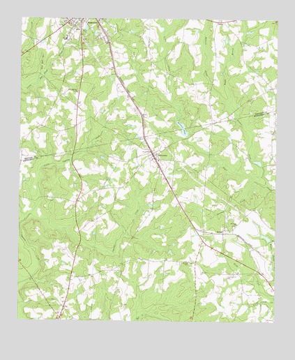
Soperton South, GA USGS Topographic Map
Click on map above to begin viewing in our Map Viewer.

This topographic map contains these locations and features:
Feature Name Type Latitude Longitude GNIS ID View Map
Adams CemeteryCemeteryN32.2880°W82.5351°345003View Map
Allmond CemeteryCemeteryN32.2899°W82.5190°345004View Map
Baker CemeteryCemeteryN32.3371°W82.6104°342630View Map
Bobtail CreekStreamN32.3066°W82.5040°311597View Map
Boggy BranchStreamN32.3393°W82.5229°311611View Map
Braddy CemeteryCemeteryN32.2741°W82.5418°311700View Map
Brown PondReservoirN32.3646°W82.6149°347494View Map
Burner CemeteryCemeteryN32.2996°W82.6101°345005View Map
Calhoun CemeteryCemeteryN32.3249°W82.5185°345006View Map
Central ChurchChurchN32.2705°W82.5749°345007View Map
Coleman LakeReservoirN32.2885°W82.5865°340329View Map
Coleman Lake DamDamN32.2885°W82.5865°340328View Map
Cypress CreekStreamN32.2930°W82.6171°313237View Map
Darley or Calhoun CemeteryCemeteryN32.2827°W82.5360°2026993View Map
Gillis Mill Pond (historical)ReservoirN32.3585°W82.5707°347497View Map
Hall PondReservoirN32.3414°W82.6157°347500View Map
Hamilton DamDamN32.2852°W82.5032°341030View Map
Hamilton Hill CemeteryCemeteryN32.2685°W82.5232°356150View Map
Hamilton LakeReservoirN32.2850°W82.5042°341031View Map
Hog Bed BranchStreamN32.3488°W82.6165°315496View Map
KibbeePopulated PlaceN32.2877°W82.5251°332144View Map
Little CreekStreamN32.3405°W82.5510°317034View Map
Little Cypress CreekStreamN32.2921°W82.6221°317053View Map
Little Swift CreekStreamN32.2602°W82.5004°317215View Map
Love CemeteryCemeteryN32.3402°W82.5971°317437View Map
Mount Nebo ChurchChurchN32.3107°W82.5557°345014View Map
Mount Olive ChurchChurchN32.3446°W82.5971°318748View Map
Mount Pisgah CemeteryCemeteryN32.2893°W82.5210°345015View Map
Mount Pisgah ChurchChurchN32.2905°W82.5185°318810View Map
Shotbag CreekStreamN32.3066°W82.5099°322962View Map
Simons ChapelChurchN32.3202°W82.5612°323015View Map
Soperton DivisionCivilN32.3709°W82.6125°1936546View Map
Sparks PondReservoirN32.3689°W82.5886°347503View Map
Story CemeteryCemeteryN32.2571°W82.5735°345018View Map
TarrytownPopulated PlaceN32.3188°W82.5593°333191View Map
Tarrytown Baptist ChurchChurchN32.3166°W82.5574°345019View Map
Tarrytown DivisionCivilN32.2832°W82.5324°1936576View Map
Tarrytown Volunteer Fire DepartmentBuildingN32.3203°W82.5600°2604975View Map
Taylor CemeteryCemeteryN32.2580°W82.6015°345020View Map
Taylor CemeteryCemeteryN32.2591°W82.6087°345021View Map
Town of TarrytownCivilN32.3187°W82.5596°2406715View Map
Treutlen County JailBuildingN32.3623°W82.6018°2734118View Map
Treutlen High SchoolSchoolN32.3668°W82.6026°342646View Map
Treutlen Primary SchoolSchoolN32.3743°W82.5871°342647View Map
Treutlen Probation Detention CenterBuildingN32.3622°W82.6017°2735764View Map
Waller PondReservoirN32.3712°W82.5932°347507View Map
Warnock PondReservoirN32.3299°W82.5456°336128View Map
Warnocks Pond DamDamN32.3299°W82.5454°336127View Map
WJHH-AM (Soperton)TowerN32.3618°W82.6176°352551View Map
ZaideePopulated PlaceN32.3741°W82.5290°333490View Map

Note: Coordinates in the location and feature list above are referenced to NAD83 datum.


Copyright (C) 2008-2025 Ryan Niemi / Sunset Dynamics ... All Rights Reserved