TopoQuest Logo
Do you find TopoQuest useful?
Help keep TopoQuest running and adding new maps/features by donating!
Bitcoin:  19c7KJd3qBynnjoSw5npx9KScwjBe4ifkT
Litecoin:  LXs6TkuXGGXo1vDsWCkWVdjQX94eUKd6ui
Home View Maps Find Maps Find Places Resources & Links


Russell, Pennsylvania Topographic Map

USGS Map Title: Russell, PA
USGS Map MRC: 41079H2
DRG (GeoTIFF) Download: o41079h2.tif


Neighboring USGS Topographic Map Quads:


  Lakewood, NY  
42079A3
 

  Jamestown, NY  
42079A2
 

  Ivory, NY  
42079A1
 

  Sugar Grove, PA  
41079H3
 

  Russell, PA  
41079H2
 

  Scandia, PA  
41079H1
 

  Youngsville, PA  
41079G3
 

  Warren, PA  
41079G2
 

  Clarendon, PA  
41079G1


Map MRC Location:

N42°
W80°
N42°
W79°
H8 H7 H6 H5 H4 H3 H2 H1
G8 G7 G6 G5 G4 G3 G2 G1
F8 F7 F6 F5 F4 F3 F2 F1
E8 E7 E6 E5 E4 E3 E2 E1
D8 D7 D6 D5 D4 D3 D2 D1
C8 C7 C6 C5 C4 C3 C2 C1
B8 B7 B6 B5 B4 B3 B2 B1
A8 A7 A6 A5 A4 A3 A2 A1
N41°
W80°
N41°
W79°

Russell, PA USGS 1:24K Topographic Map Preview:
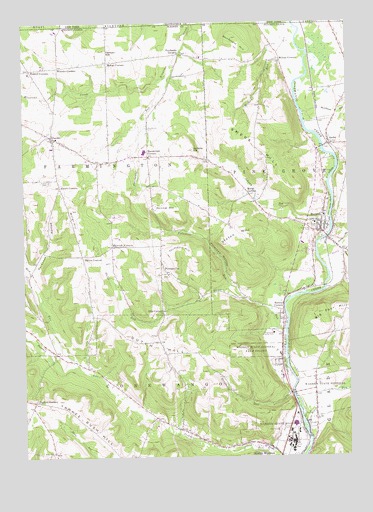
Russell, PA USGS Topographic Map
Click on map above to begin viewing in our Map Viewer.

This topographic map contains these locations and features:
Feature Name Type Latitude Longitude GNIS ID View Map
Ackley Station Post Office (historical)Post OfficeN41.9648°W79.1309°1214604View Map
AkeleyPopulated PlaceN41.9648°W79.1309°1202953View Map
Akeley RunStreamN41.9312°W79.1350°1209383View Map
Alcorn CornersLocaleN41.9531°W79.2356°1168124View Map
AlcuinLocaleN41.9701°W79.2398°1208905View Map
BabcockLocaleN41.9428°W79.2162°1212112View Map
Babcock CornersLocaleN41.9356°W79.2156°1168545View Map
Backup CornersPopulated PlaceN41.9173°W79.1500°1168563View Map
Big Four HillSummitN41.9164°W79.1348°1169510View Map
Carlson HillSummitN41.9920°W79.2175°1171219View Map
Conewango Country ClubLocaleN41.9103°W79.1537°1213182View Map
D O C Airport (historical)AirportN41.8834°W79.1331°1194306View Map
Dougherty RunStreamN41.8928°W79.1475°1173417View Map
Dunham CornersLocaleN41.8912°W79.2459°1173607View Map
Dutch HillSummitN41.9070°W79.2006°1173655View Map
Dutch Hill SchoolSchoolN41.9045°W79.1950°1201223View Map
Eisenhower High SchoolSchoolN41.9628°W79.2031°1211640View Map
Ellis CornersLocaleN41.9170°W79.1962°1174156View Map
Fairbanks CornersLocaleN41.9912°W79.1878°1174418View Map
Fairbanks RunStreamN41.9876°W79.1925°1174416View Map
Foster CemeteryCemeteryN41.9548°W79.2400°1175037View Map
Guy C Irving HouseLocaleN41.9231°W79.1462°1212115View Map
Hatch CornersLocaleN41.8928°W79.1381°1212114View Map
Hatch RunStreamN41.8870°W79.1428°1209662View Map
Jackson RunLocaleN41.8801°W79.1831°1208906View Map
Jackson RunPopulated PlaceN41.9051°W79.2381°1202138View Map
Jackson Run SchoolSchoolN41.8923°W79.2095°1201220View Map
Jackson Run School (historical)SchoolN41.8792°W79.2181°1201221View Map
Jenkins HillSummitN41.9634°W79.1834°1178031View Map
Johnny RunStreamN41.9439°W79.1317°1178102View Map
LanderPopulated PlaceN41.9670°W79.2381°1198189View Map
Lander Volunteer Fire Department Station 56BuildingN41.9627°W79.2373°2645397View Map
Mahan CornersLocaleN41.9887°W79.2167°1180202View Map
Marsh CornersLocaleN41.9506°W79.1625°1180441View Map
Marshtown CemeteryCemeteryN41.9698°W79.2007°1180482View Map
Marshtown CornersLocaleN41.9617°W79.2006°1180483View Map
Mead CemeteryCemeteryN41.8763°W79.2391°1180811View Map
Mead SchoolSchoolN41.8764°W79.2473°1201222View Map
Mud RunStreamN41.9009°W79.2287°1198096View Map
North Branch Akeley RunStreamN41.9326°W79.1362°1209856View Map
North Warren Census Designated PlaceCensusN41.8832°W79.1671°2584494View Map
Parker CornersLocaleN41.9328°W79.2275°1183312View Map
Parker SchoolSchoolN41.9328°W79.2275°1201219View Map
Peterson HollowValleyN41.9219°W79.1659°1183637View Map
Pine Grove CemeteryCemeteryN41.9408°W79.1392°1183803View Map
Preston CornersLocaleN41.9864°W79.2467°1184400View Map
PutnamvillePopulated PlaceN41.9289°W79.1950°1204452View Map
Rhine RunStreamN41.9106°W79.1492°1184977View Map
Rollin RunStreamN41.9798°W79.2225°1212113View Map
Russel Post OfficePost OfficeN41.9397°W79.1343°2779708View Map
RussellPopulated PlaceN41.9414°W79.1350°1198199View Map
Russell Census Designated PlaceCensusN41.9394°W79.1392°2631301View Map
Russell Volunteer Fire Department Station 54BuildingN41.9420°W79.1382°2644973View Map
Scranton HollowValleyN41.9279°W79.2467°1187179View Map
Scranton Hollow School (historical)SchoolN41.9309°W79.2453°1201218View Map
Shield Farm AirportAirportN41.9314°W79.1300°2443632View Map
Simons HollowValleyN41.8951°W79.1273°1209985View Map
Skinner HillSummitN41.9459°W79.1909°1187757View Map
State Game Lands Number 282ParkN41.9917°W79.1331°1208392View Map
Staton HillSummitN41.9364°W79.1731°1188566View Map
Storehouse RunStreamN41.9744°W79.1422°1210020View Map
Sturdevant HillSummitN41.9953°W79.1689°966664View Map
Swede HillSummitN41.9645°W79.1573°1189156View Map
Thompson HillSummitN41.9320°W79.1917°1189500View Map
Township of ConewangoCivilN41.8760°W79.2082°1217174View Map
Township of FarmingtonCivilN41.9540°W79.2319°1217164View Map
Trinity ChurchChurchN41.9581°W79.1723°1201224View Map
Valentine RunStreamN41.9206°W79.1650°1190281View Map
Warren State HospitalHospitalN41.8794°W79.1470°1210085View Map
Warren State Hospital Farm ColonyHospitalN41.9053°W79.1609°1190598View Map
Wheeler CornersLocaleN41.9873°W79.2359°1198204View Map
Wheeler School (historical)SchoolN41.9878°W79.2356°1205289View Map
Wiltsie CornersLocaleN41.9889°W79.1498°1191560View Map
Wiltsie RunStreamN41.9995°W79.1450°971434View Map
Wiltsie SchoolSchoolN41.9889°W79.1548°1201225View Map

Note: Coordinates in the location and feature list above are referenced to NAD83 datum.


Copyright (C) 2008-2025 Ryan Niemi / Sunset Dynamics ... All Rights Reserved