TopoQuest Logo
Do you find TopoQuest useful?
Help keep TopoQuest running and adding new maps/features by donating!
Bitcoin:  19c7KJd3qBynnjoSw5npx9KScwjBe4ifkT
Litecoin:  LXs6TkuXGGXo1vDsWCkWVdjQX94eUKd6ui
Home View Maps Find Maps Find Places Resources & Links


Warren, Pennsylvania Topographic Map

USGS Map Title: Warren, PA
USGS Map MRC: 41079G2
DRG (GeoTIFF) Download: o41079g2.tif


Neighboring USGS Topographic Map Quads:


  Sugar Grove, PA  
41079H3
 

  Russell, PA  
41079H2
 

  Scandia, PA  
41079H1
 

  Youngsville, PA  
41079G3
 

  Warren, PA  
41079G2
 

  Clarendon, PA  
41079G1
 

  Cobham, PA  
41079F3
 

  Cherry Grove, PA  
41079F2
 

  Sheffield, PA  
41079F1


Map MRC Location:

N42°
W80°
N42°
W79°
H8 H7 H6 H5 H4 H3 H2 H1
G8 G7 G6 G5 G4 G3 G2 G1
F8 F7 F6 F5 F4 F3 F2 F1
E8 E7 E6 E5 E4 E3 E2 E1
D8 D7 D6 D5 D4 D3 D2 D1
C8 C7 C6 C5 C4 C3 C2 C1
B8 B7 B6 B5 B4 B3 B2 B1
A8 A7 A6 A5 A4 A3 A2 A1
N41°
W80°
N41°
W79°

Warren, PA USGS 1:24K Topographic Map Preview:
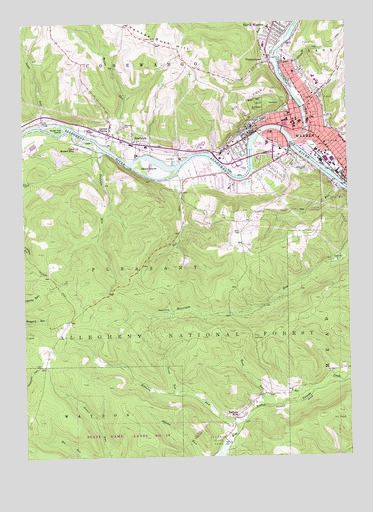
Warren, PA USGS Topographic Map
Click on map above to begin viewing in our Map Viewer.

This topographic map contains these locations and features:
Feature Name Type Latitude Longitude GNIS ID View Map
Beaver PondsLakeN41.7918°W79.1944°1210448View Map
Buchers MillsPopulated PlaceN41.7612°W79.1698°1209450View Map
Camp Birdsell EdeyLocaleN41.8389°W79.2289°1209472View Map
Chapman DamDamN41.7534°W79.1714°1210258View Map
Chapman Dam ReservoirReservoirN41.7500°W79.1767°1210257View Map
Chapman State ParkParkN41.7523°W79.1778°1209492View Map
City of WarrenCivilN41.8433°W79.1444°1215648View Map
City of Warren Fire DepartmentBuildingN41.8466°W79.1490°2645392View Map
Conewango CreekStreamN41.8412°W79.1453°1210156View Map
Conewango Township Police DepartmentBuildingN41.8412°W79.2048°2777095View Map
East WarrenPopulated PlaceN41.8467°W79.1364°1210375View Map
Elkhorn RunStreamN41.7589°W79.1684°1209594View Map
Grass Flat IslandIslandN41.8448°W79.2362°1209640View Map
Grunder RunStreamN41.8387°W79.2212°1209648View Map
Grunderville (historical)Populated PlaceN41.8367°W79.2206°1213697View Map
Hazeltine CornersPopulated PlaceN41.8634°W79.1492°1212119View Map
Indian HollowValleyN41.8539°W79.1356°1209687View Map
Indian Hollow RunStreamN41.8514°W79.1420°1212120View Map
Irvine CemeteryCemeteryN41.8430°W79.1269°1209694View Map
Jackson CrossingPopulated PlaceN41.8434°W79.2167°1209698View Map
Jackson RunStreamN41.8648°W79.1523°1209700View Map
Knupp School (historical)SchoolN41.8617°W79.1831°1210334View Map
Leek IslandIslandN41.8406°W79.2234°1209750View Map
Liberty School (historical)SchoolN41.7889°W79.2323°1210333View Map
Mead IslandIslandN41.8328°W79.2009°1209811View Map
Mead RunStreamN41.7648°W79.1559°1209813View Map
Mix RunStreamN41.7503°W79.2287°1209830View Map
Morse RunStreamN41.8387°W79.2156°1210197View Map
North WarrenPopulated PlaceN41.8742°W79.1523°1209866View Map
North Warren Volunteer Fire Department Station 55BuildingN41.8724°W79.1478°2644824View Map
Oakland CemeteryCemeteryN41.8331°W79.1420°1209868View Map
Ott RunStreamN41.8276°W79.1275°1209871View Map
Pennsylvania Railroad Passenger StationLocaleN41.8451°W79.1614°1212124View Map
Pennsylvania State Police Troop E Warren StationBuildingN41.8450°W79.2256°2777338View Map
Pleasant School (historical)SchoolN41.8095°W79.1573°1210335View Map
Pleasant Volunteer Fire DepartmentBuildingN41.8294°W79.1690°2645255View Map
Rocky Gap Trail Bike TrailTrailN41.7976°W79.2187°1210449View Map
Saint Josephs CemeteryCemeteryN41.8352°W79.1456°1209951View Map
Scott RunStreamN41.8464°W79.2417°1209962View Map
Sill RunStreamN41.8312°W79.1903°1209982View Map
South WarrenPopulated PlaceN41.8298°W79.1689°1212125View Map
StarbrickPopulated PlaceN41.8403°W79.2053°1210006View Map
Starbrick Census Designated PlaceCensusN41.8419°W79.2133°2633841View Map
Starbrick Volunteer Fire Department Station 52BuildingN41.8411°W79.2056°2644818View Map
Still School (historical)SchoolN41.8289°W79.1887°1210337View Map
Struthers LibraryBuildingN41.8487°W79.1470°1212123View Map
Township of PleasantCivilN41.7983°W79.2032°1217172View Map
Trout RunStreamN41.7687°W79.1931°1210058View Map
VenturetownPopulated PlaceN41.8634°W79.1548°1210073View Map
WarrenLocaleN41.8537°W79.1575°1214217View Map
WarrenPopulated PlaceN41.8439°W79.1450°1210083View Map
Warren AirparkAirportN41.8663°W79.2058°2442888View Map
Warren County CourthouseBuildingN41.8487°W79.1470°1212122View Map
Warren County Sheriff's OfficeBuildingN41.8490°W79.1471°2776929View Map
Warren General HospitalHospitalN41.8433°W79.1540°2718068View Map
Warren Police DepartmentBuildingN41.8465°W79.1494°2777132View Map
Warren Post OfficePost OfficeN41.8466°W79.1474°2779938View Map
Warren ReservoirReservoirN41.8062°W79.1298°1210336View Map
Warren South Census Designated PlaceCensusN41.8312°W79.1567°2390454View Map
Washington ParkParkN41.8498°W79.1589°1210086View Map
Westview CemeteryCemeteryN41.8450°W79.2106°1210105View Map
Wetmore HouseBuildingN41.8487°W79.1439°1212121View Map
WNAE-AM (Warren)TowerN41.8139°W79.1675°1210247View Map
WRRN-FM (Warren)TowerN41.8139°W79.1675°1210244View Map
Yankee Bush CemeteryCemeteryN41.8693°W79.1981°1210141View Map
Yankee Bush HillSummitN41.8668°W79.1838°1210142View Map

Note: Coordinates in the location and feature list above are referenced to NAD83 datum.


Copyright (C) 2008-2025 Ryan Niemi / Sunset Dynamics ... All Rights Reserved