TopoQuest Logo
Do you find TopoQuest useful?
Help keep TopoQuest running and adding new maps/features by donating!
Bitcoin:  19c7KJd3qBynnjoSw5npx9KScwjBe4ifkT
Litecoin:  LXs6TkuXGGXo1vDsWCkWVdjQX94eUKd6ui
Home View Maps Find Maps Find Places Resources & Links


Elliott Park, Pennsylvania Topographic Map

USGS Map Title: Elliott Park, PA
USGS Map MRC: 41078A5
DRG (GeoTIFF) Download: o41078a5.tif


Neighboring USGS Topographic Map Quads:


  Sabula, PA  
41078B6
 

  Penfield, PA  
41078B5
 

  Huntley, PA  
41078B4
 

  Luthersburg, PA  
41078A6
 

  Elliott Park, PA  
41078A5
 

  Clearfield, PA  
41078A4
 

  Mahaffey, PA  
40078H6
 

  Curwensville, PA  
40078H5
 

  Glen Richey, PA  
40078H4


Map MRC Location:

N42°
W79°
N42°
W78°
H8 H7 H6 H5 H4 H3 H2 H1
G8 G7 G6 G5 G4 G3 G2 G1
F8 F7 F6 F5 F4 F3 F2 F1
E8 E7 E6 E5 E4 E3 E2 E1
D8 D7 D6 D5 D4 D3 D2 D1
C8 C7 C6 C5 C4 C3 C2 C1
B8 B7 B6 B5 B4 B3 B2 B1
A8 A7 A6 A5 A4 A3 A2 A1
N41°
W79°
N41°
W78°

Elliott Park, PA USGS 1:24K Topographic Map Preview:
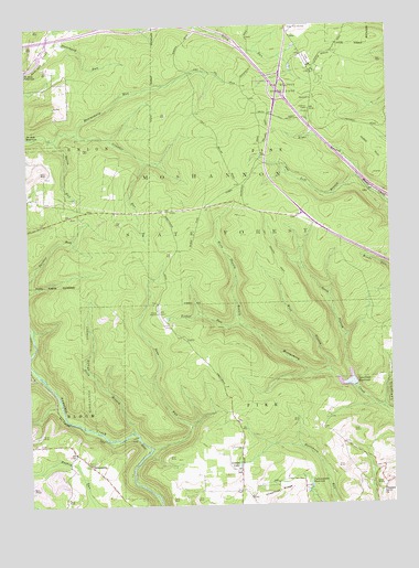
Elliott Park, PA USGS Topographic Map
Click on map above to begin viewing in our Map Viewer.

This topographic map contains these locations and features:
Feature Name Type Latitude Longitude GNIS ID View Map
Bailey FieldAreaN41.1195°W78.5700°1201688View Map
Bear RunStreamN41.0151°W78.5828°1168921View Map
Bear Run DamDamN41.0201°W78.5697°1195203View Map
Bear Run ReservoirReservoirN41.0207°W78.5696°1195204View Map
Blanchard RunStreamN41.1212°W78.6164°1169808View Map
Bloom Run VistaSummitN41.0142°W78.5909°1201874View Map
Burns RunStreamN41.0959°W78.6167°1170737View Map
Chestnut RidgeRidgeN41.0012°W78.5447°1192256View Map
Chestnut Ridge SchoolSchoolN41.0039°W78.5520°1206448View Map
Clearfield ReservoirReservoirN41.0320°W78.5146°1192276View Map
Clearfield State Tree NurseryForestN41.1167°W78.5281°1212739View Map
Coupler RunStreamN41.0970°W78.6078°1172512View Map
Curwensville ReservoirReservoirN41.0048°W78.5281°1192323View Map
Glendale (historical)Populated PlaceN41.0331°W78.6239°1201689View Map
Gordon CampLocaleN41.0903°W78.5436°1206452View Map
GreenvillePopulated PlaceN41.0106°W78.6042°1176173View Map
Greenville SchoolSchoolN41.0106°W78.6039°1206447View Map
Hobo HillSummitN41.0923°W78.5017°1192617View Map
Hoover FarmLocaleN41.0867°W78.5939°1206450View Map
Horn Shanty BranchStreamN41.0473°W78.5520°1177418View Map
Irvin BranchStreamN41.0192°W78.5886°1177860View Map
Laurel LakeLakeN41.0105°W78.5526°1178950View Map
Left Branch Moose CreekStreamN41.0853°W78.5100°1179139View Map
Montgomery DamDamN41.0308°W78.5121°1195210View Map
Montgomery RunStreamN41.0962°W78.6239°1181464View Map
North Branch Montgomery CreekStreamN41.0351°W78.5145°1182544View Map
Old Orchard AirportAirportN41.0105°W78.5607°2442791View Map
Pleasant Grove ChurchChurchN41.0039°W78.5028°1184016View Map
Right Branch Moose CreekStreamN41.0853°W78.5100°1185073View Map
Rockton Fire TowerTowerN41.0756°W78.5511°1206382View Map
S B Elliott State ParkParkN41.1084°W78.5328°1193239View Map
Smith Fire TowerTowerN41.1034°W78.5270°1206449View Map
Stone Palace CampLocaleN41.0906°W78.5439°1206691View Map
Tar RunStreamN41.0346°W78.5283°2778546View Map
Tinker RunStreamN41.0473°W78.5520°1189586View Map
Township of PineCivilN41.1000°W78.5336°1216246View Map
Weilder CampLocaleN41.0981°W78.5381°1206451View Map
West Branch Montgomery CreekStreamN41.0348°W78.5209°1190917View Map

Note: Coordinates in the location and feature list above are referenced to NAD83 datum.


Copyright (C) 2008-2025 Ryan Niemi / Sunset Dynamics ... All Rights Reserved